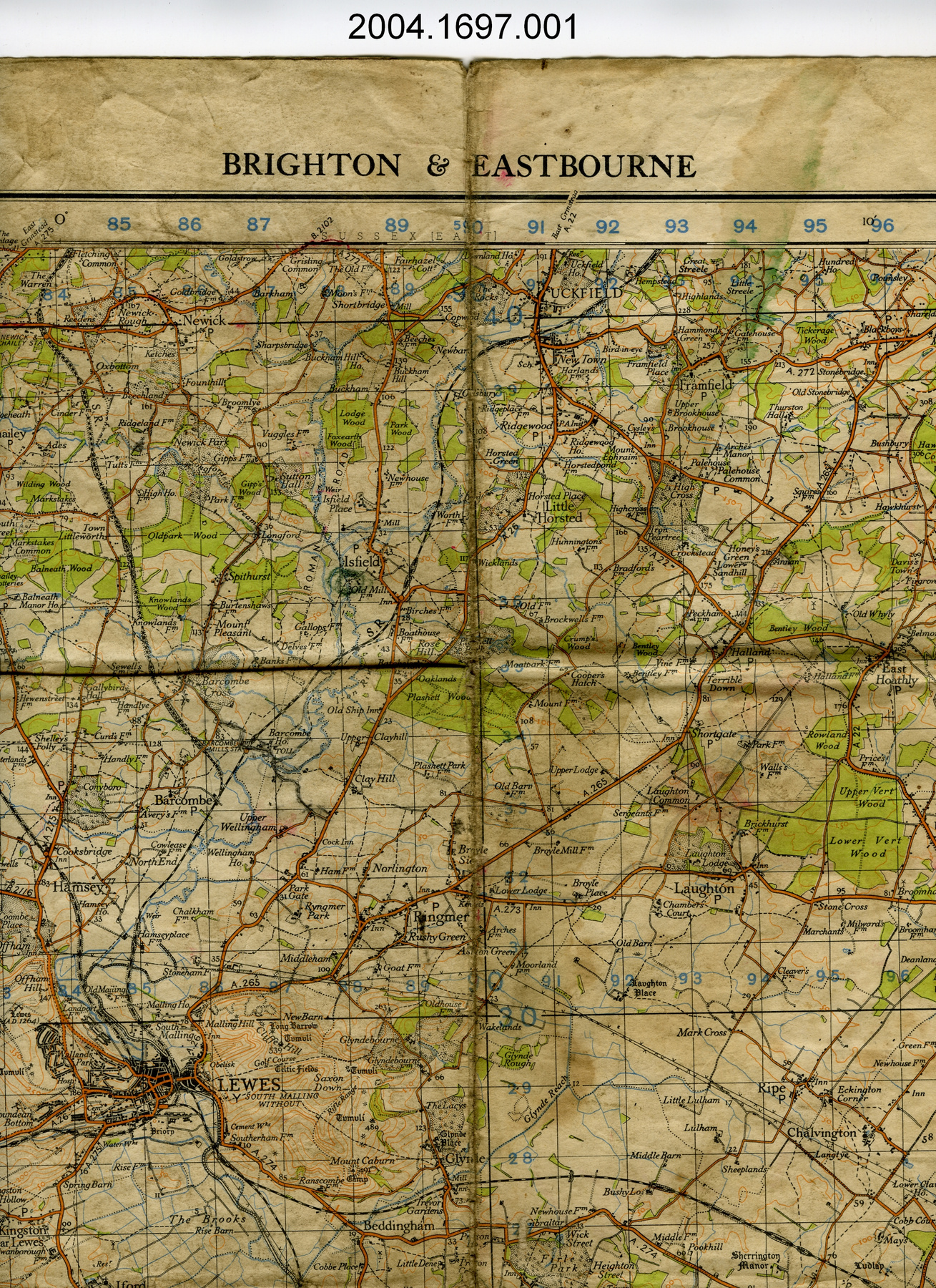
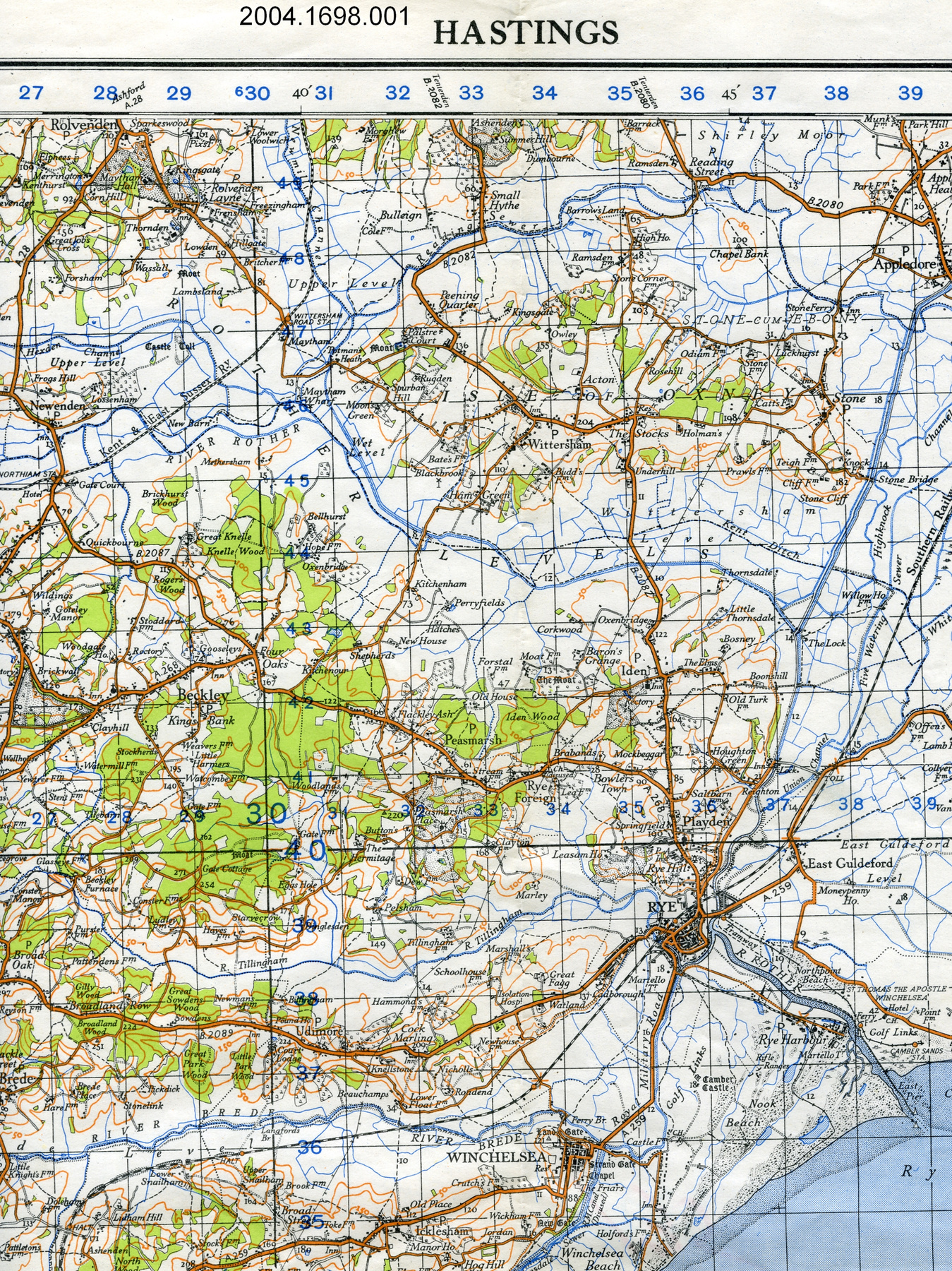
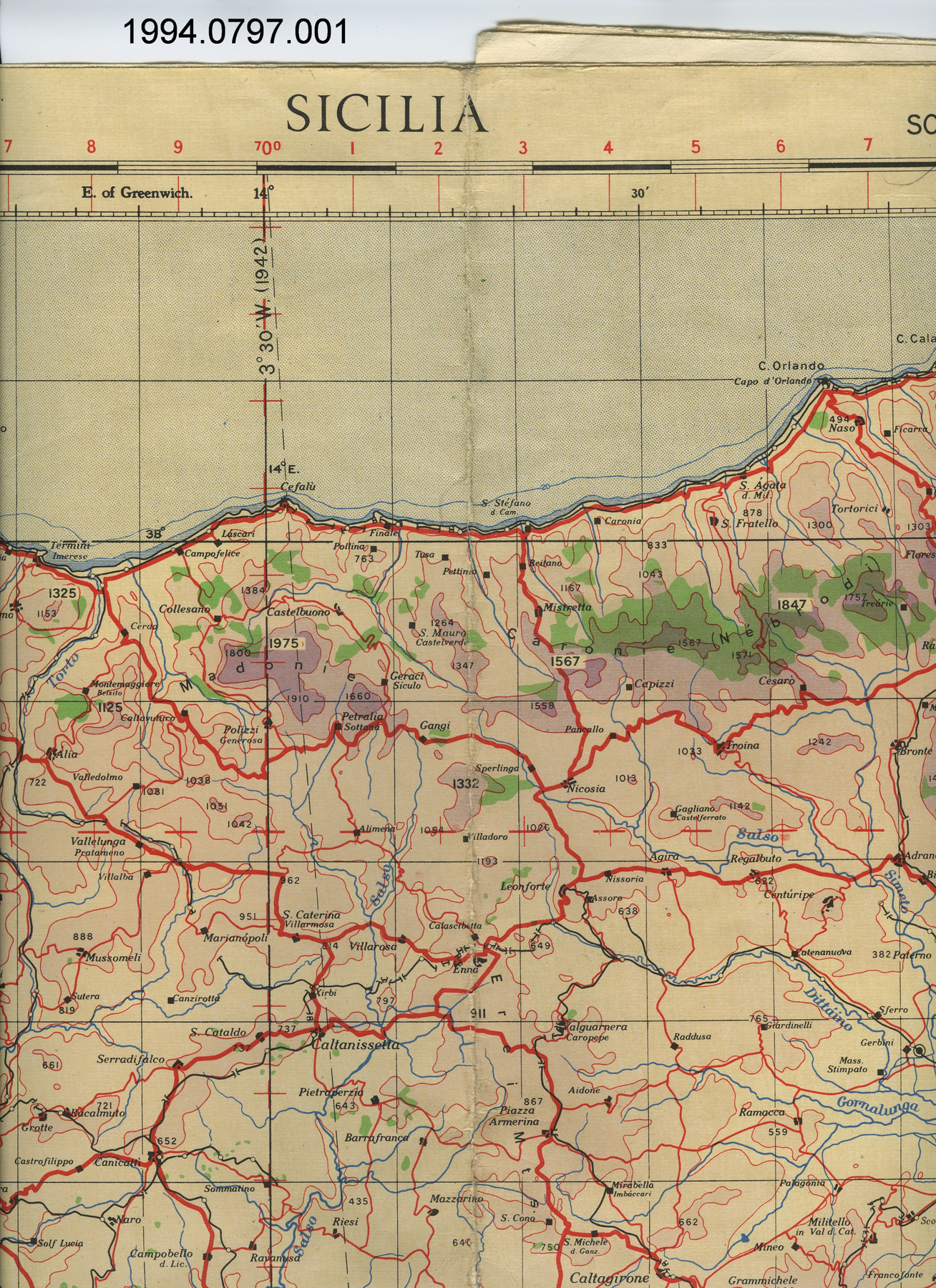
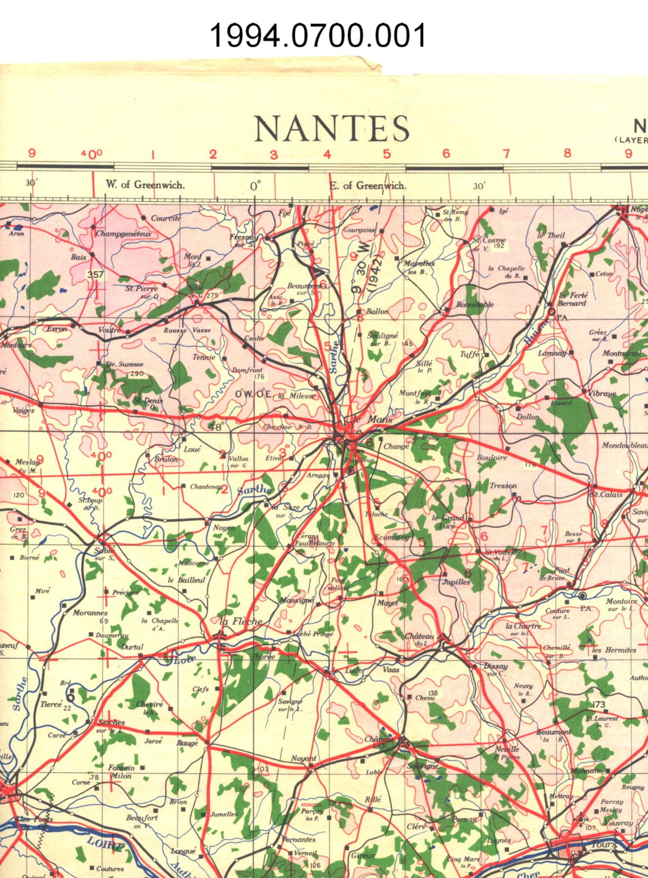
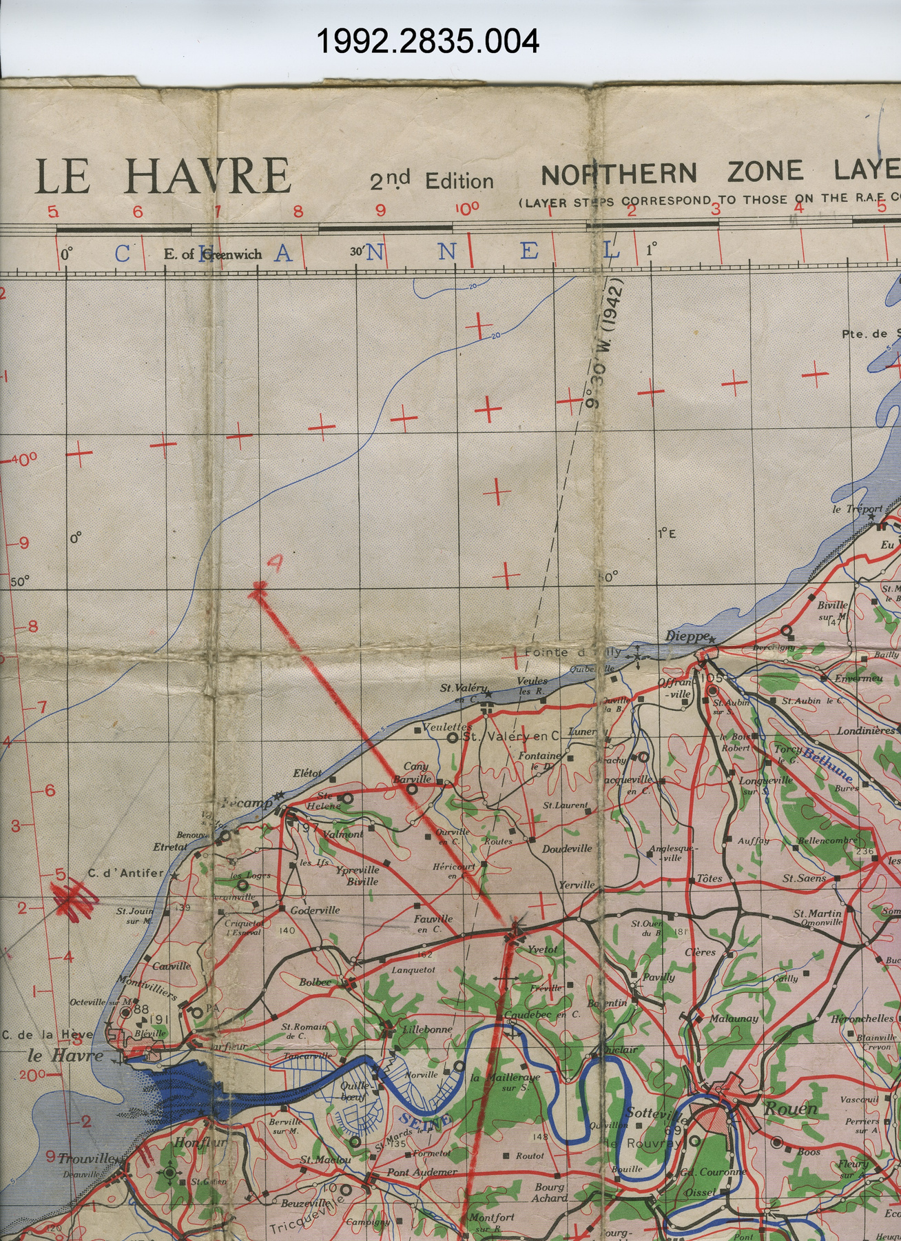
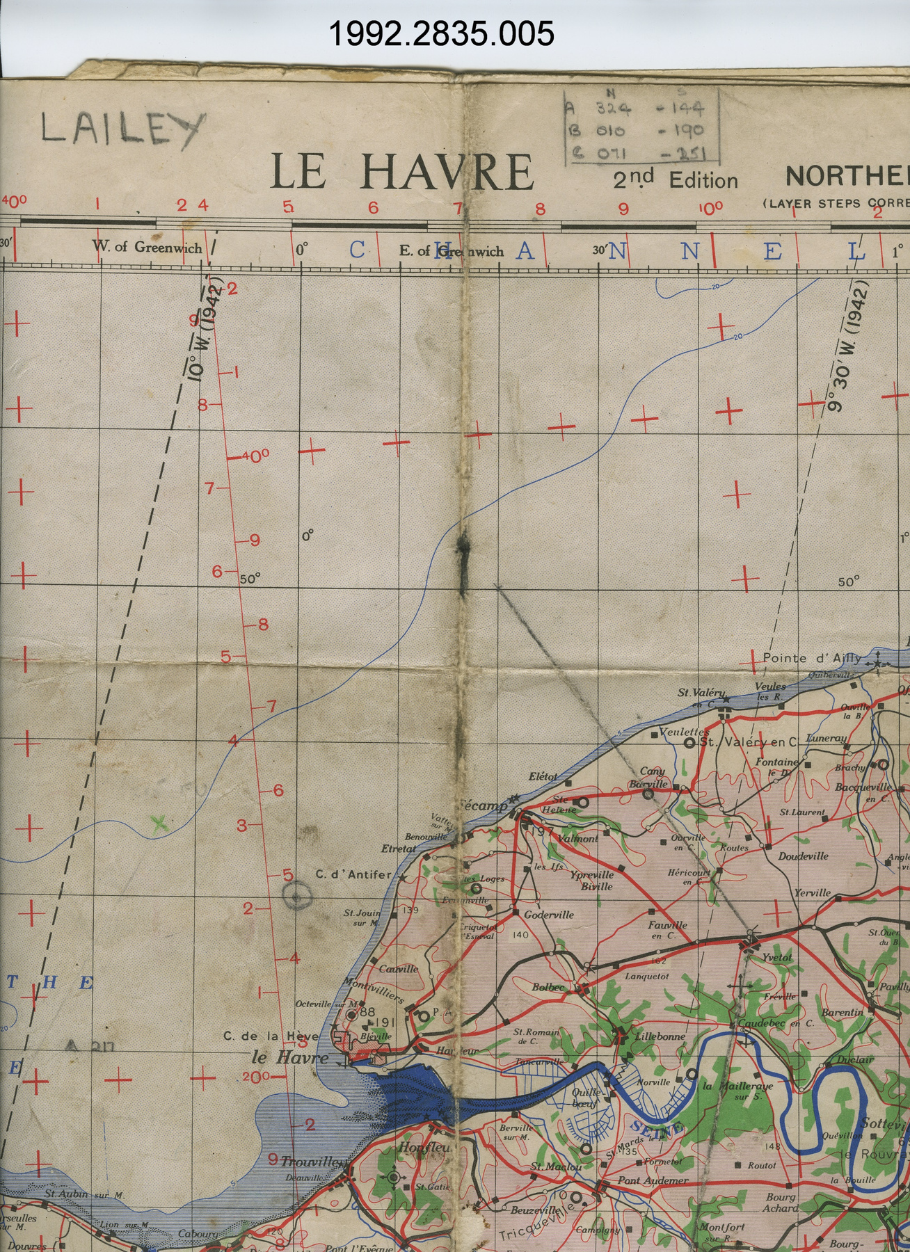
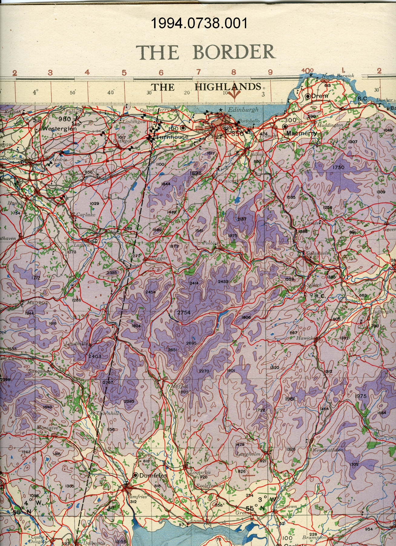
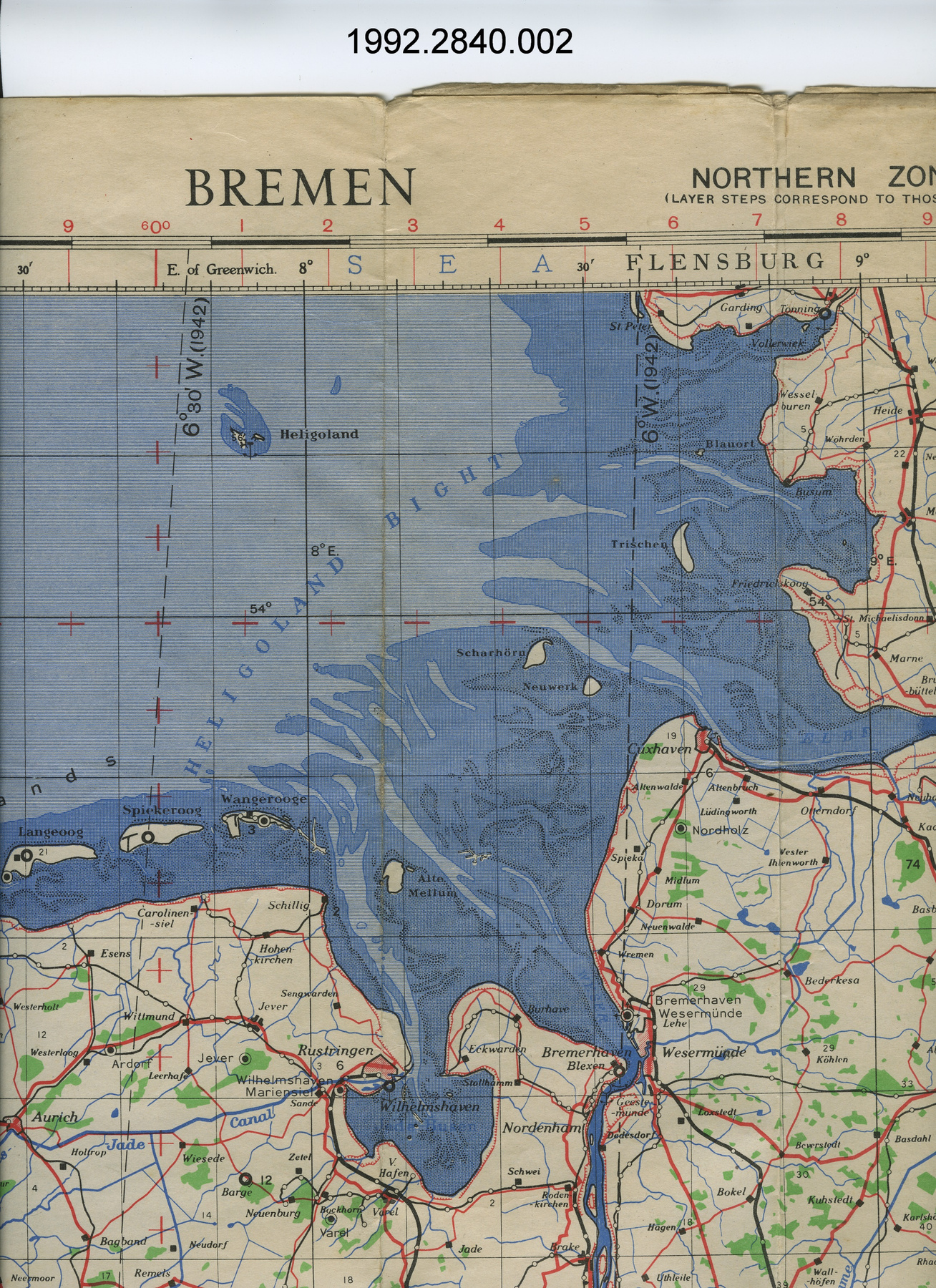
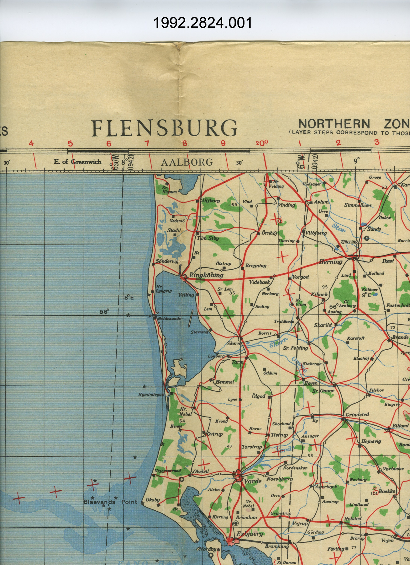
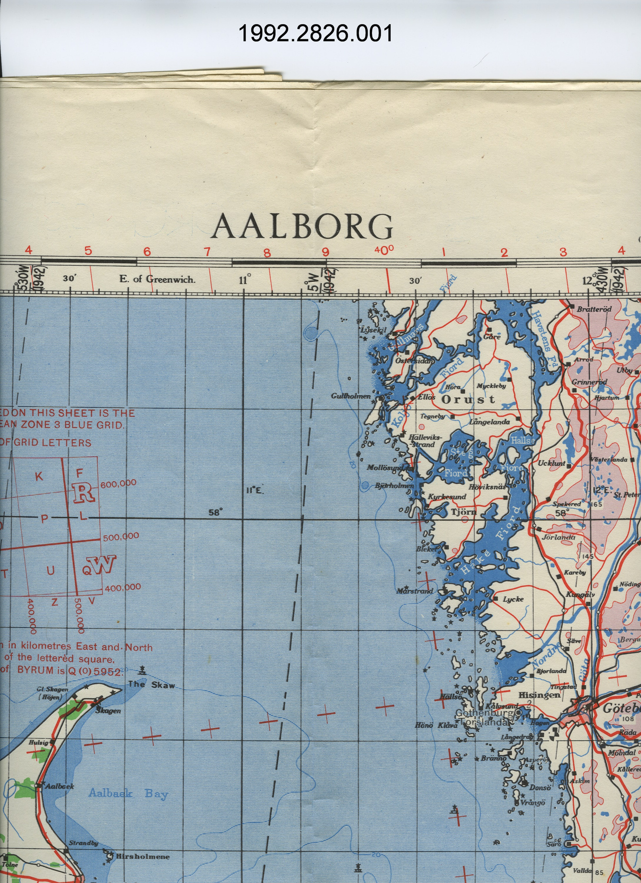
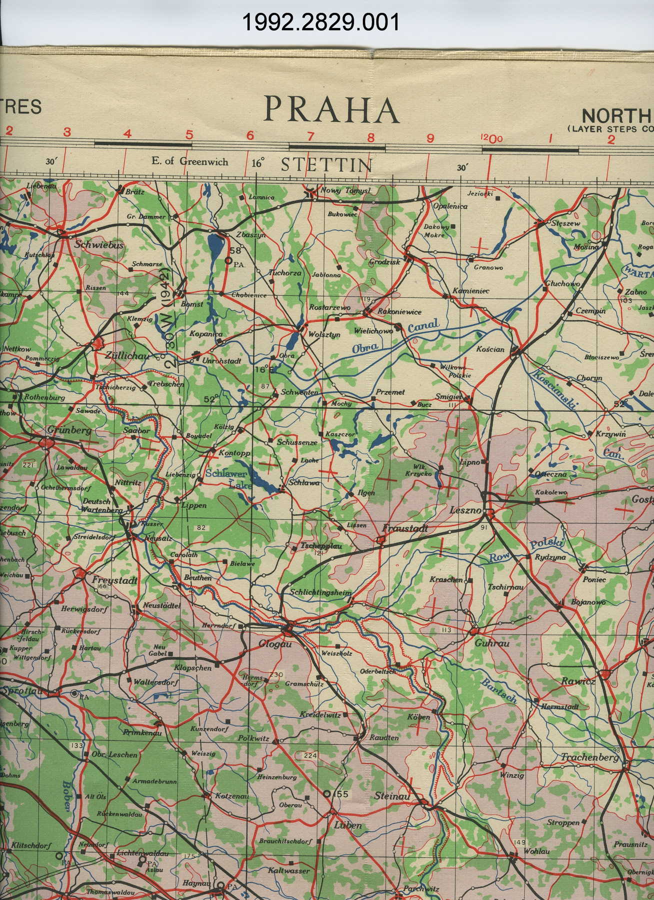
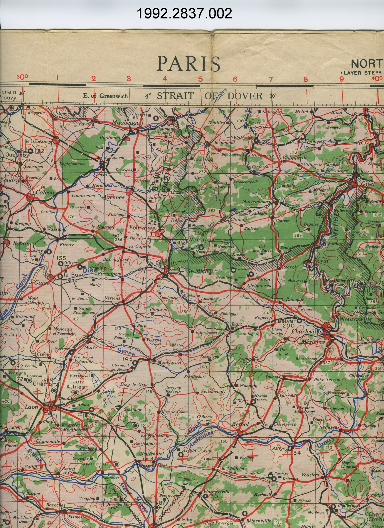
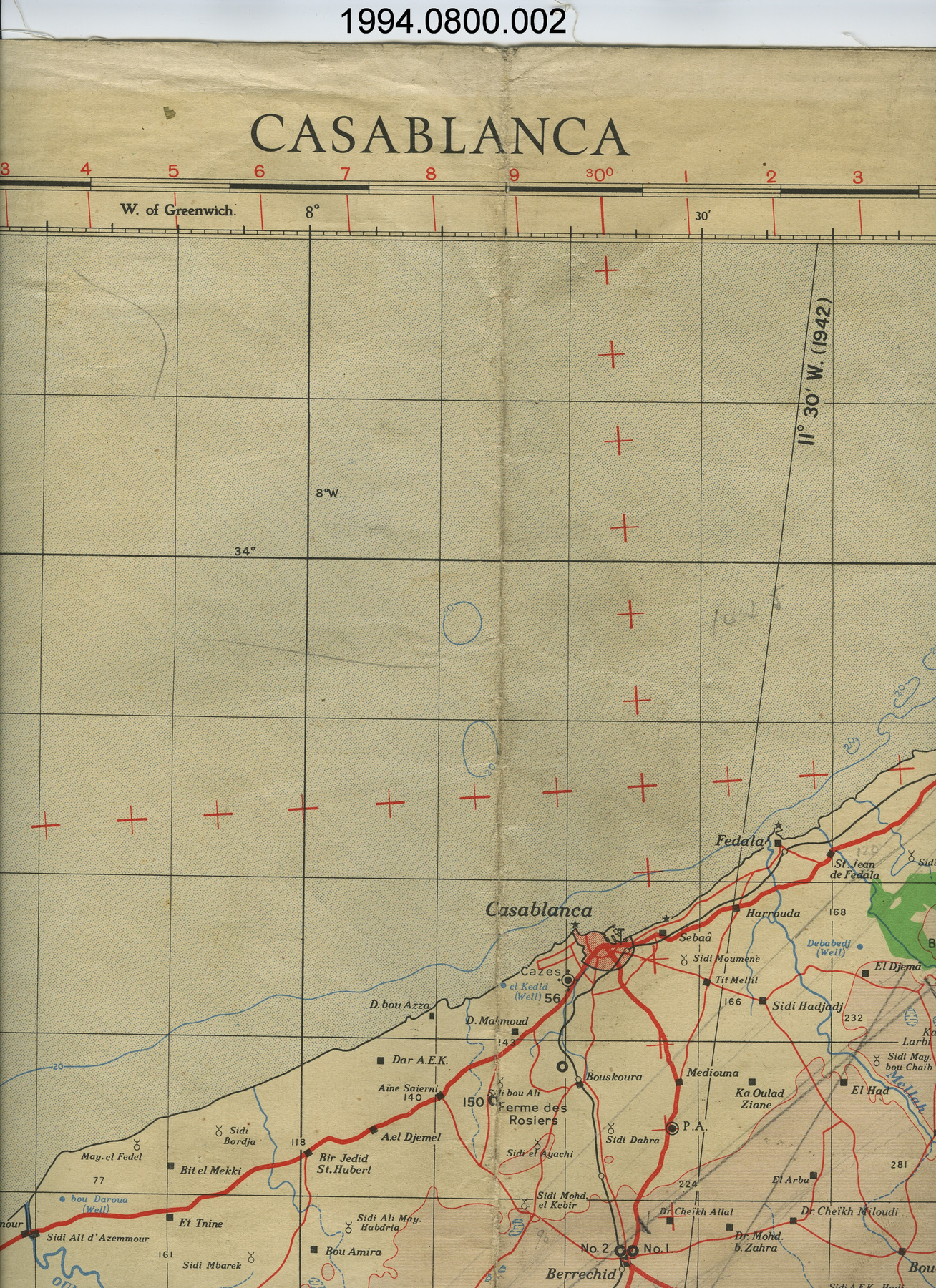
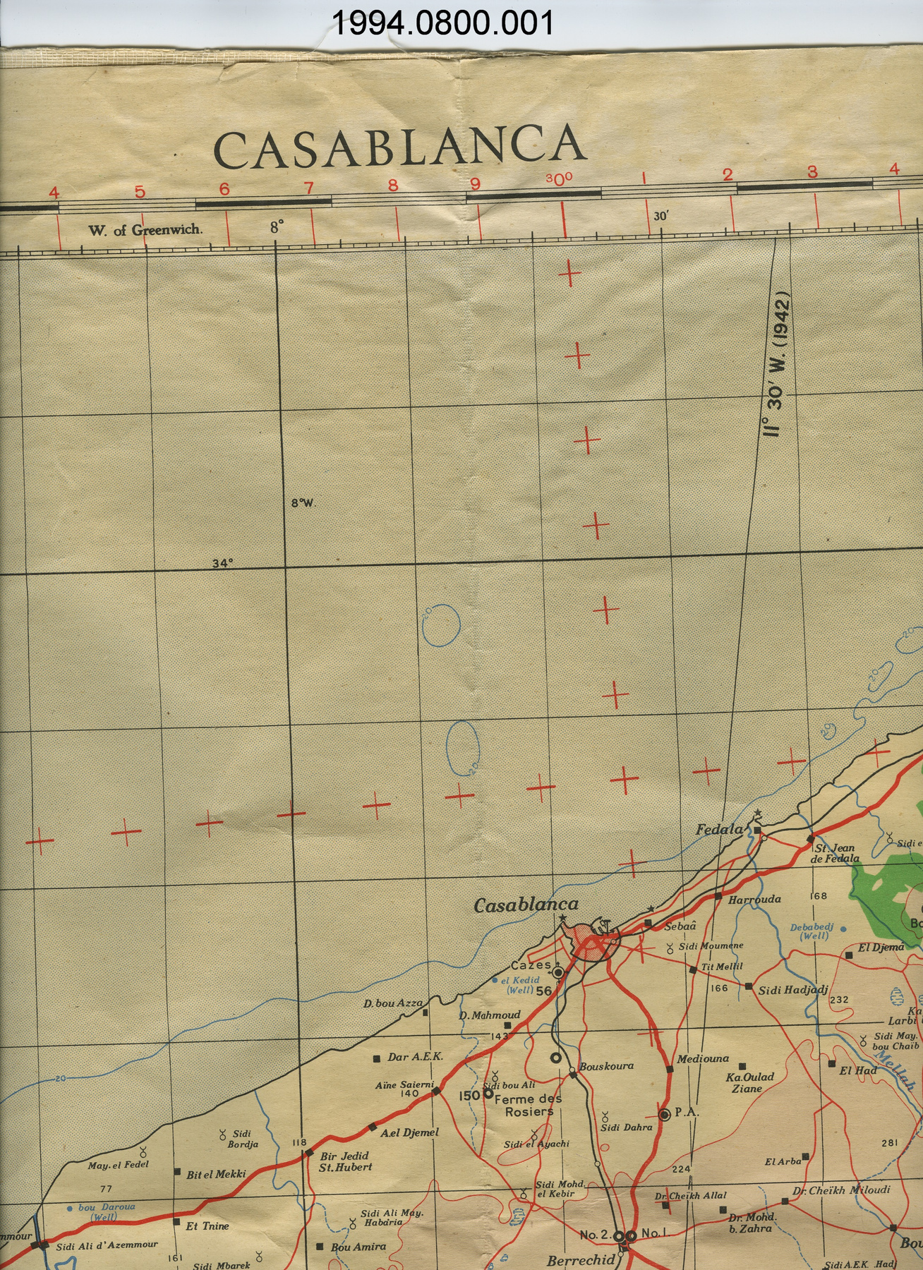
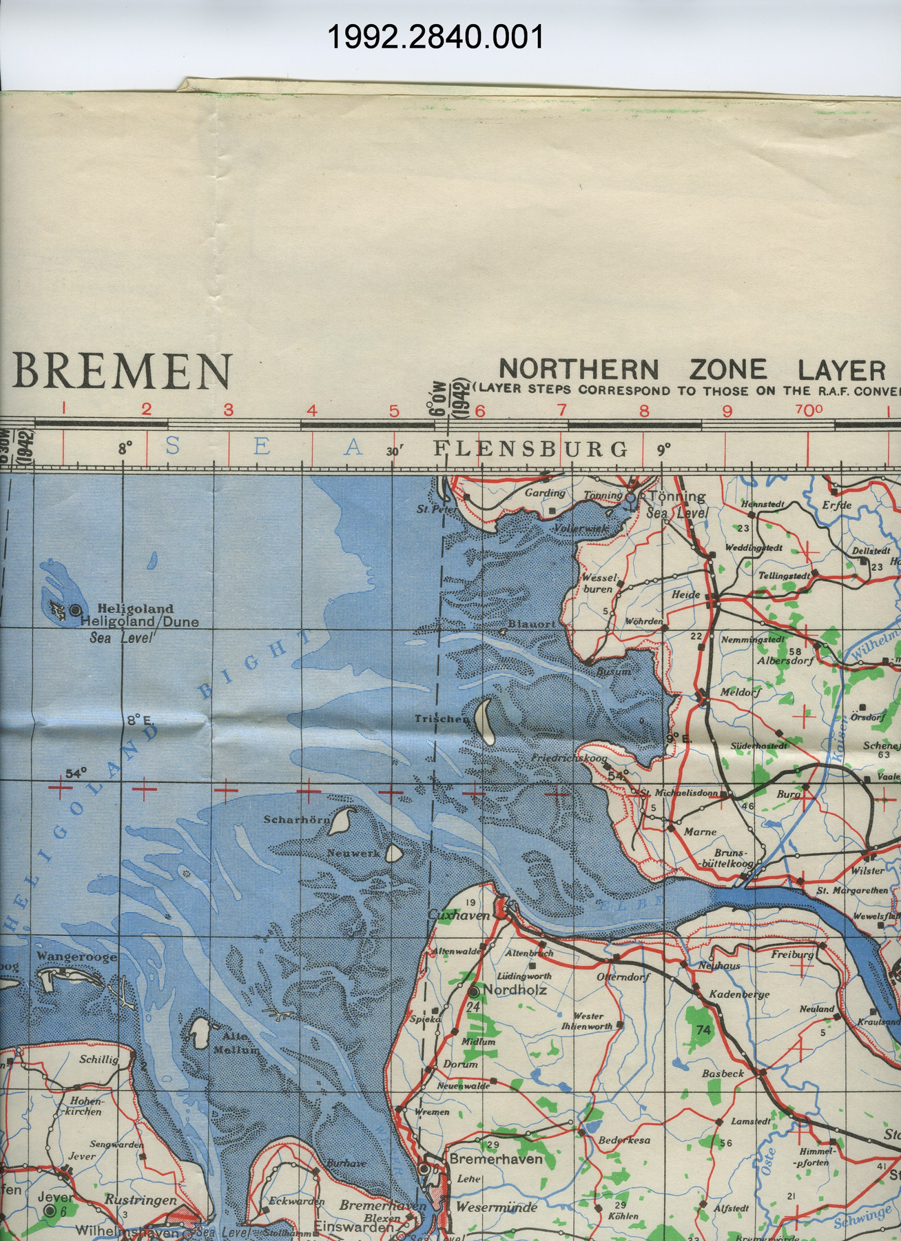
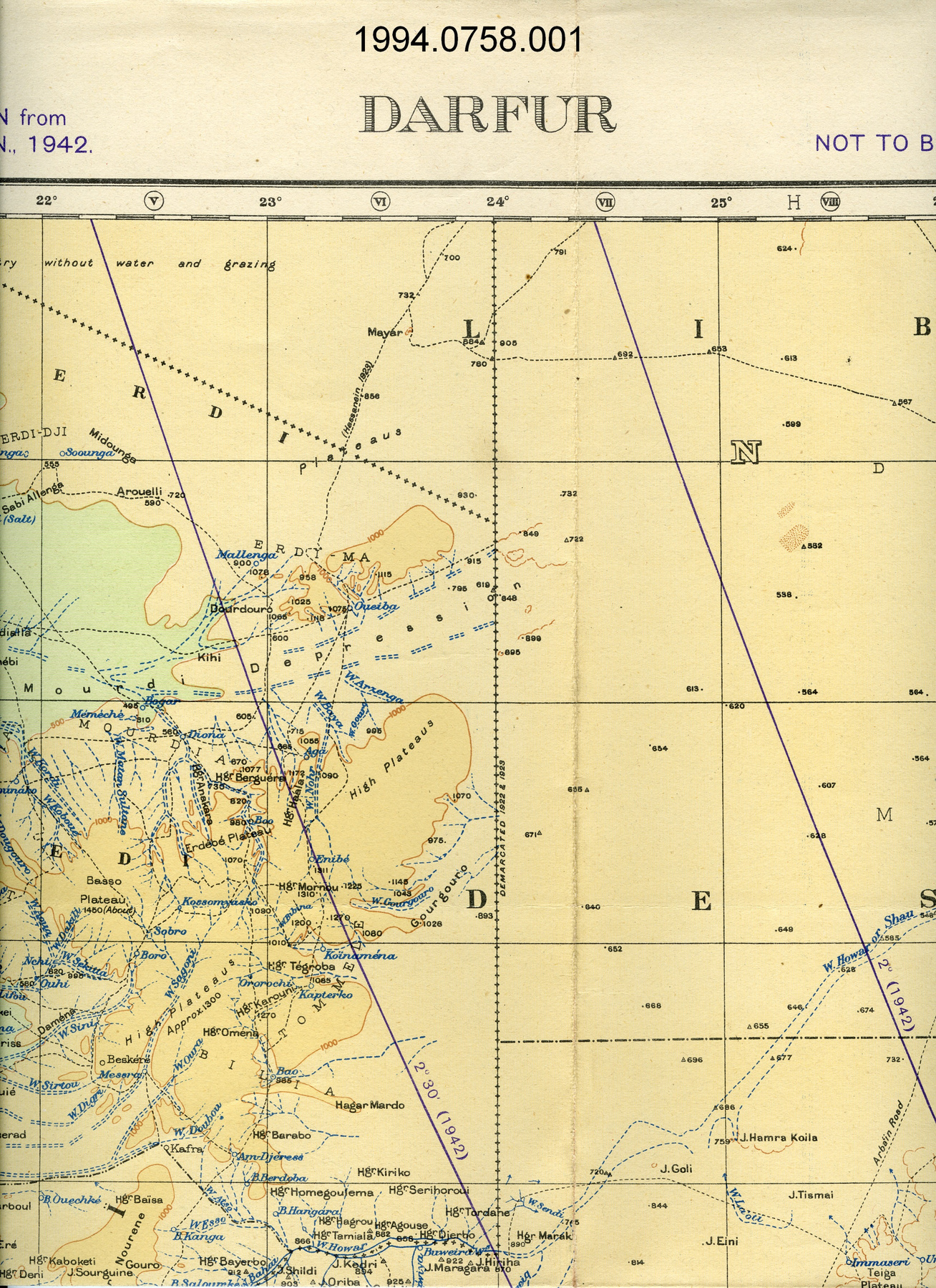
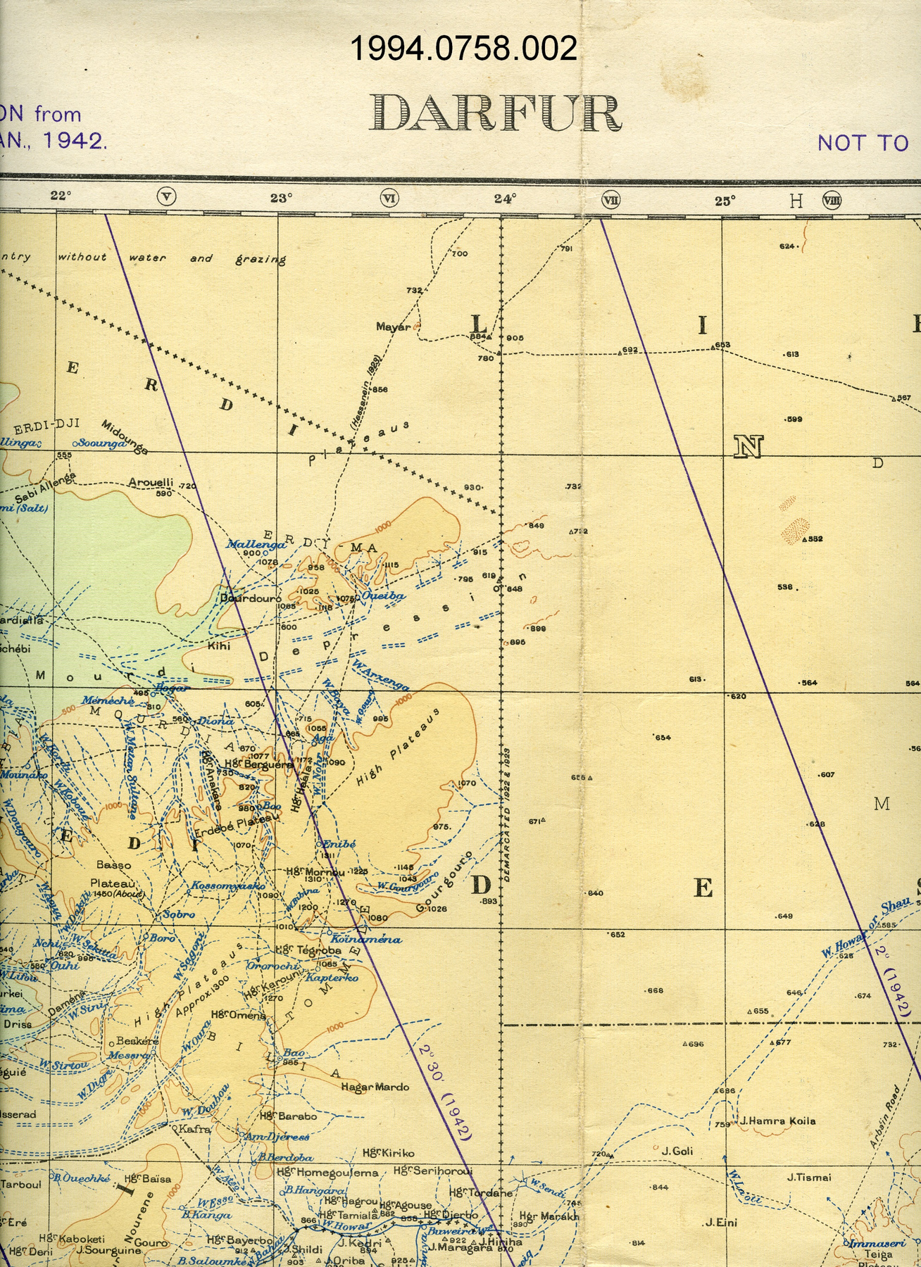
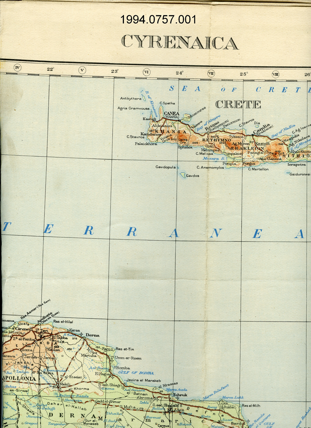
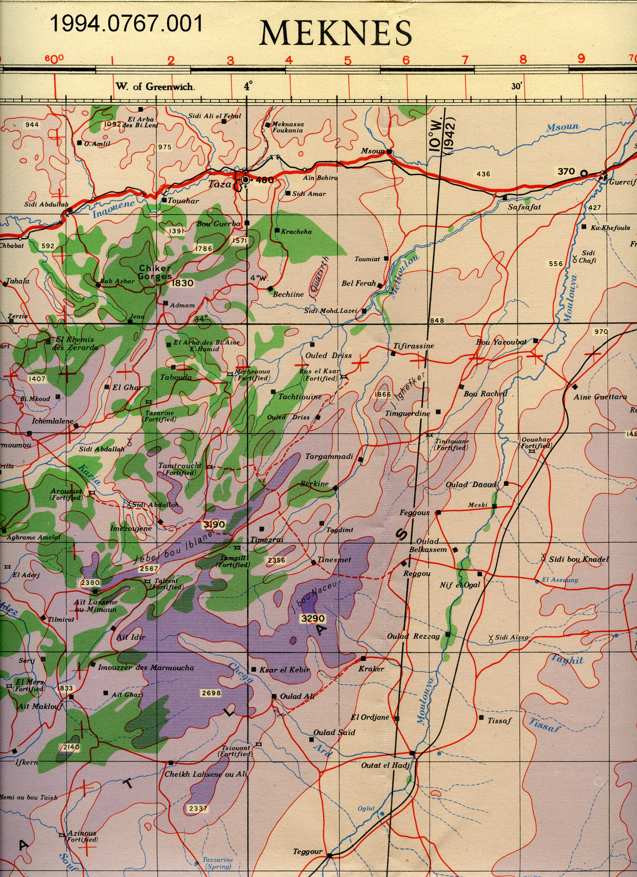
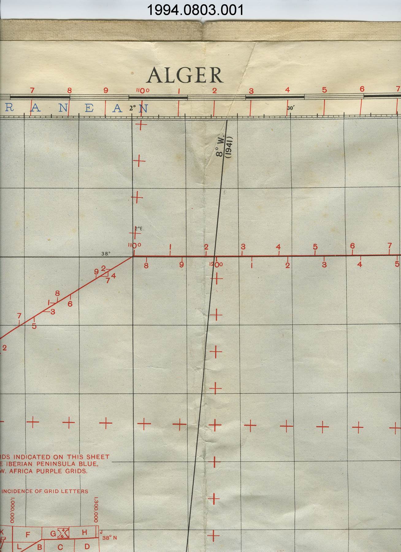
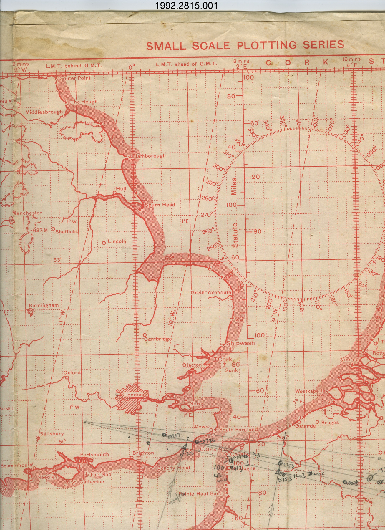
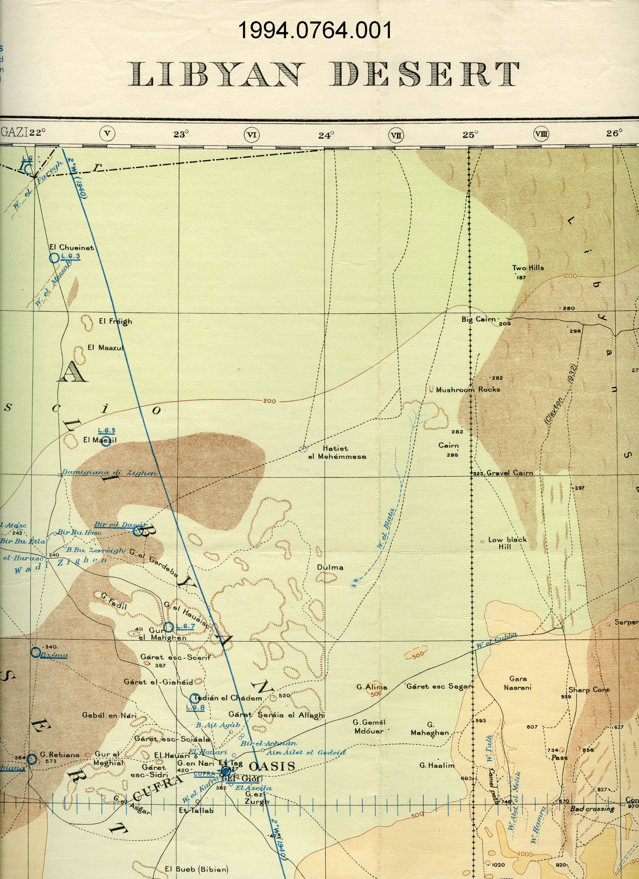
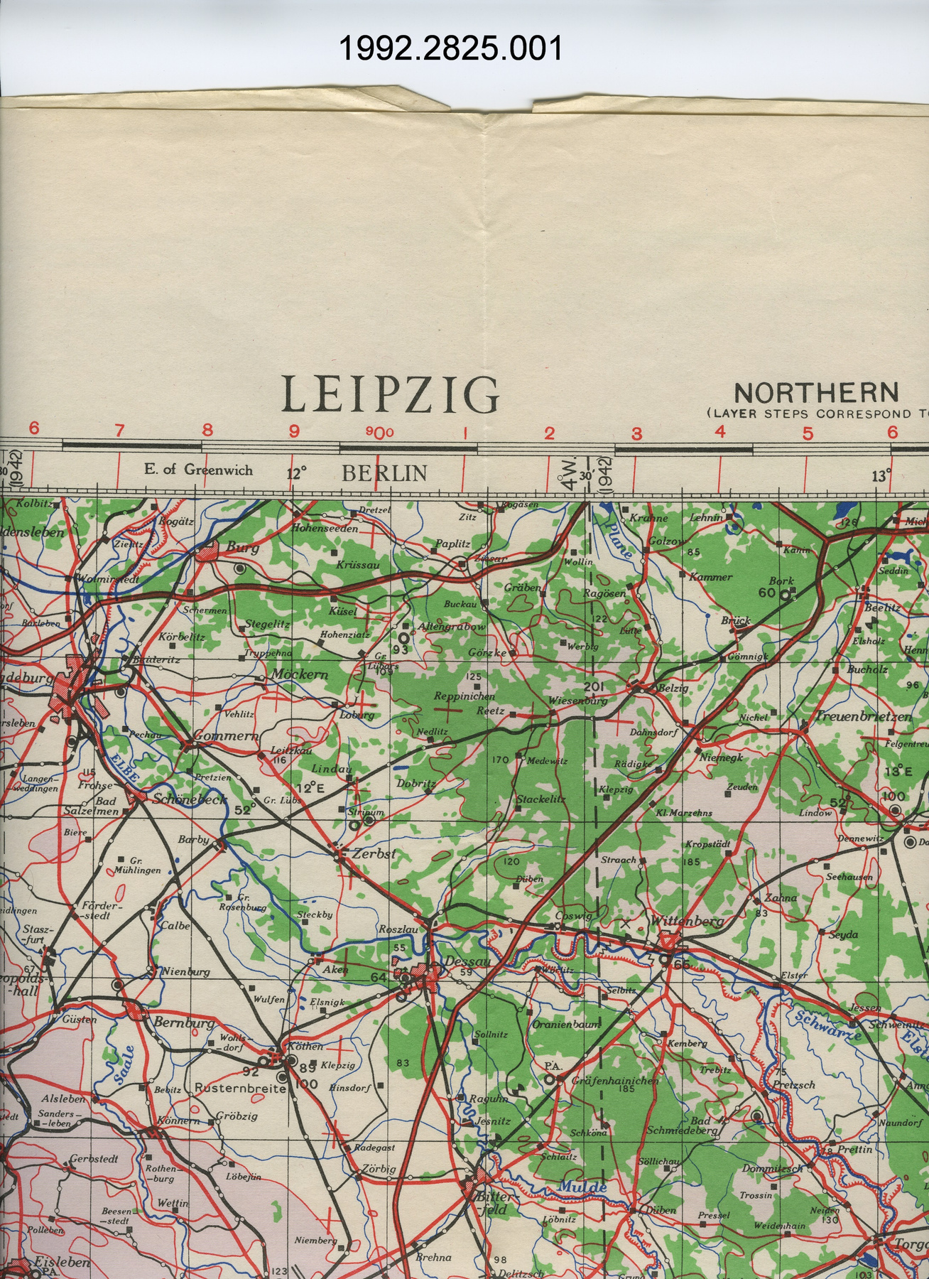
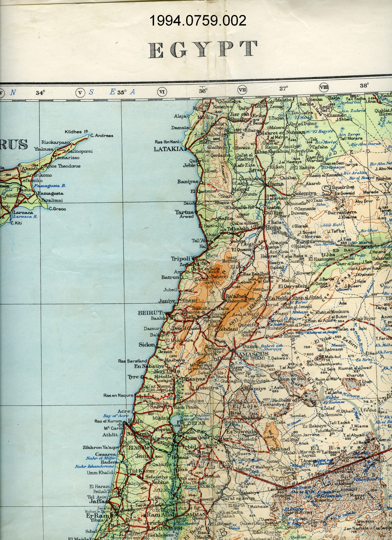
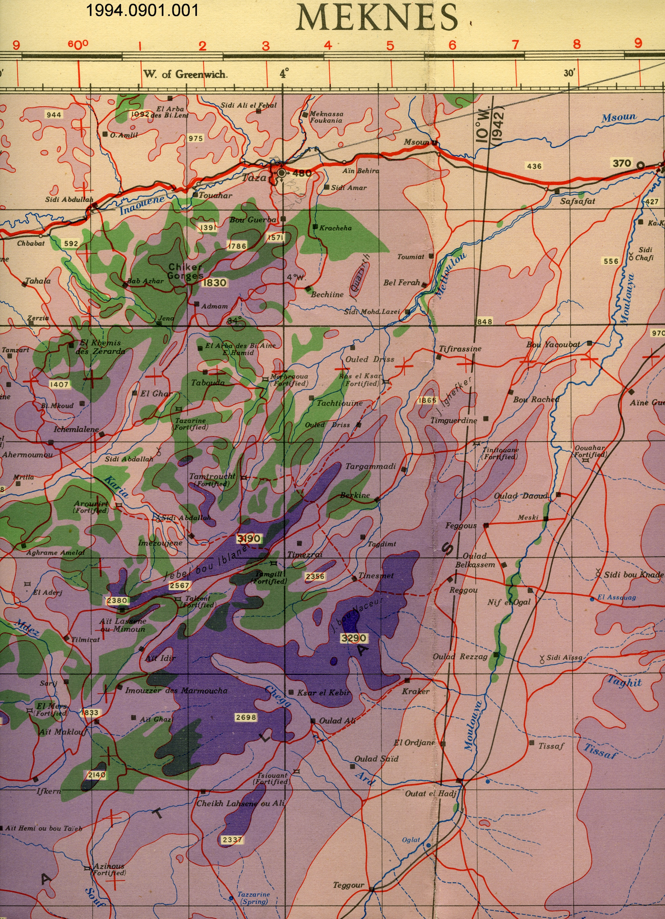
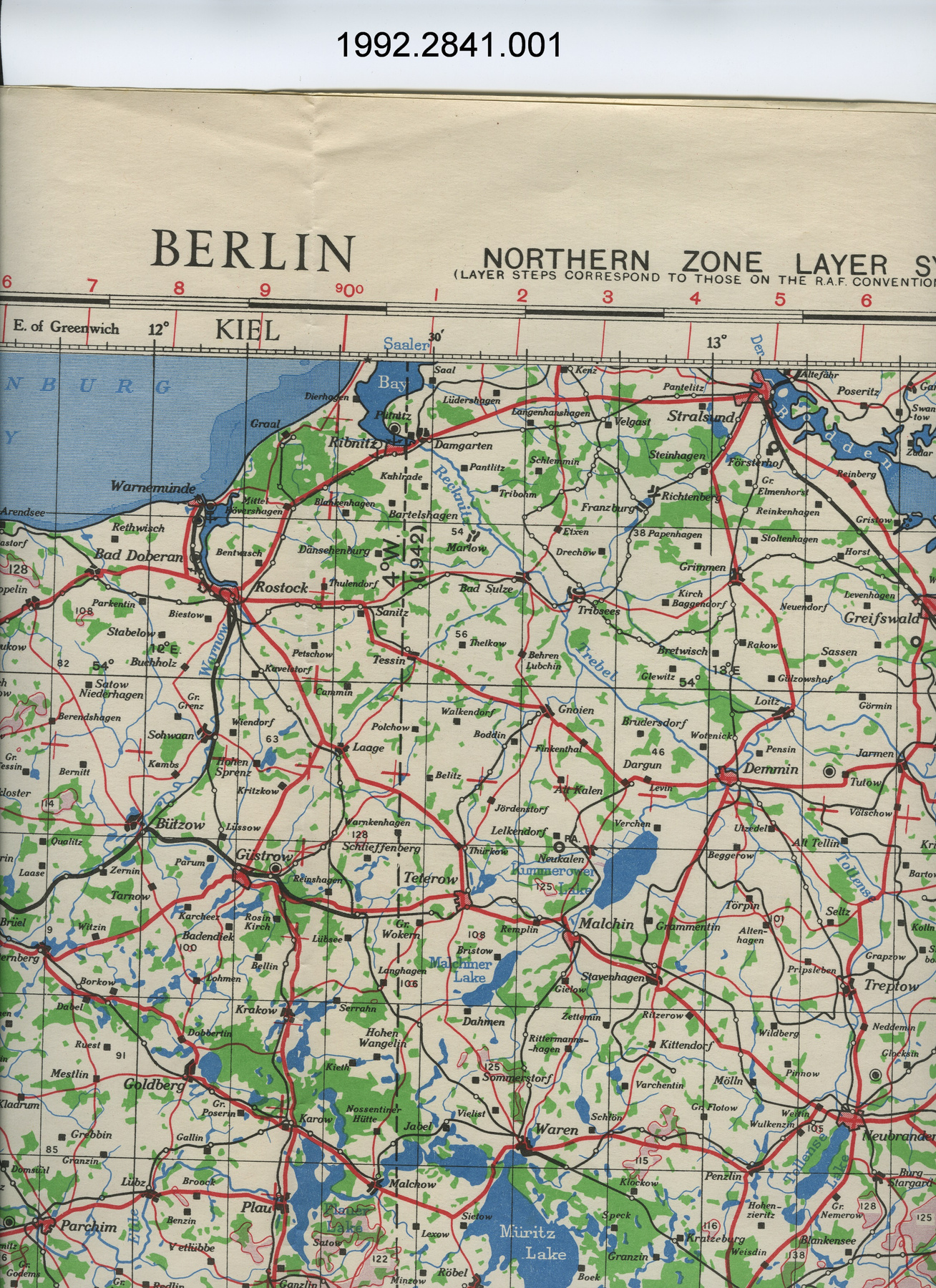
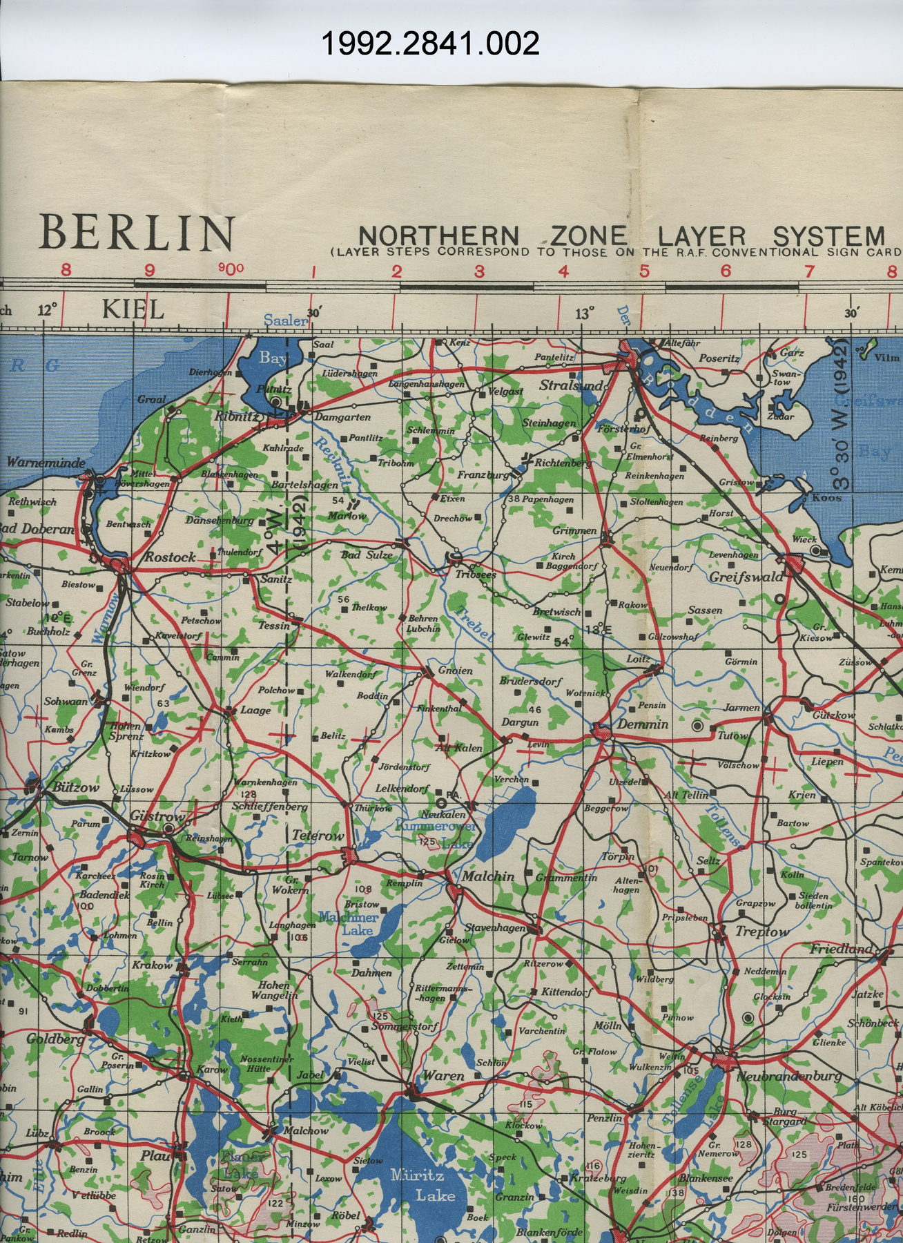
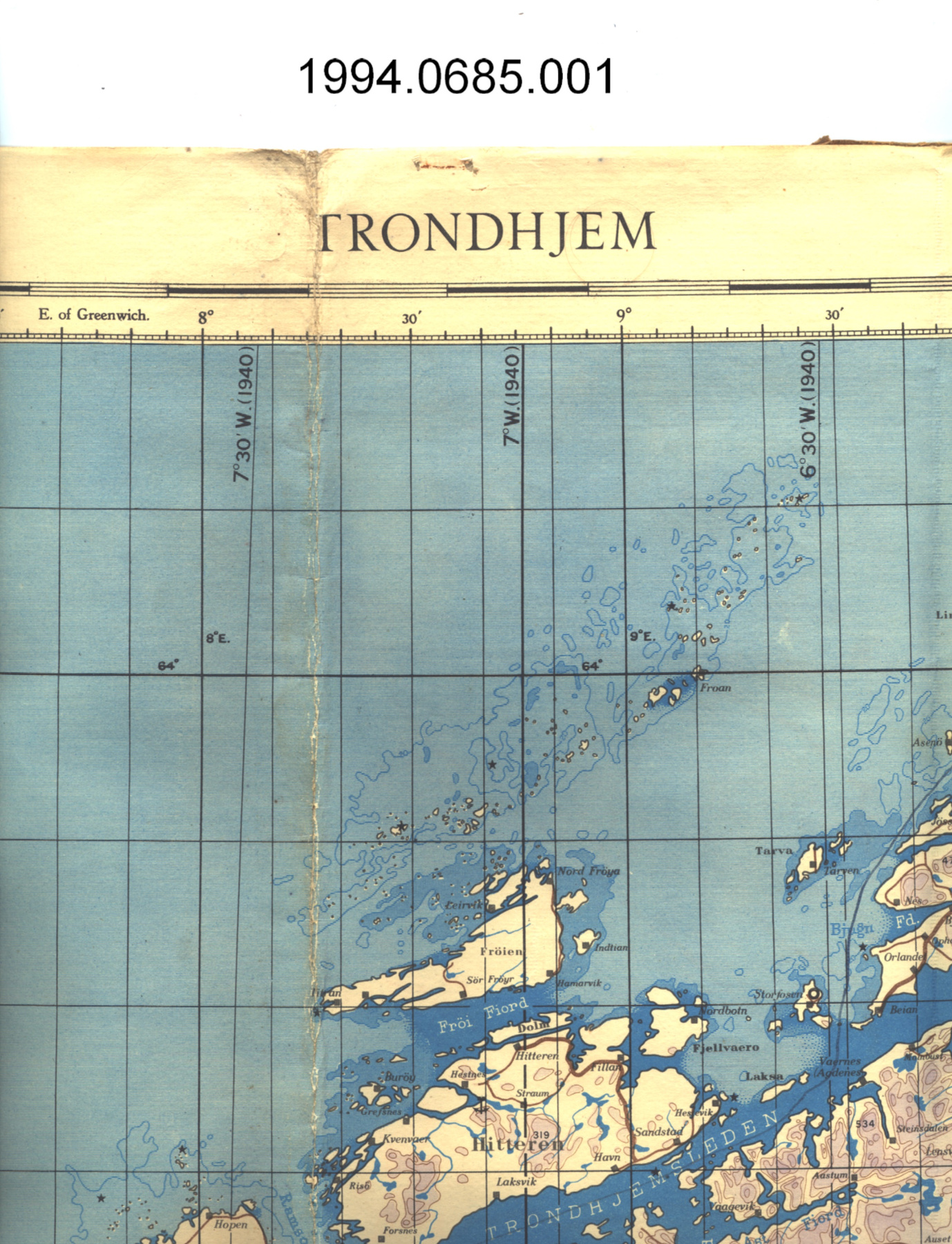
Map
Use this image
Can I reuse this image without permission? Yes
Object images on the Ingenium Collection’s portal have the following Creative Commons license:
Copyright Ingenium / CC BY-NC-ND (Attribution-NonCommercial 4.0 International (CC BY-NC 4.0)
ATTRIBUTE THIS IMAGE
Ingenium,
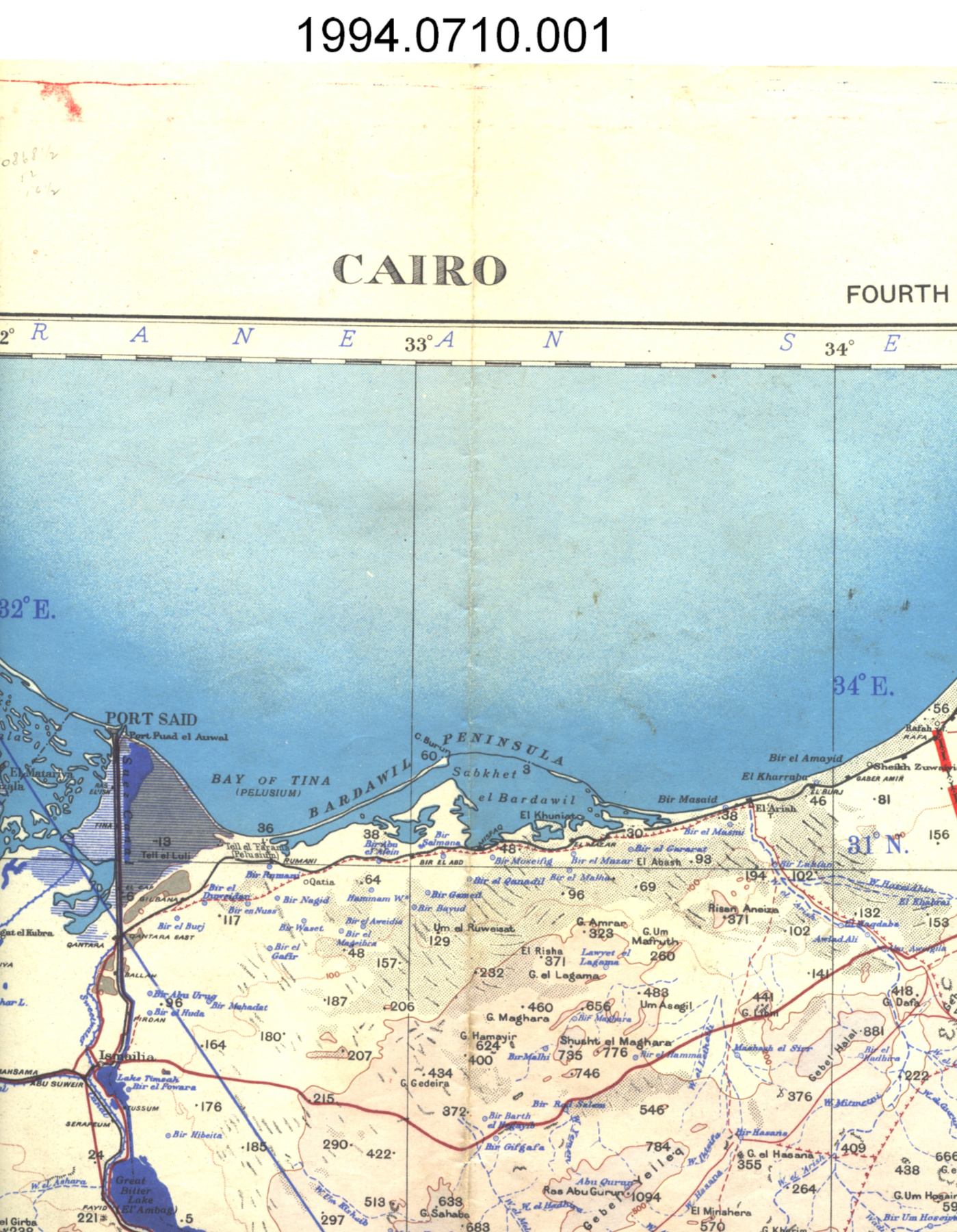
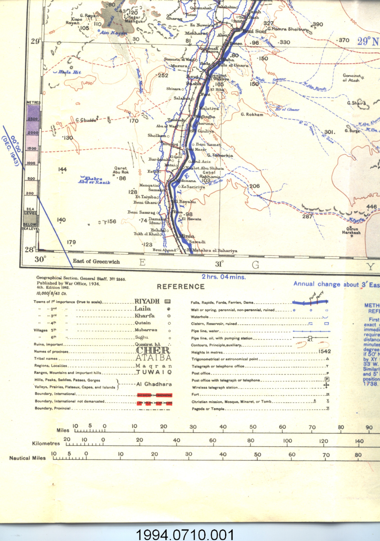
1994.0710.001
Permalink:
Ingenium is releasing this image under the Creative Commons licensing framework, and encourages downloading and reuse for non-commercial purposes. Please acknowledge Ingenium and cite the artifact number.
DOWNLOAD IMAGEPURCHASE THIS IMAGE
This image is free for non-commercial use.
For commercial use, please consult our Reproduction Fees and contact us to purchase the image.
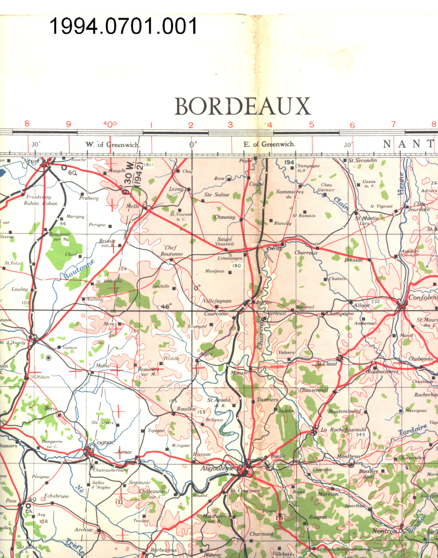
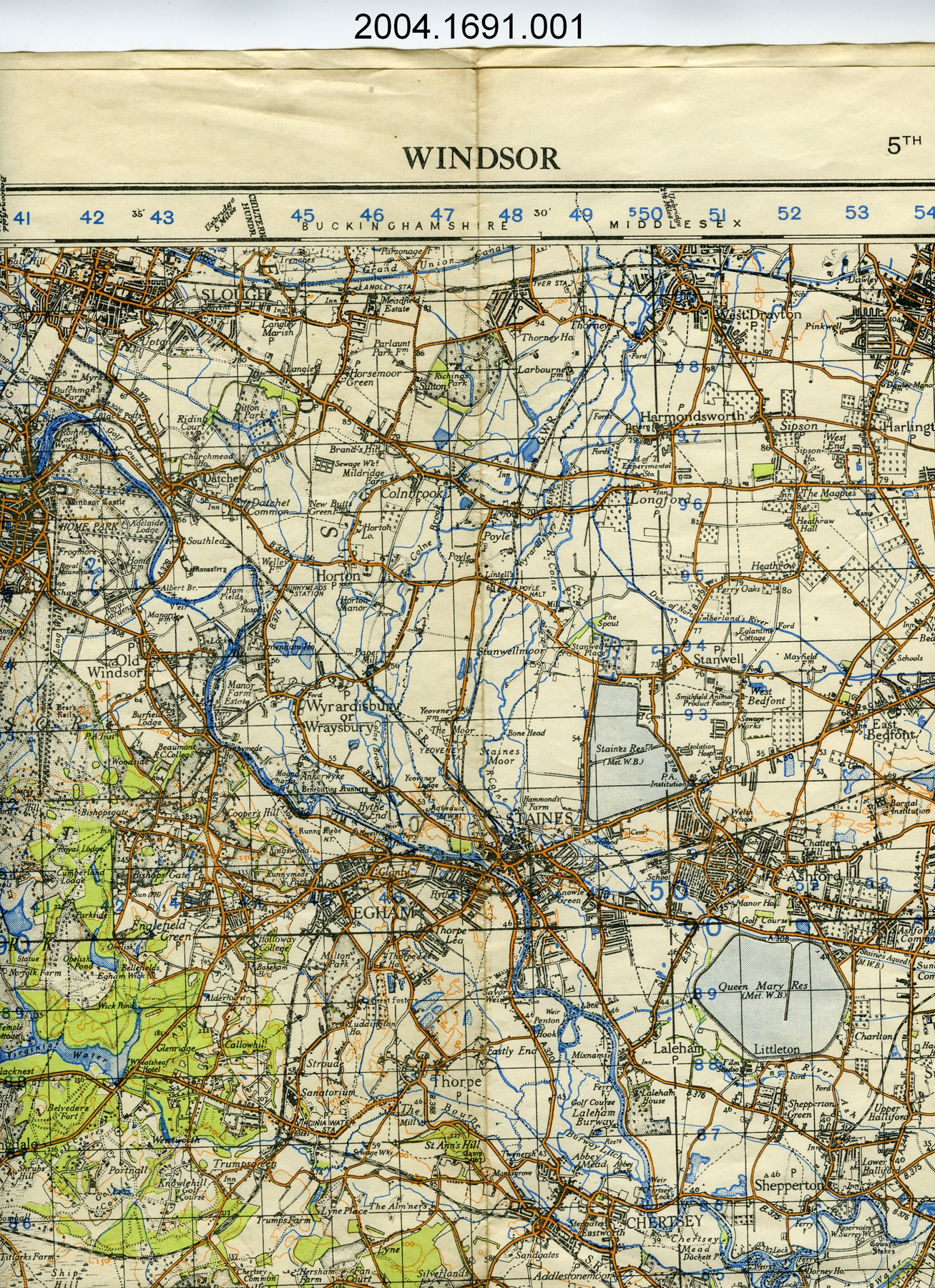
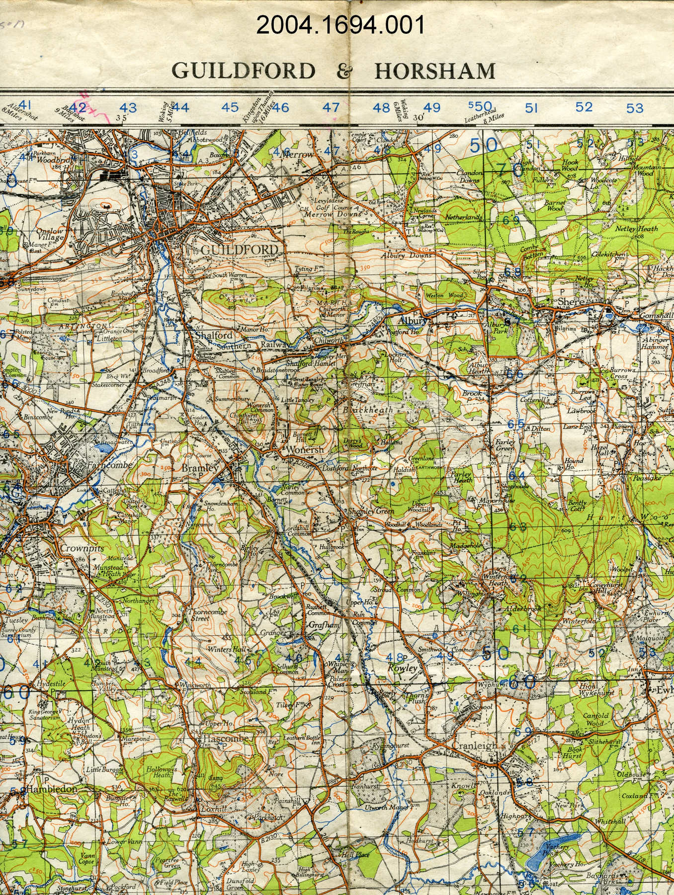
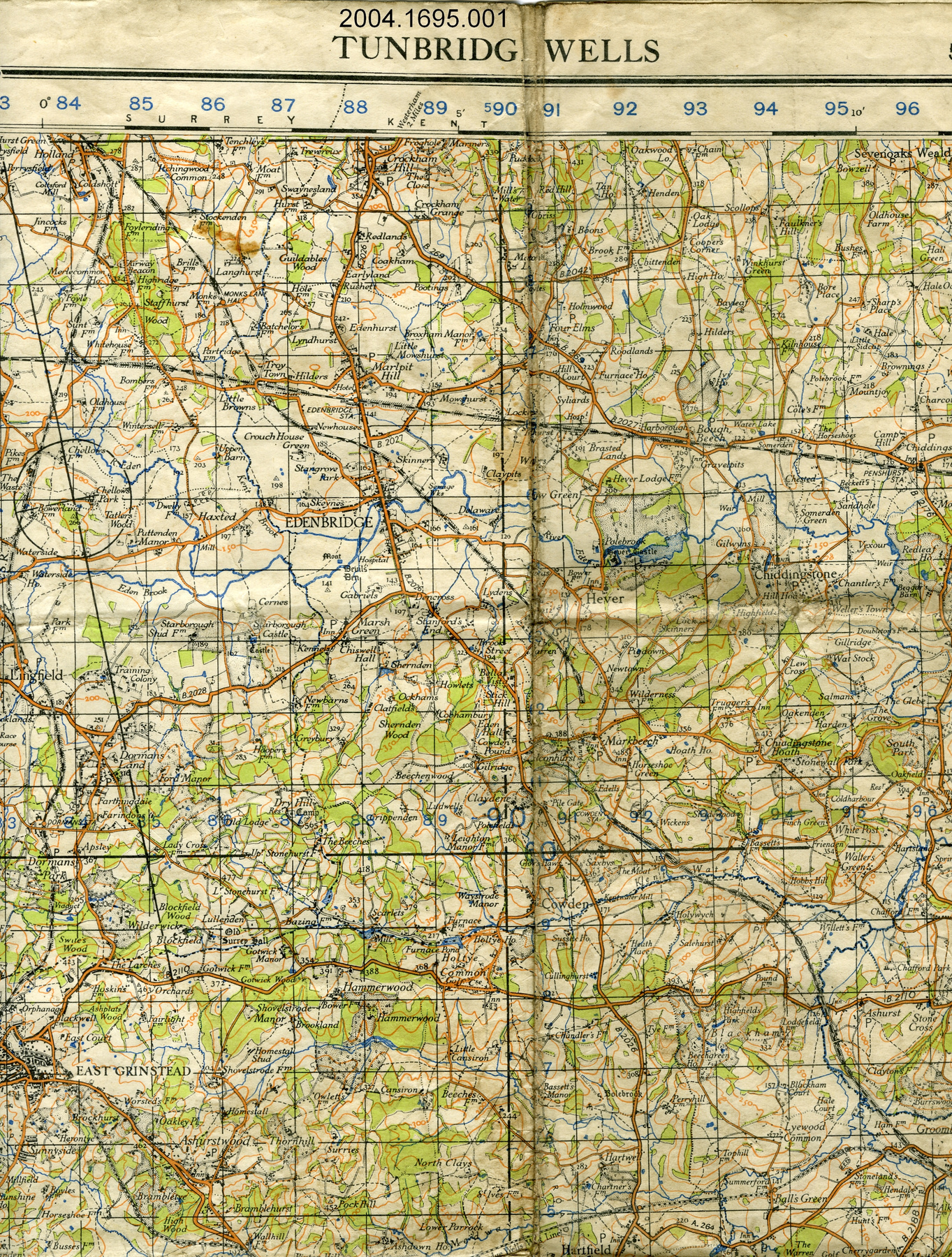
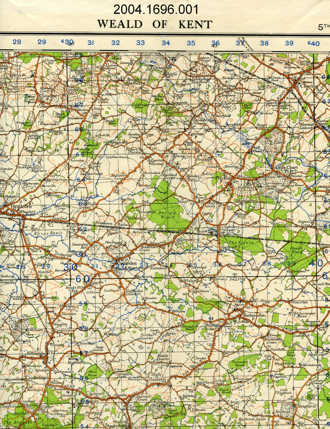
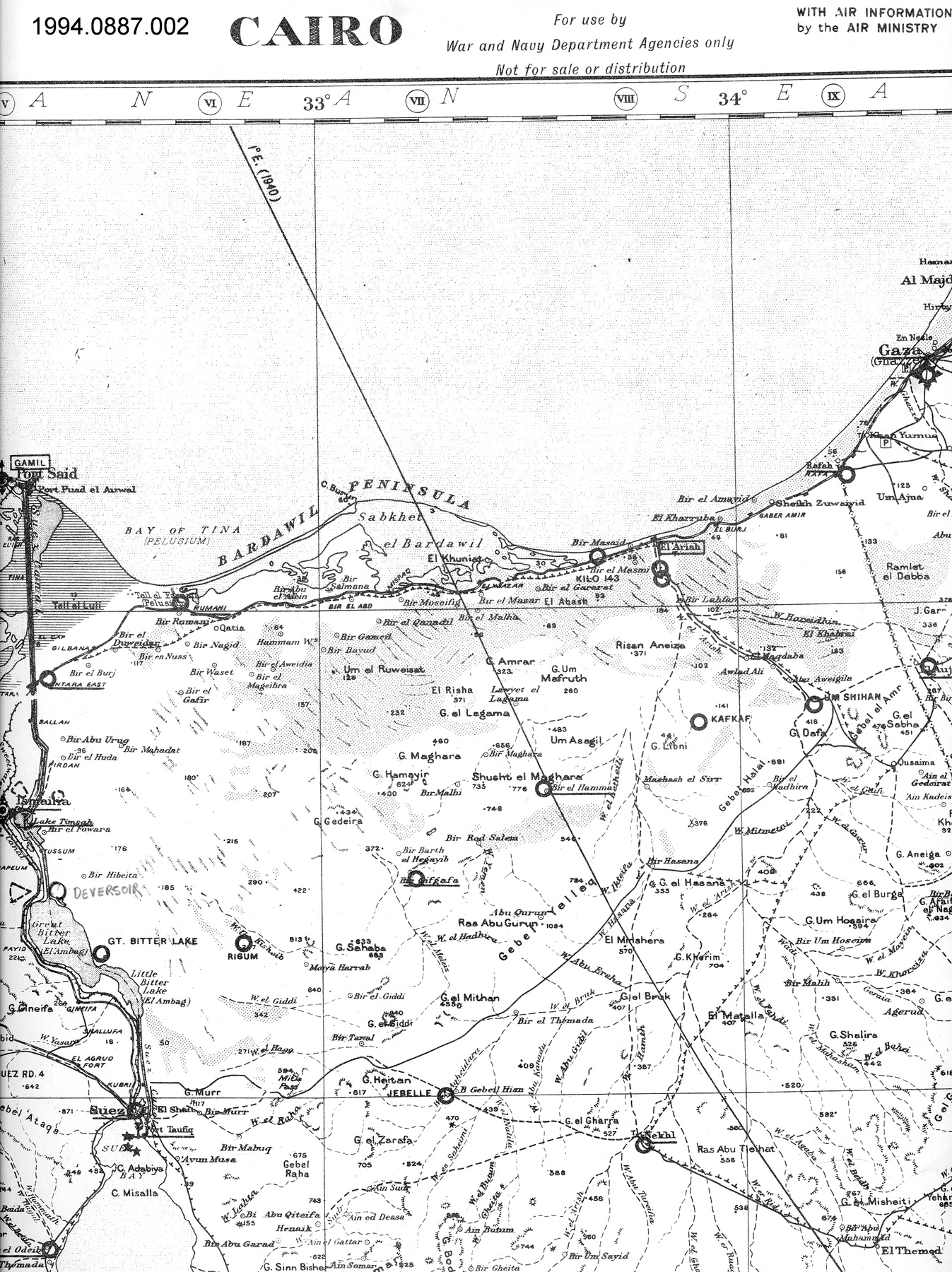
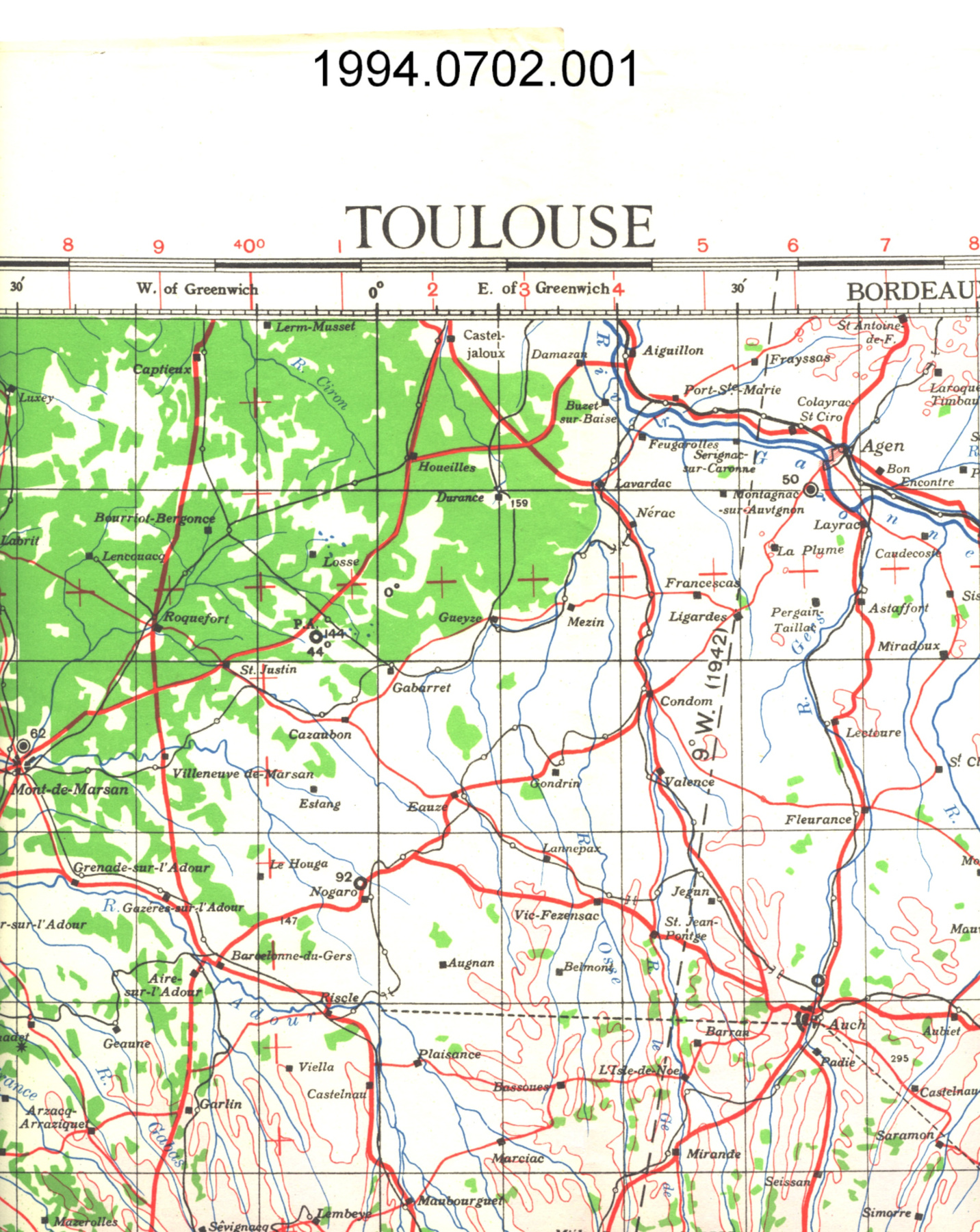
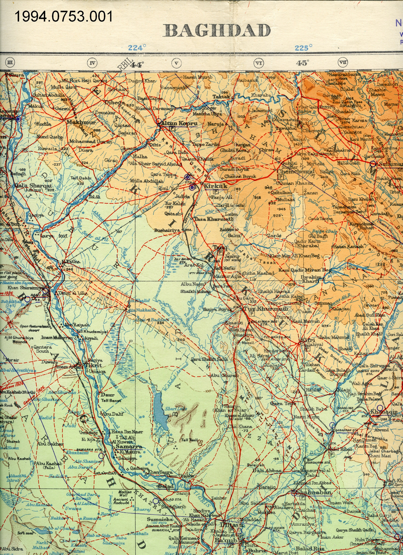
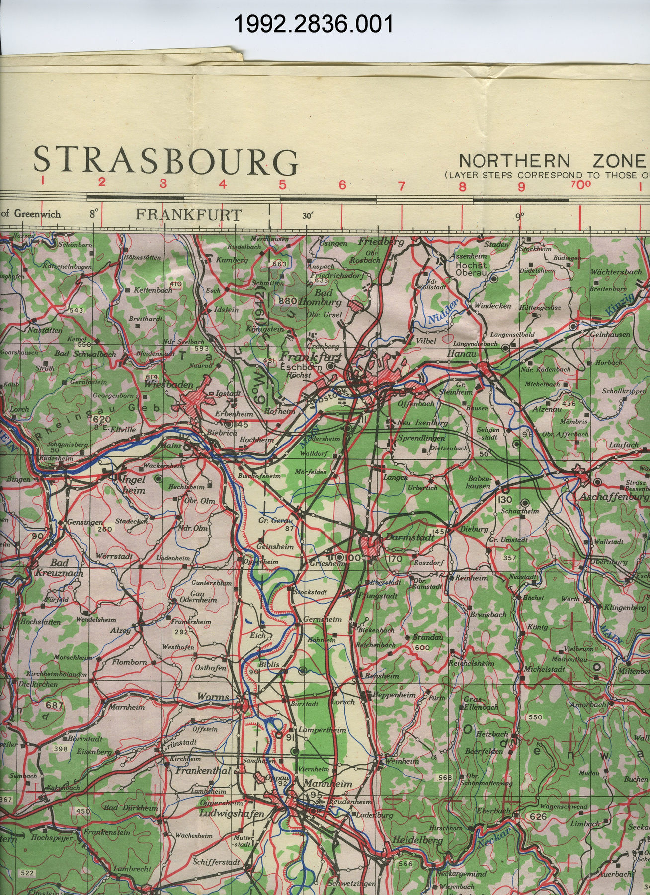
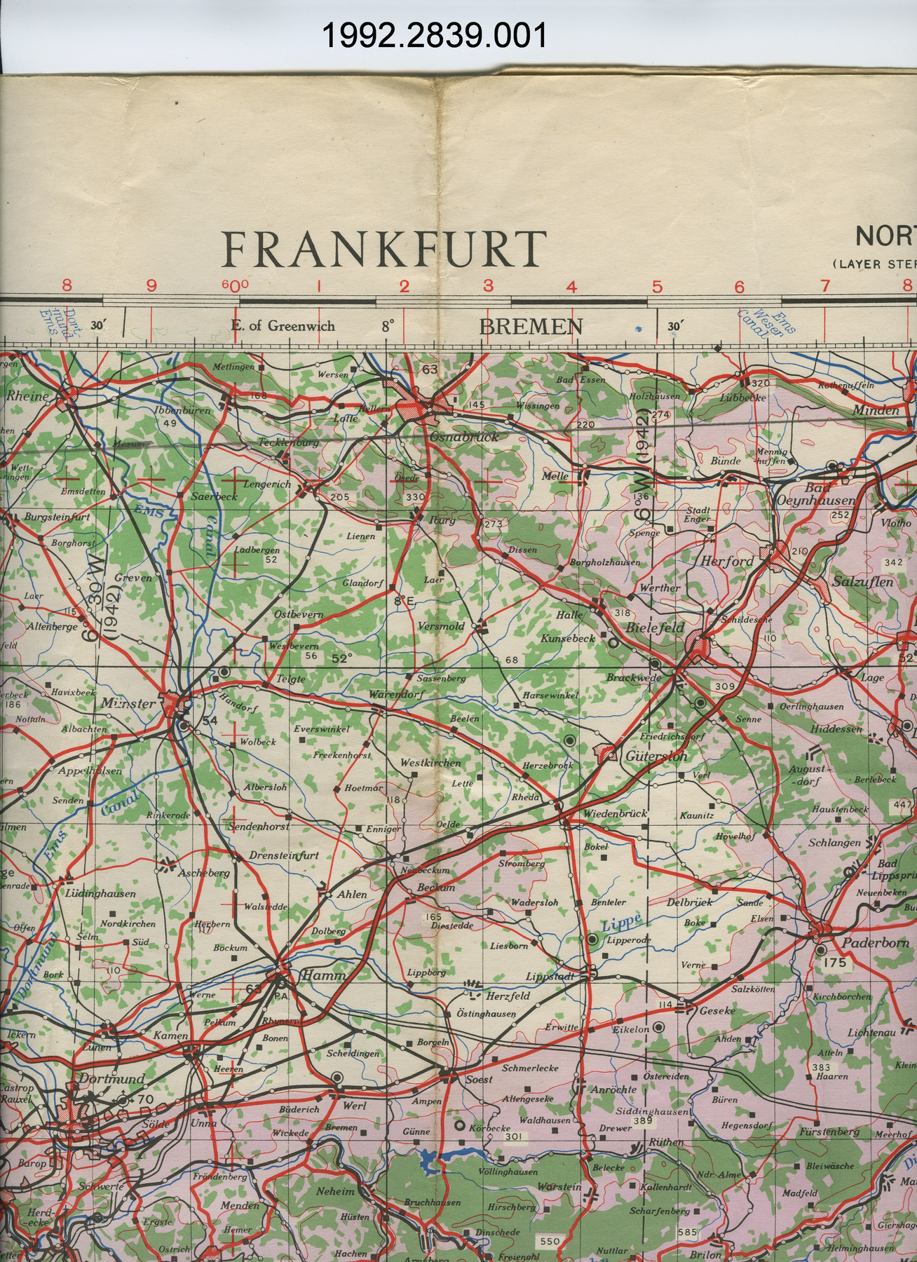
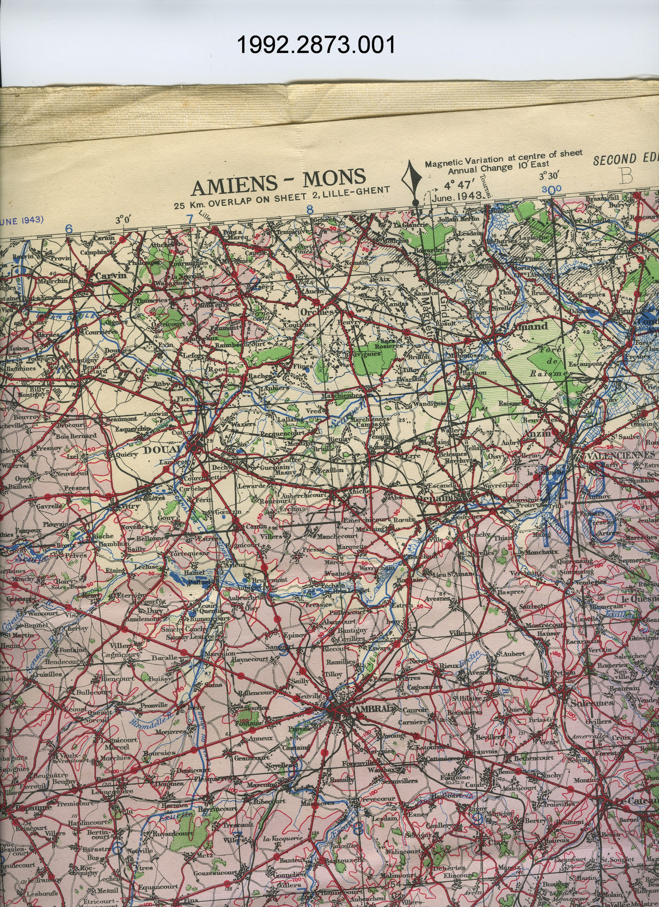
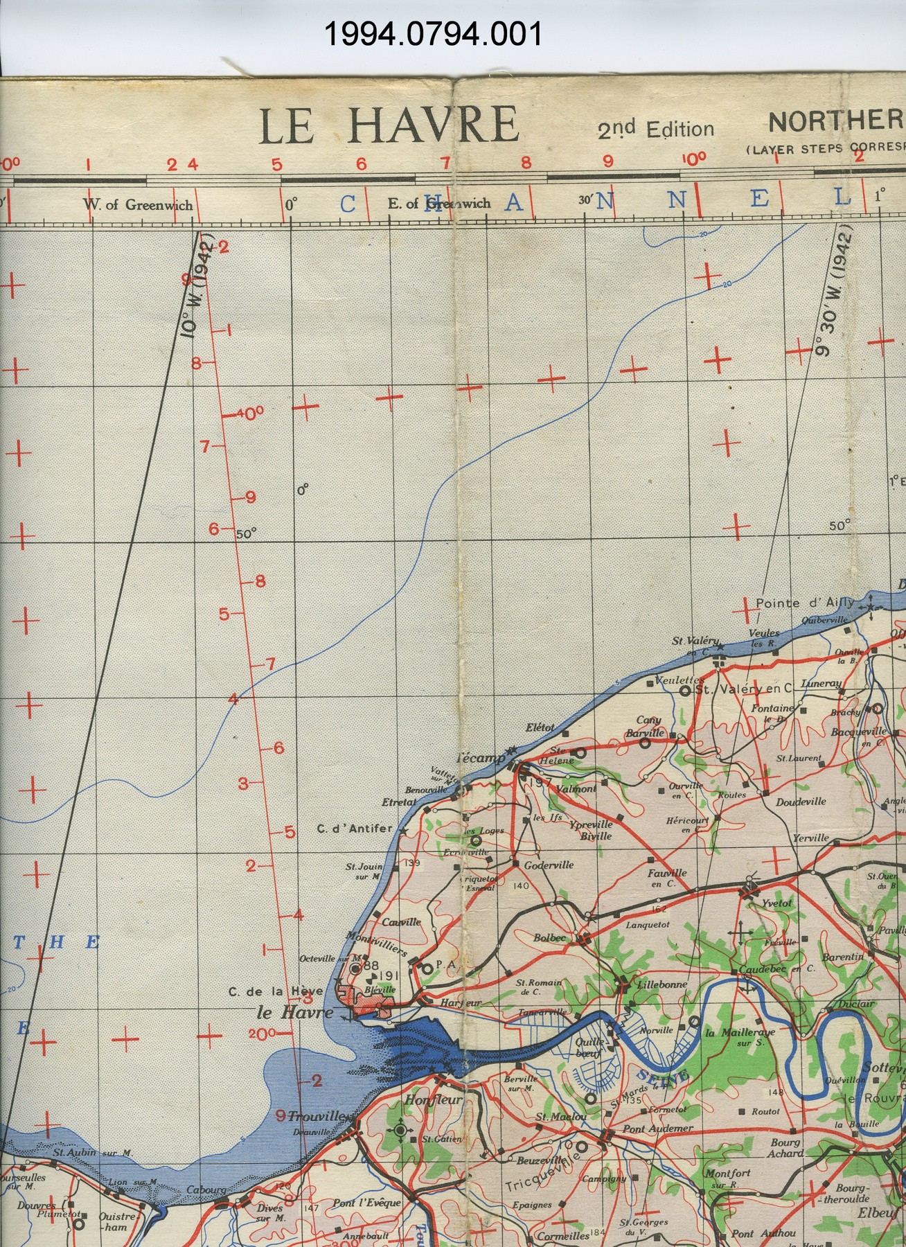
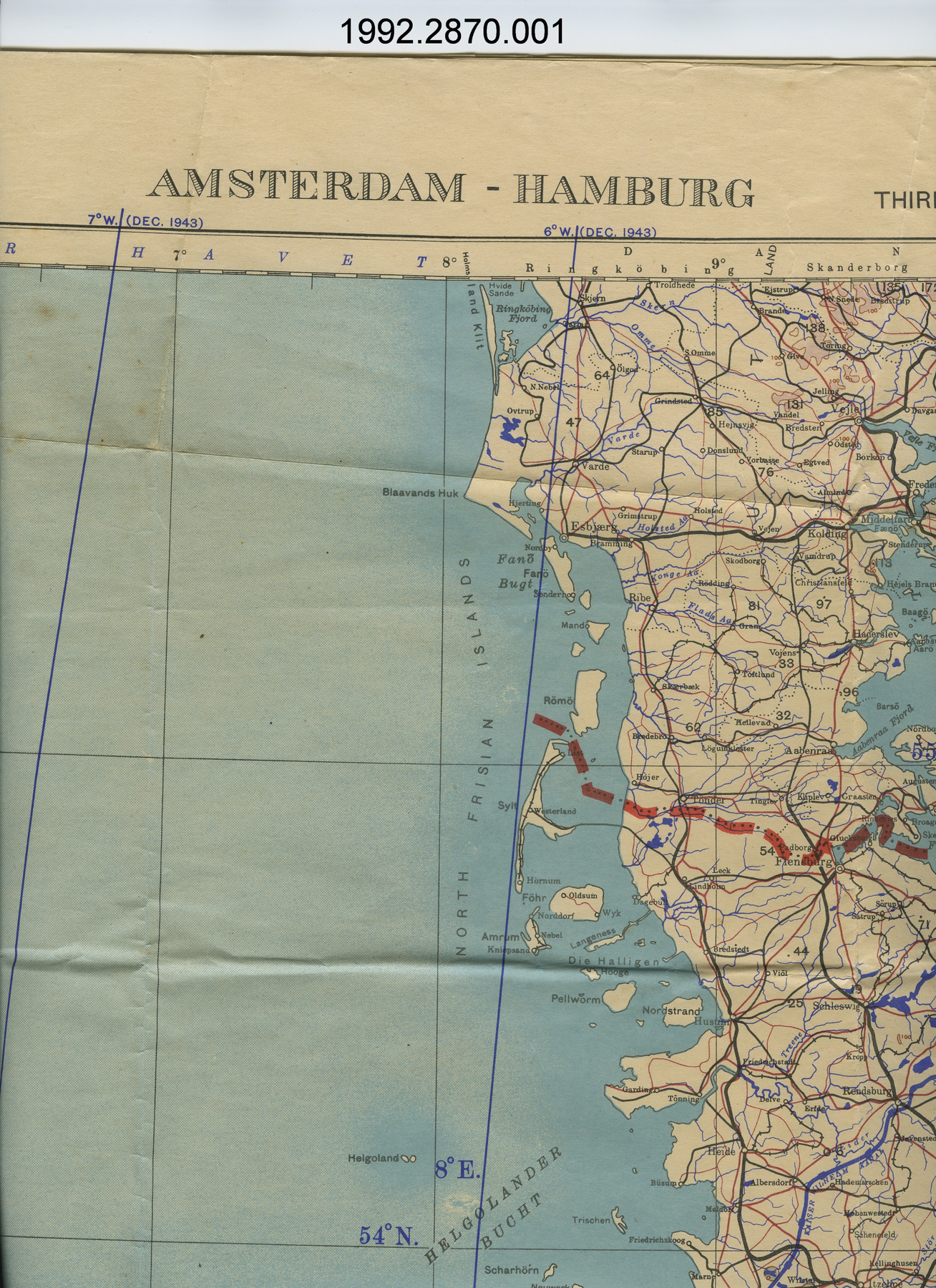
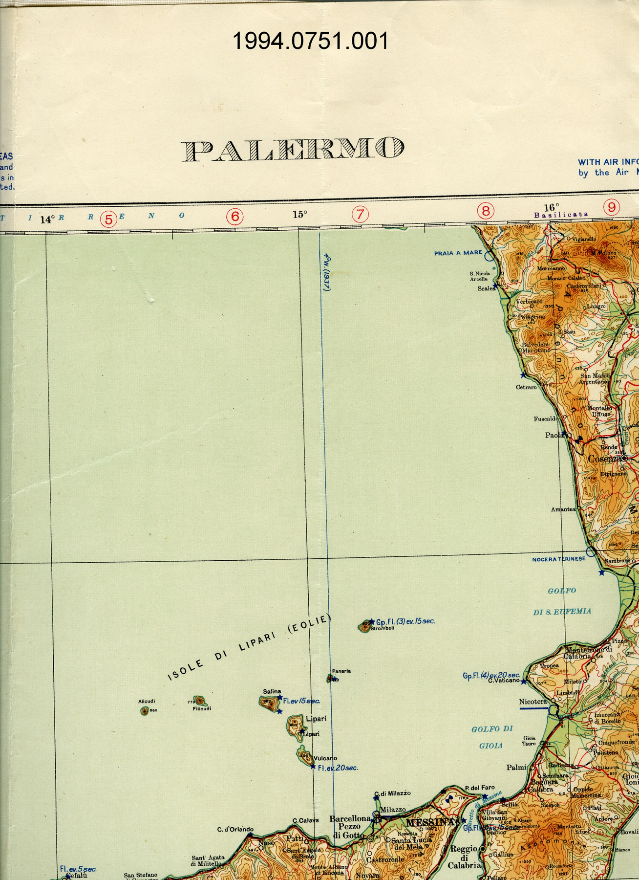
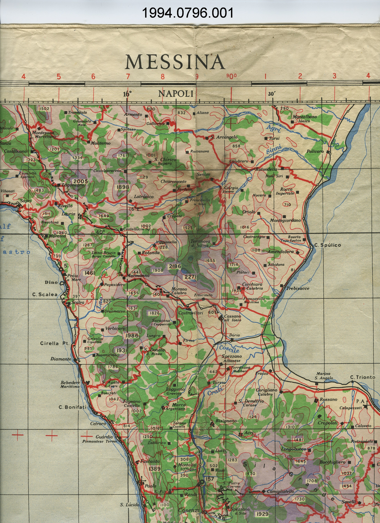
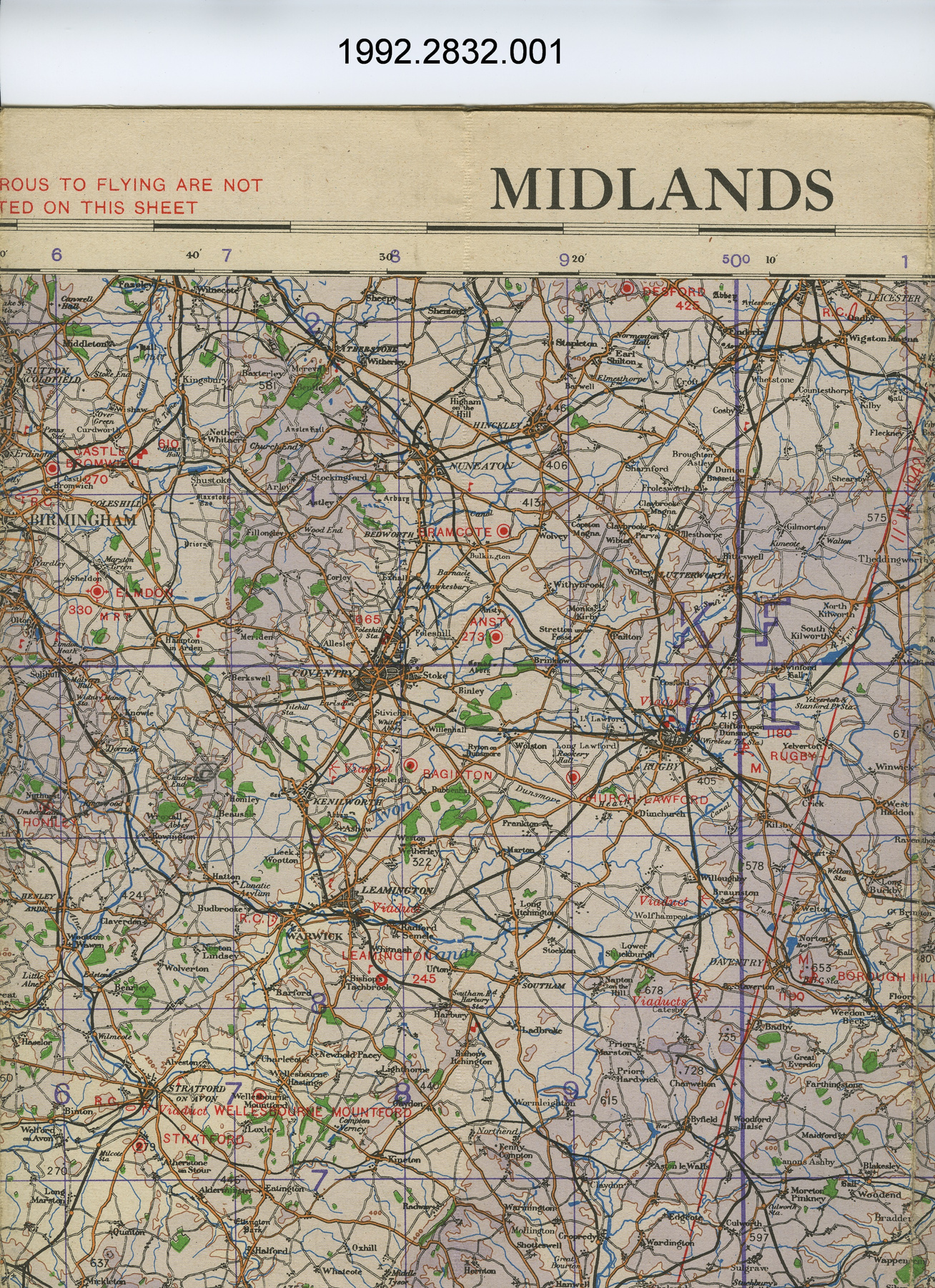
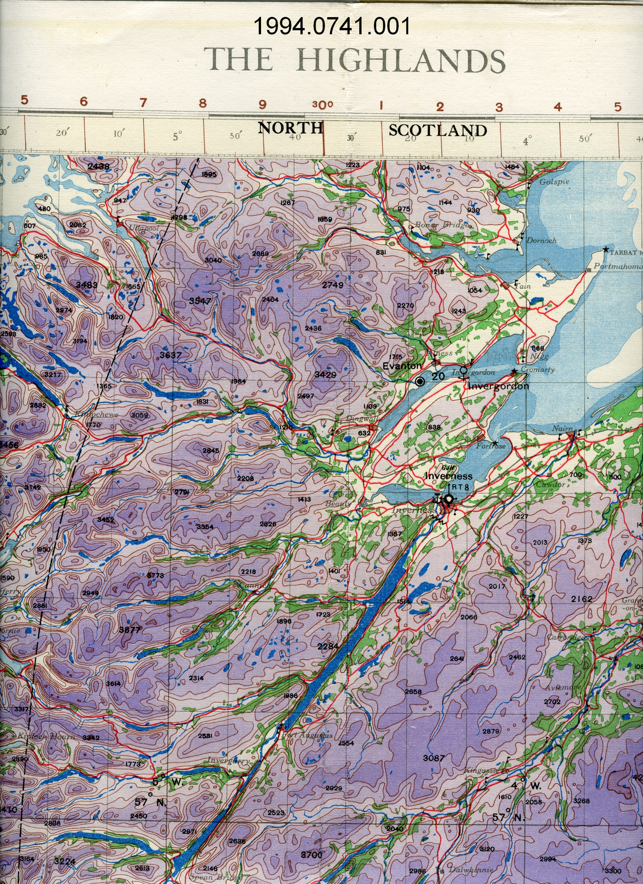
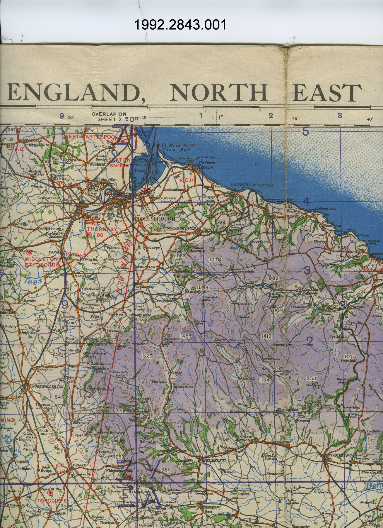
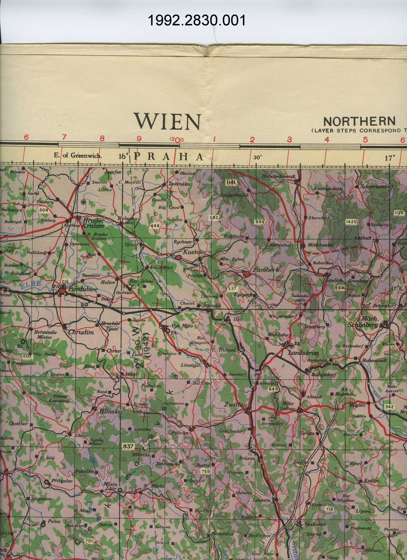
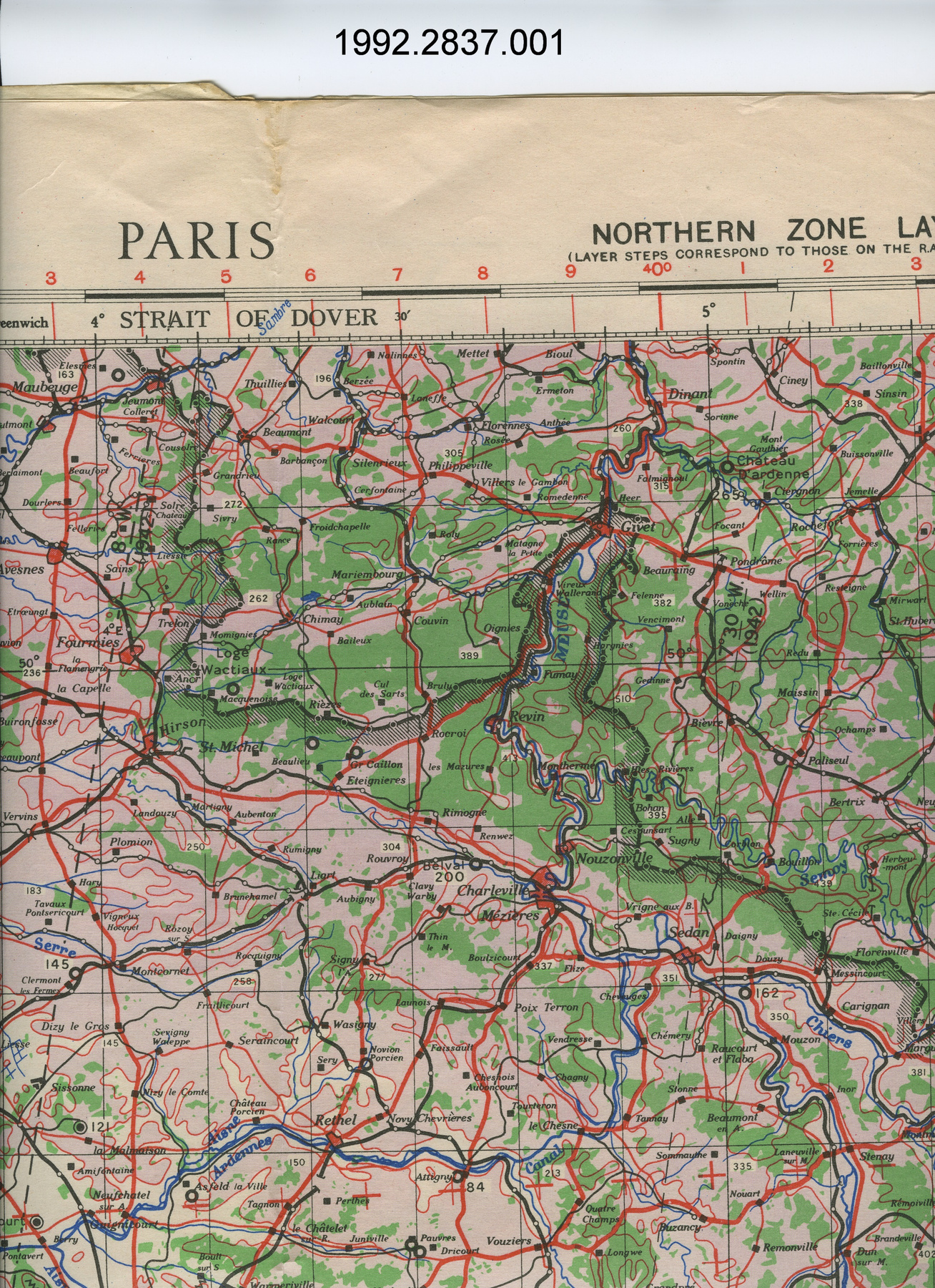
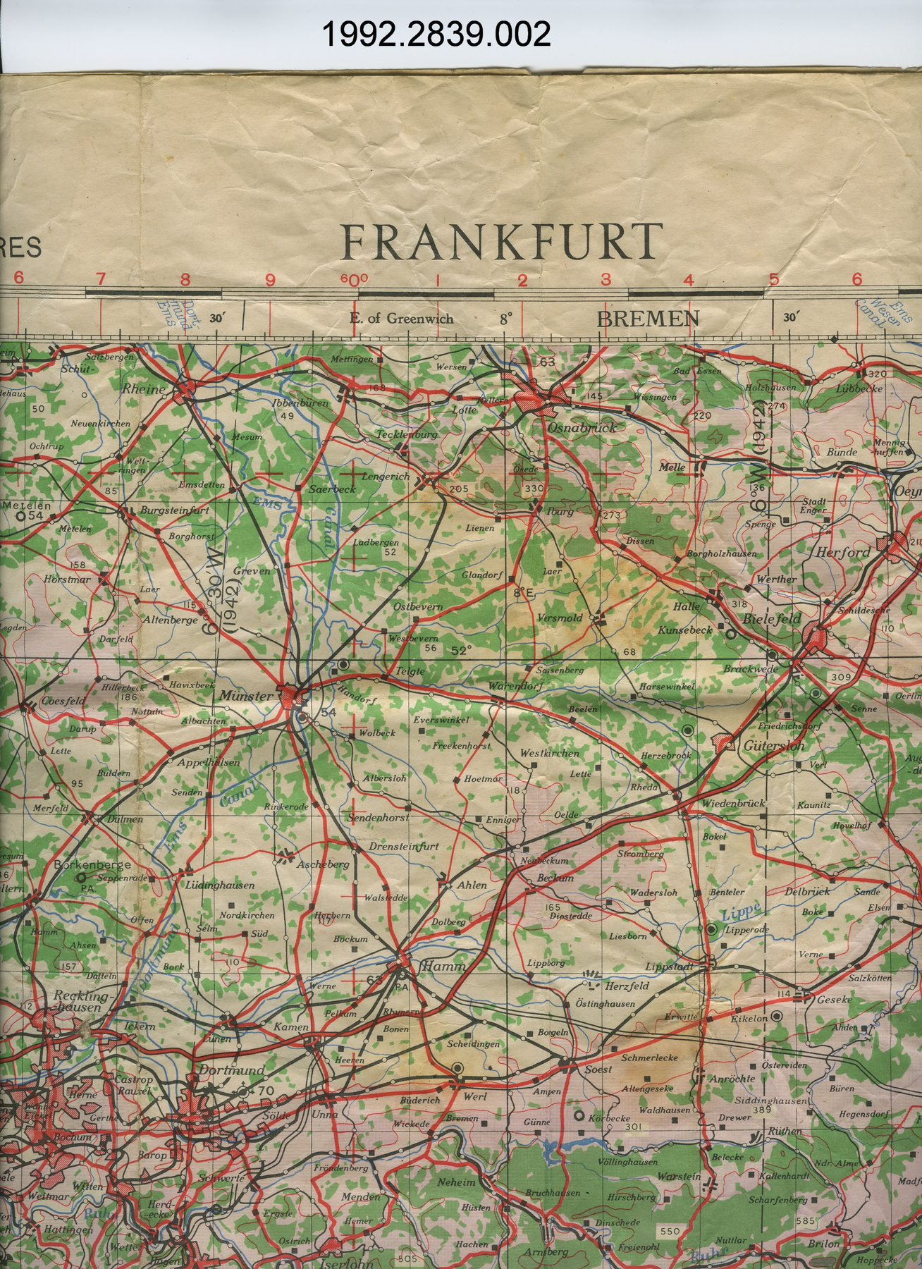
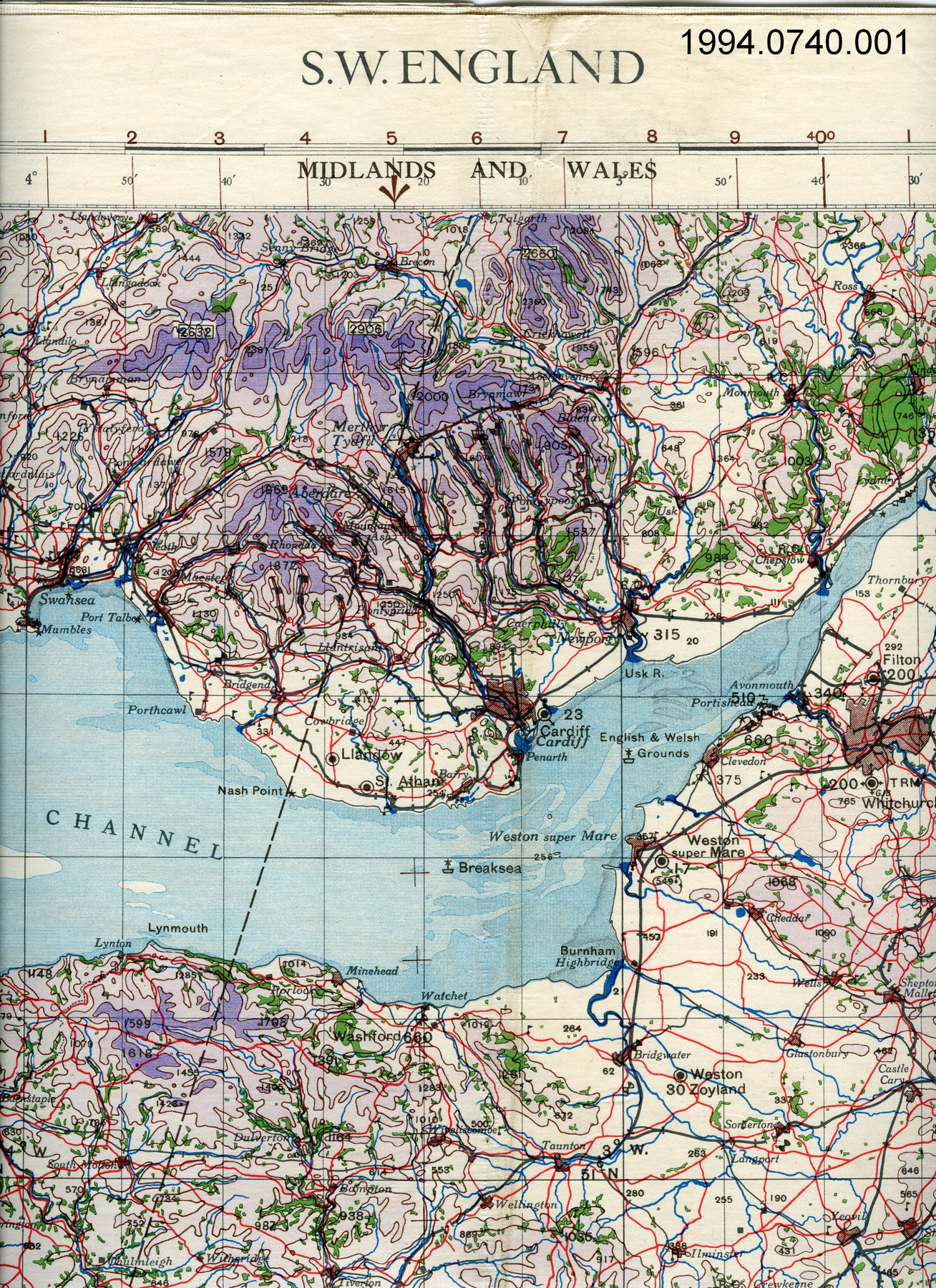
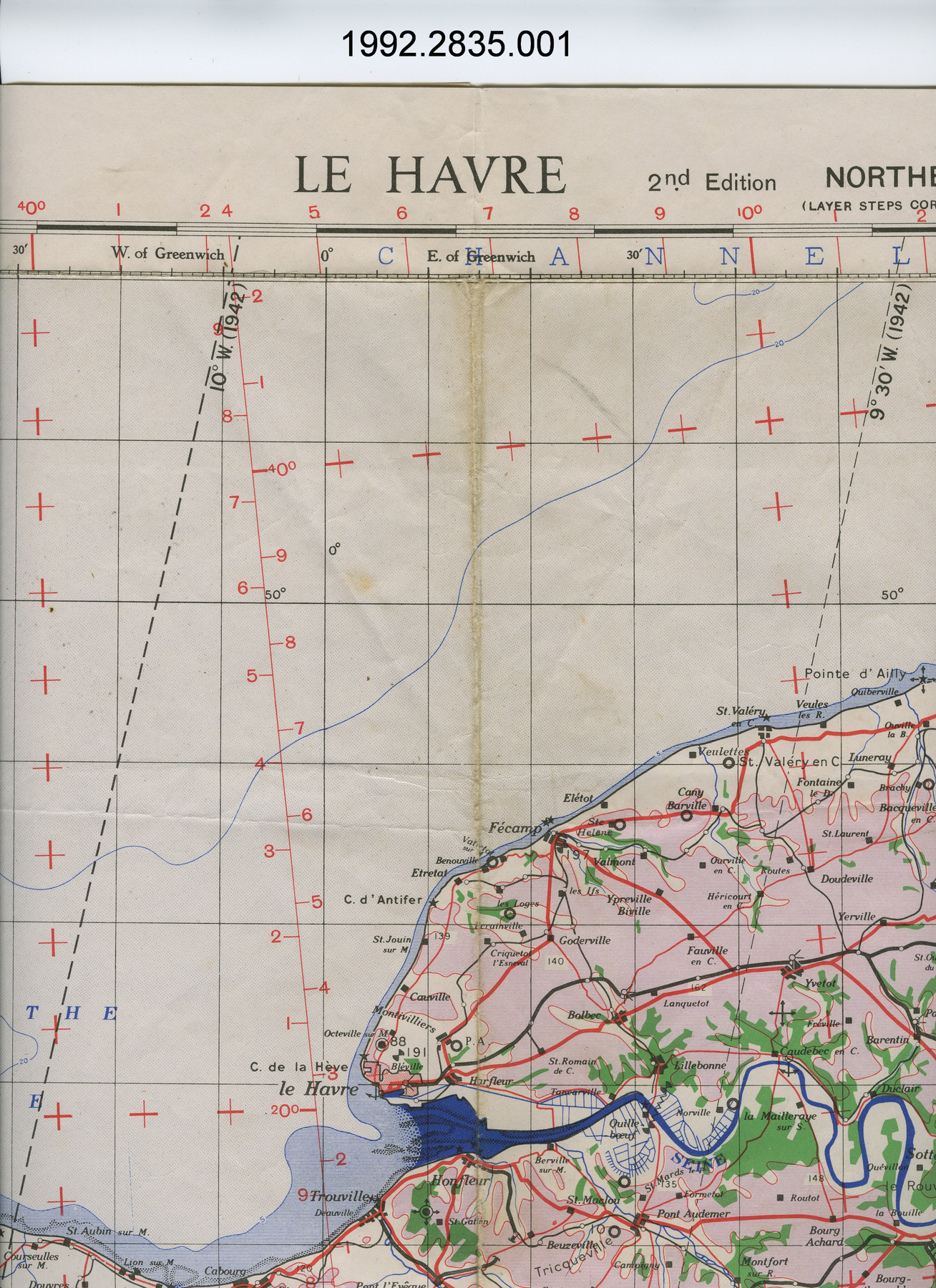
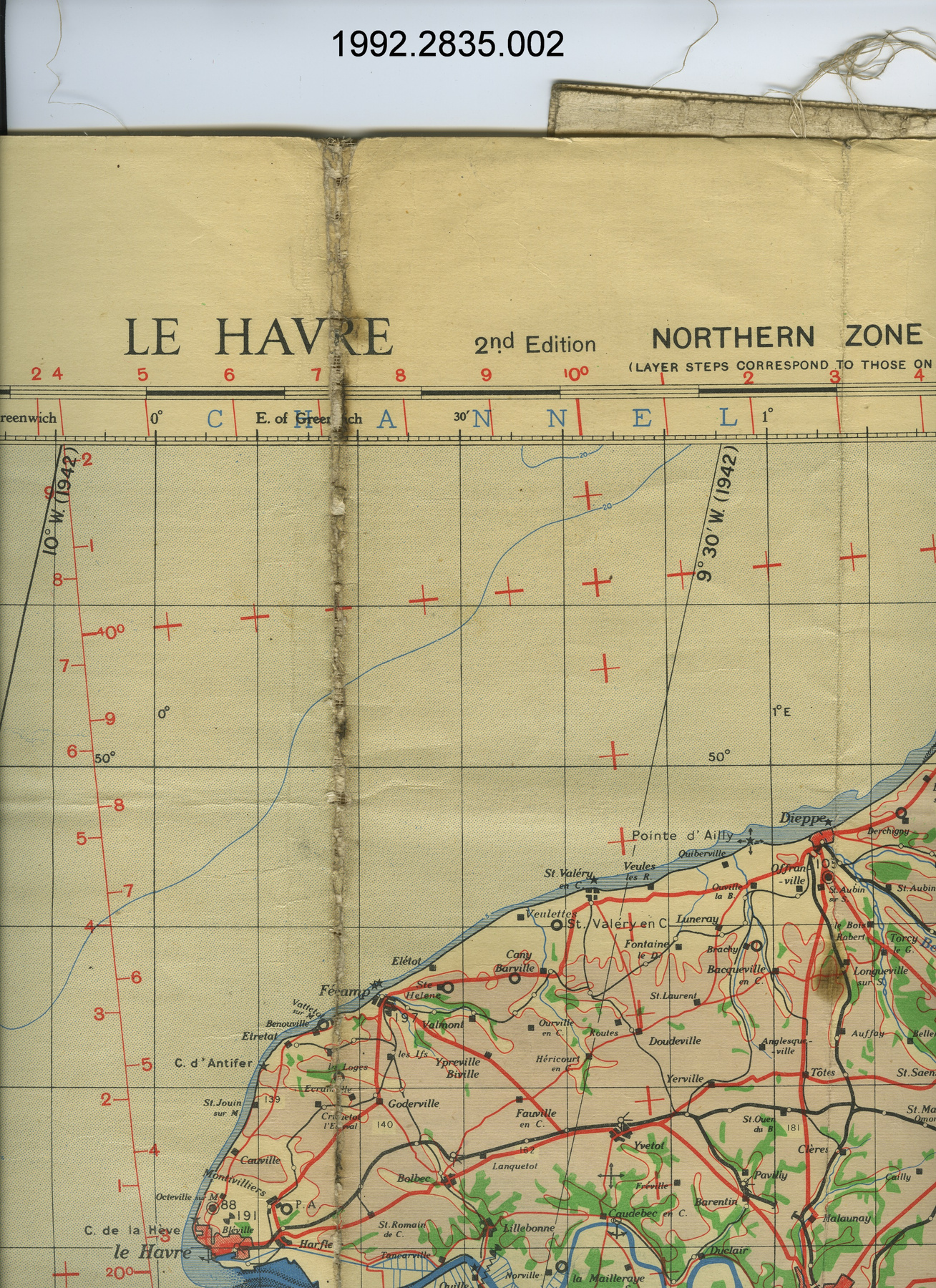
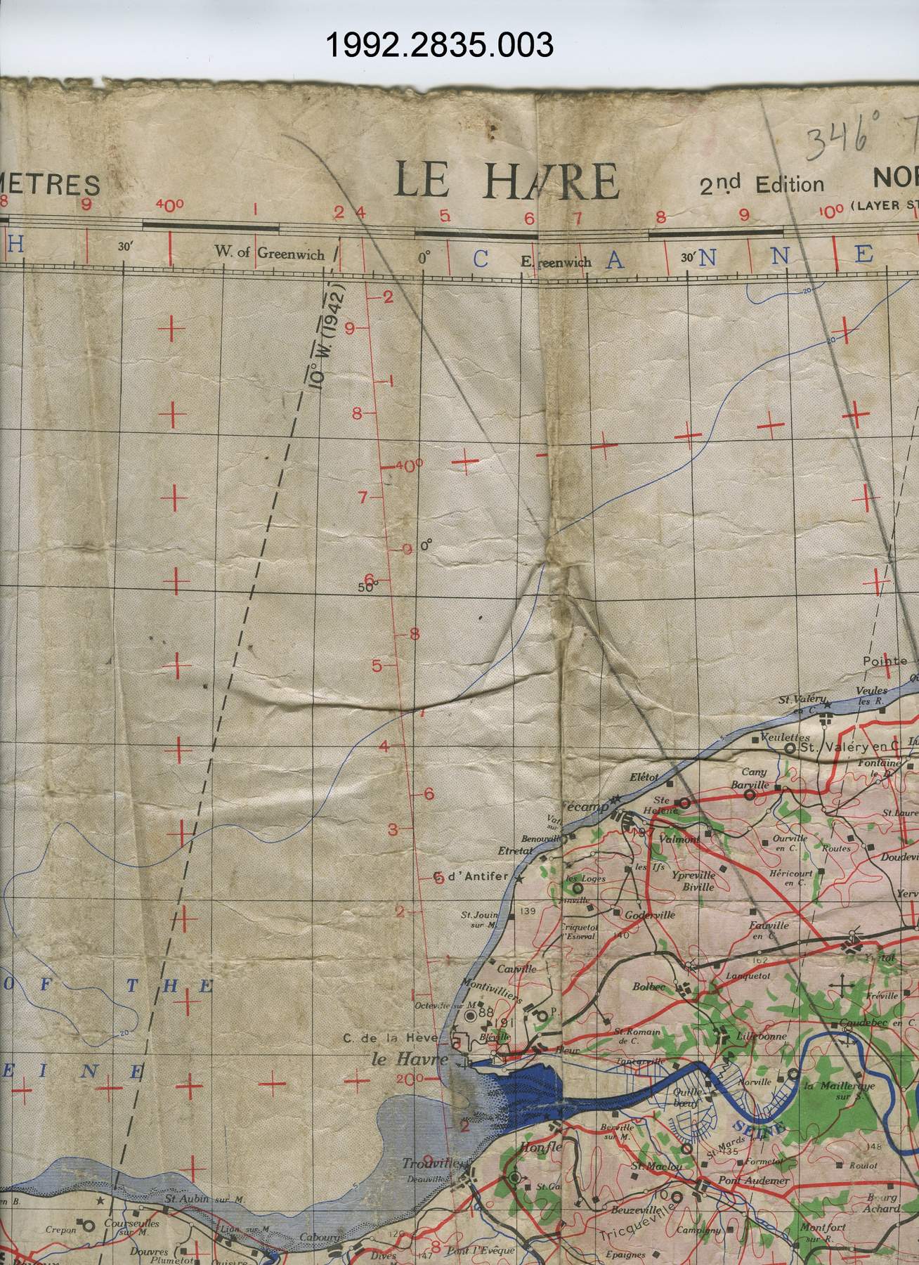
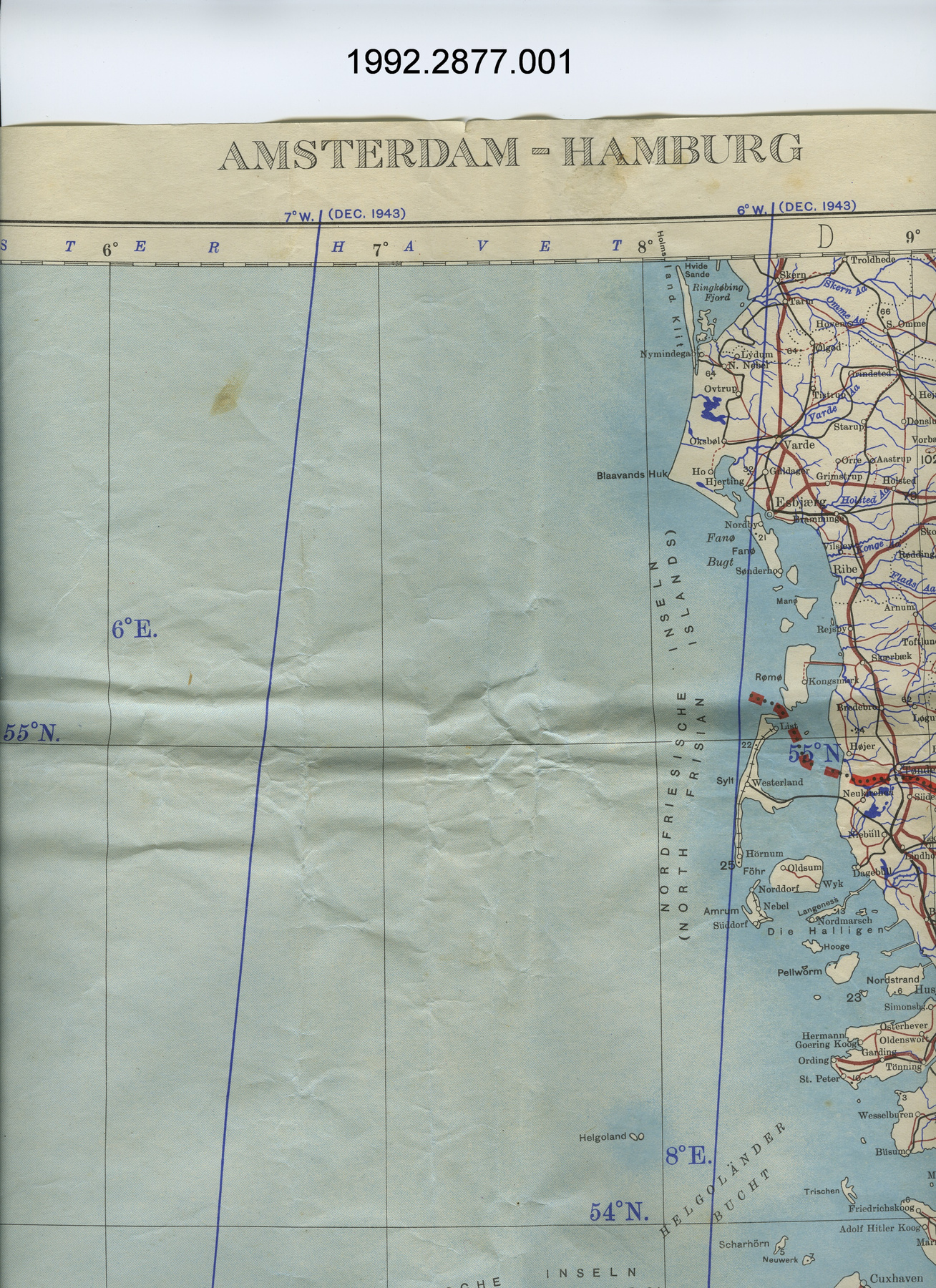
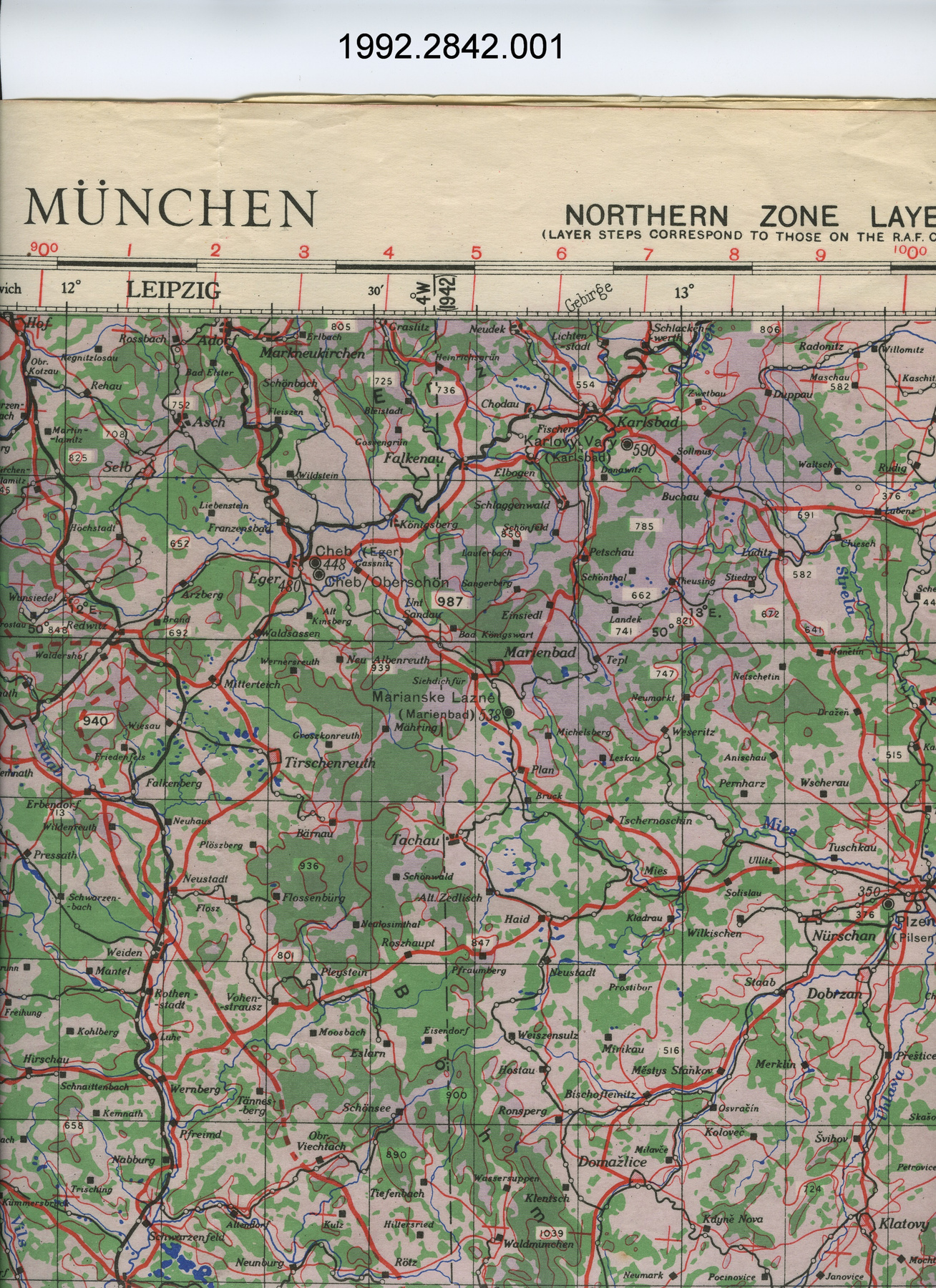
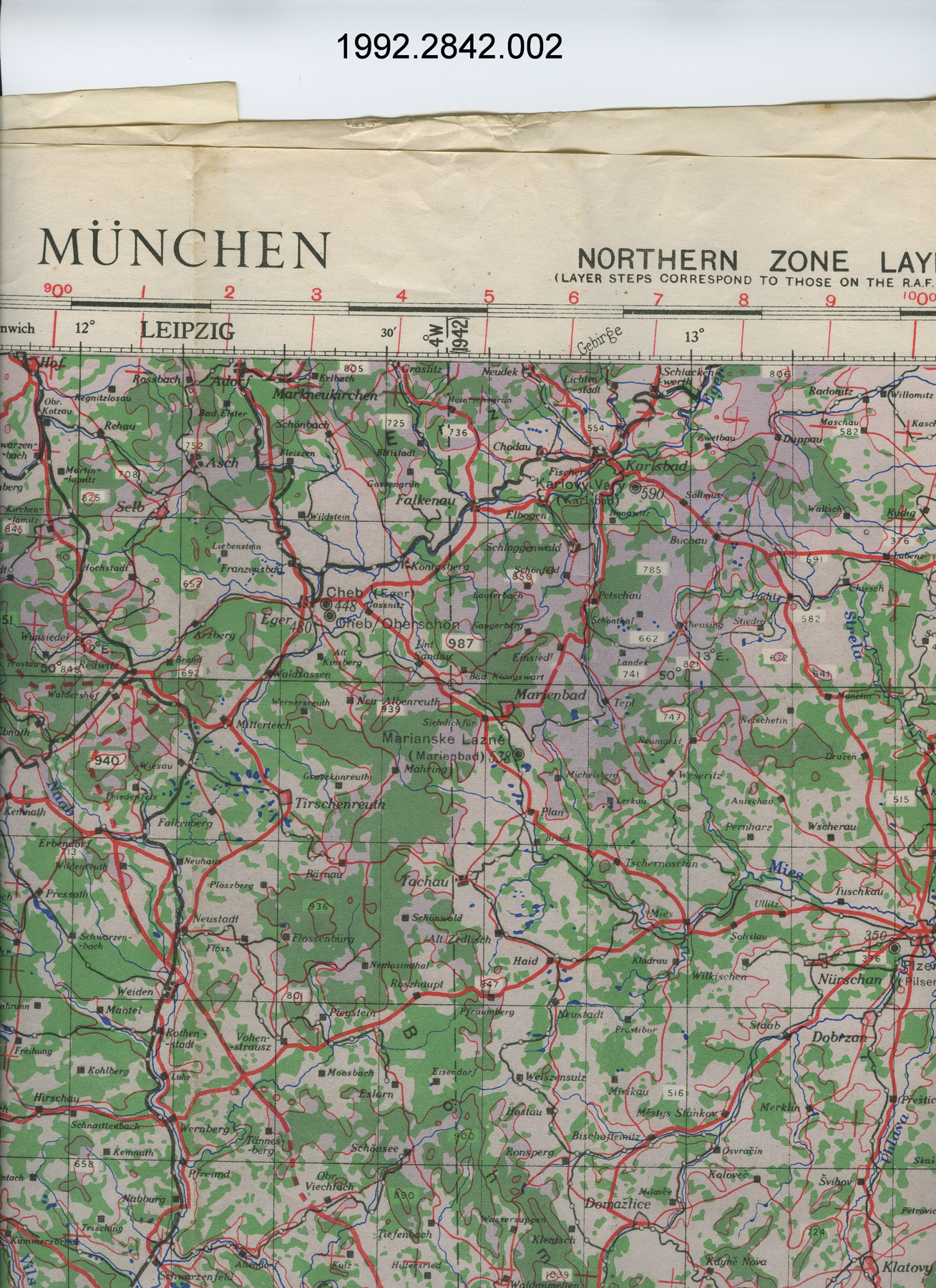
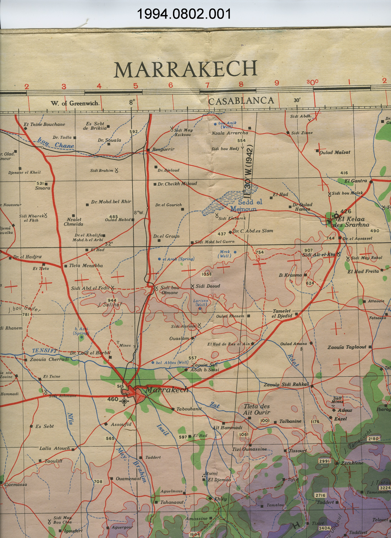
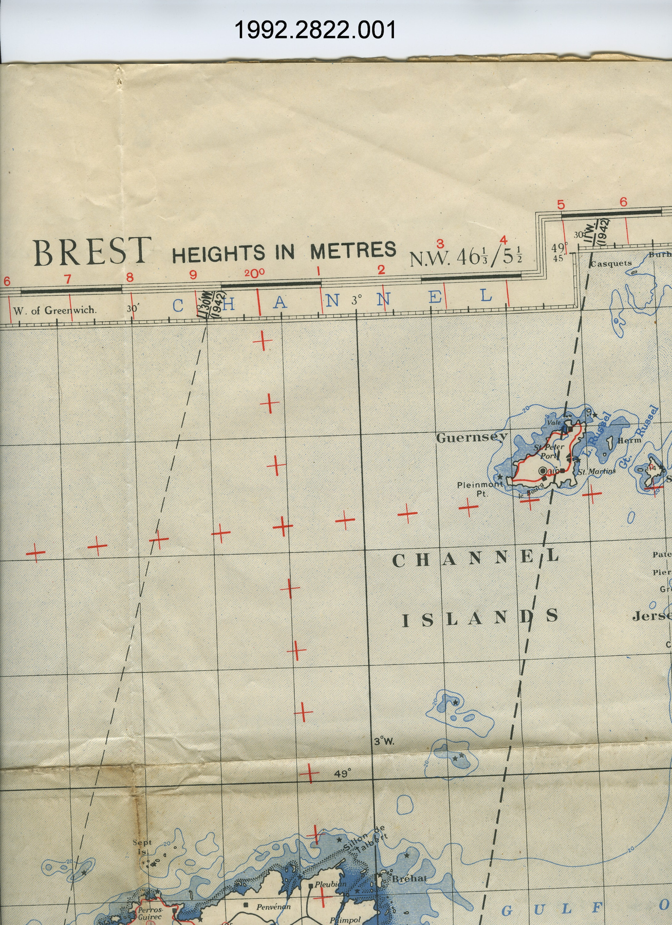
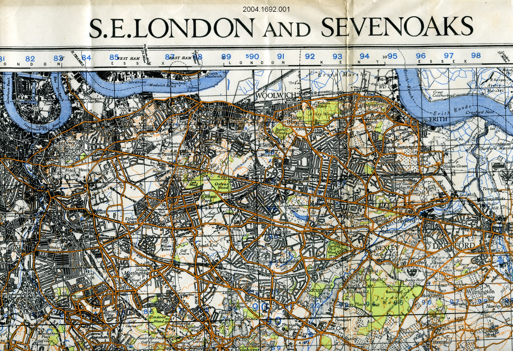
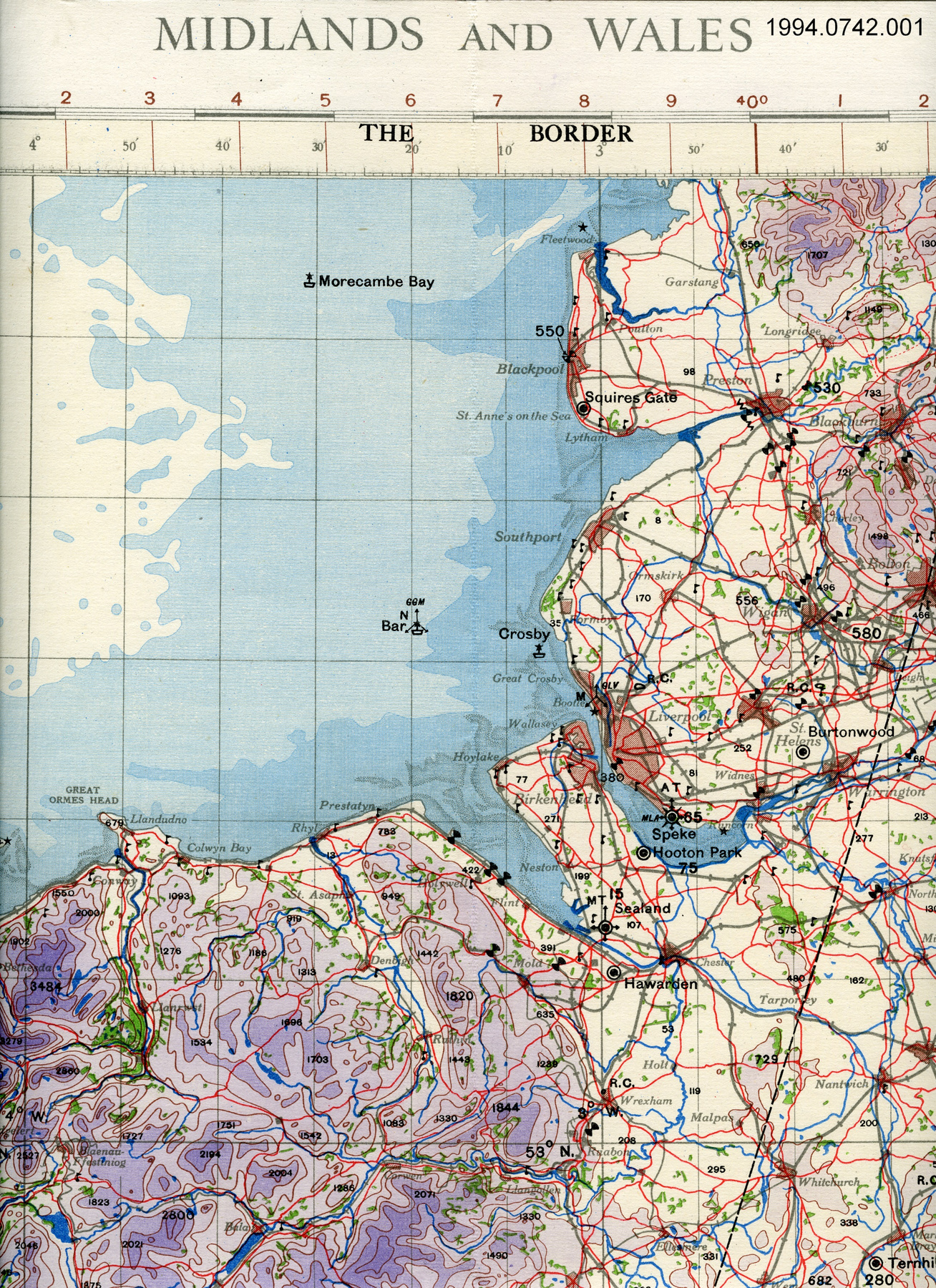
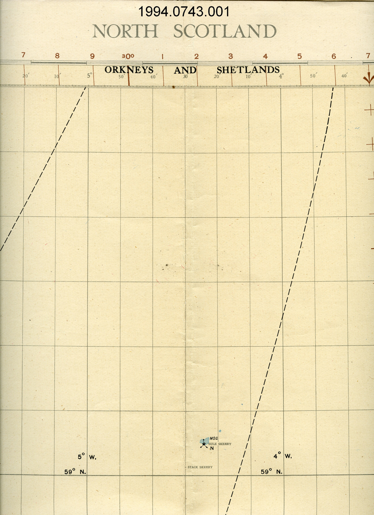
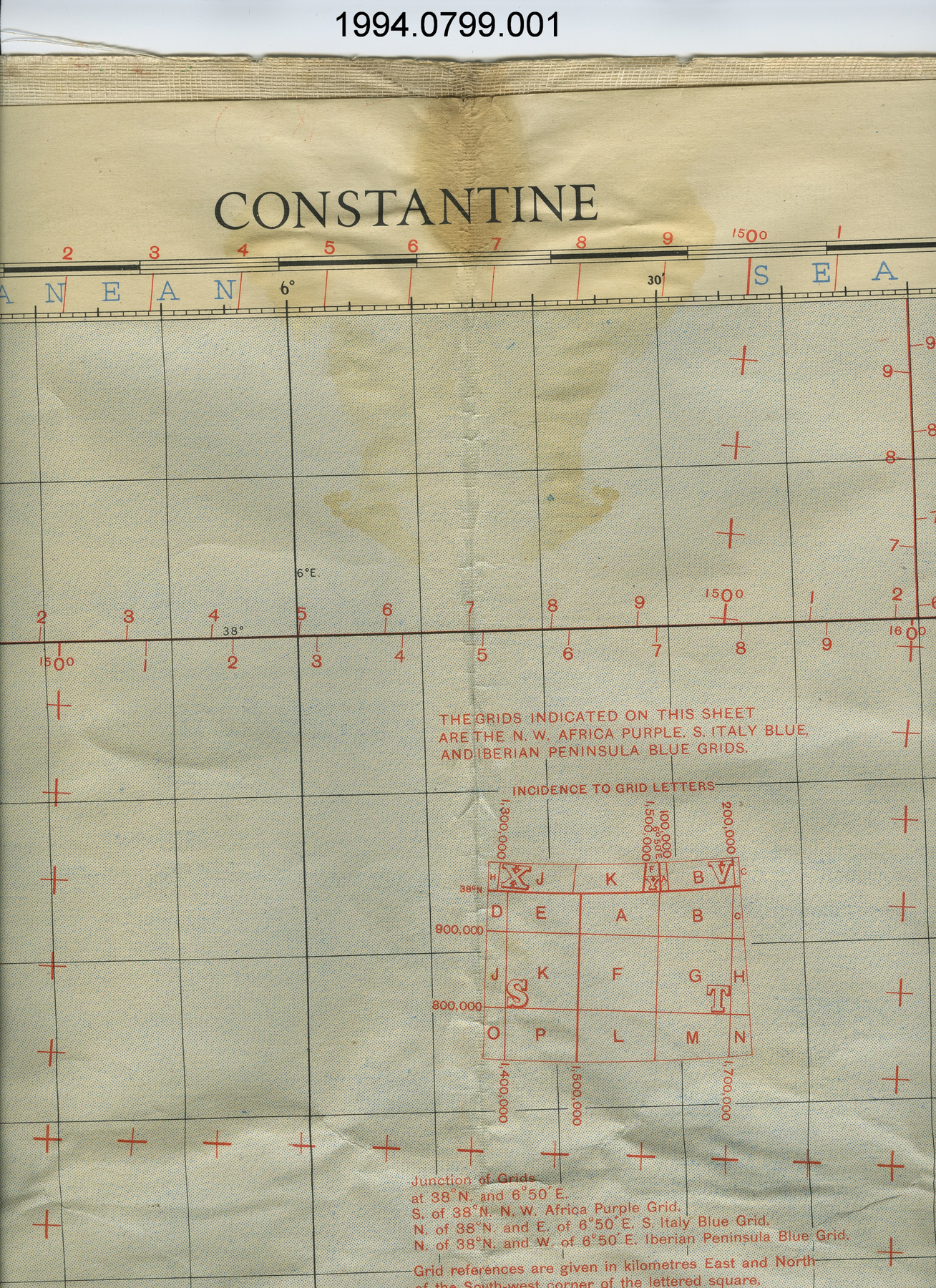
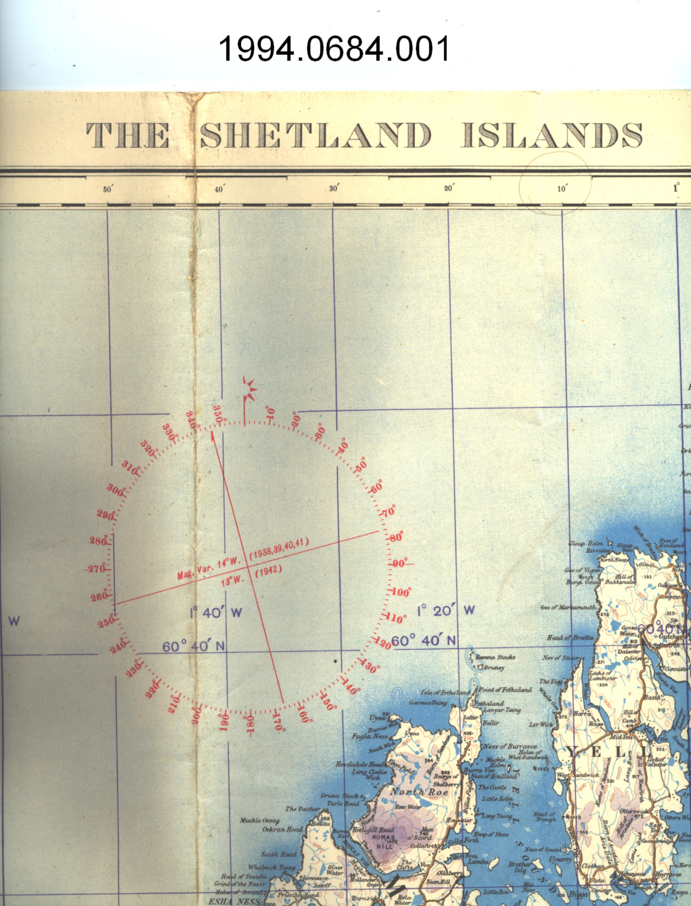
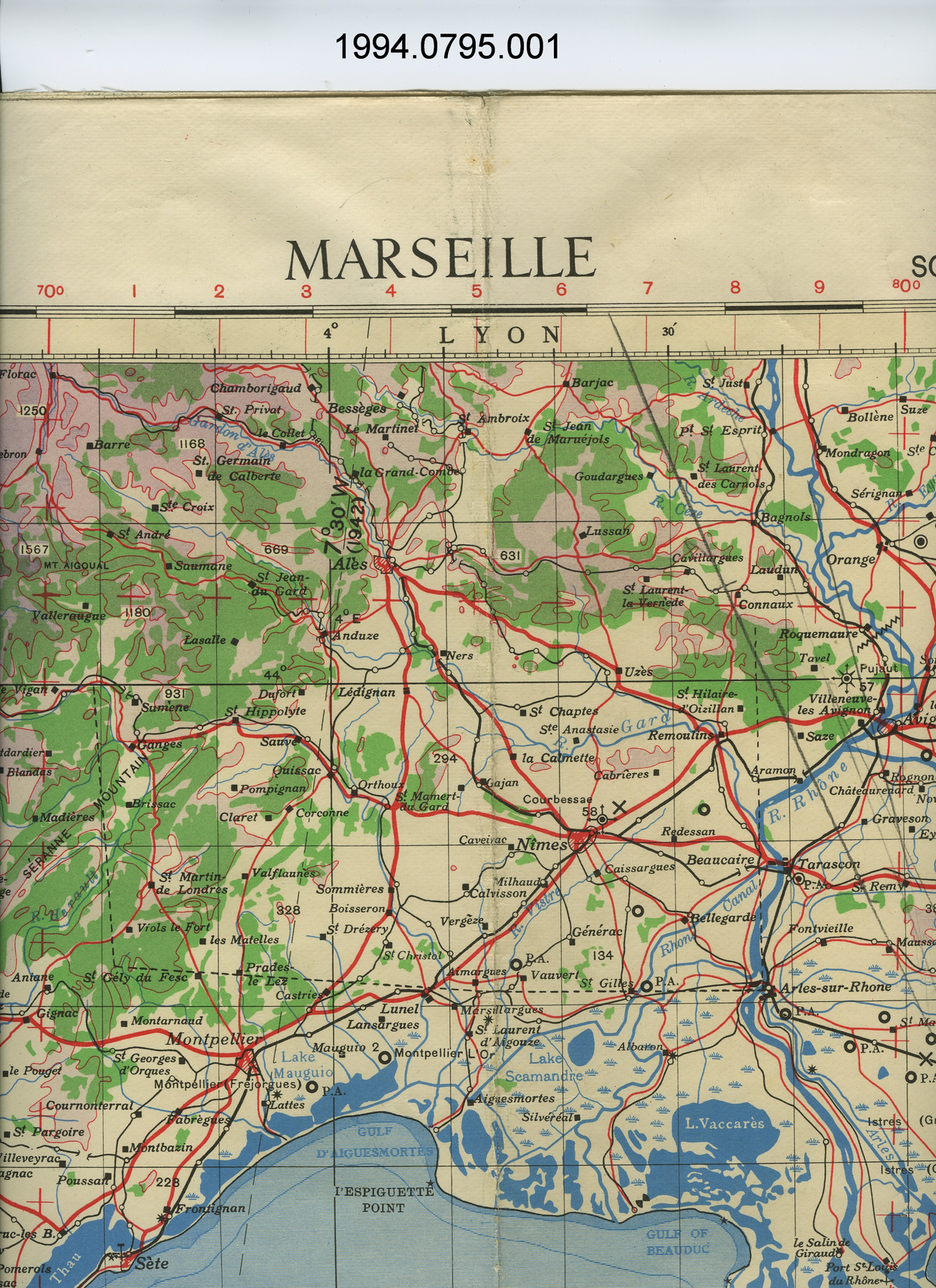
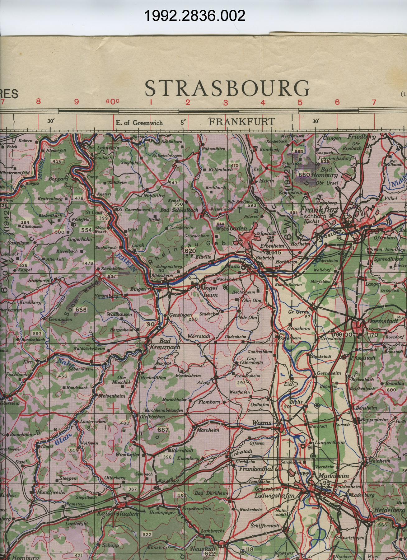
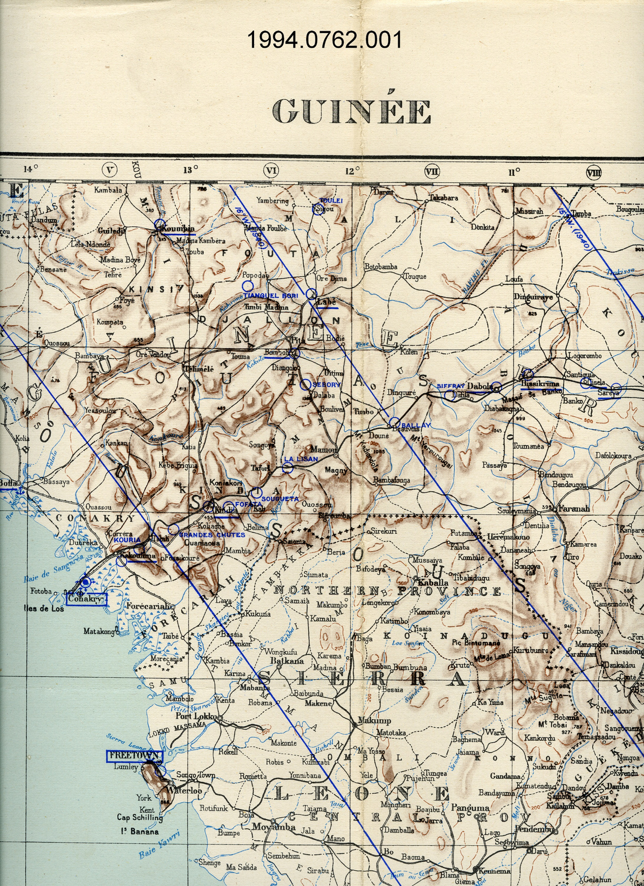
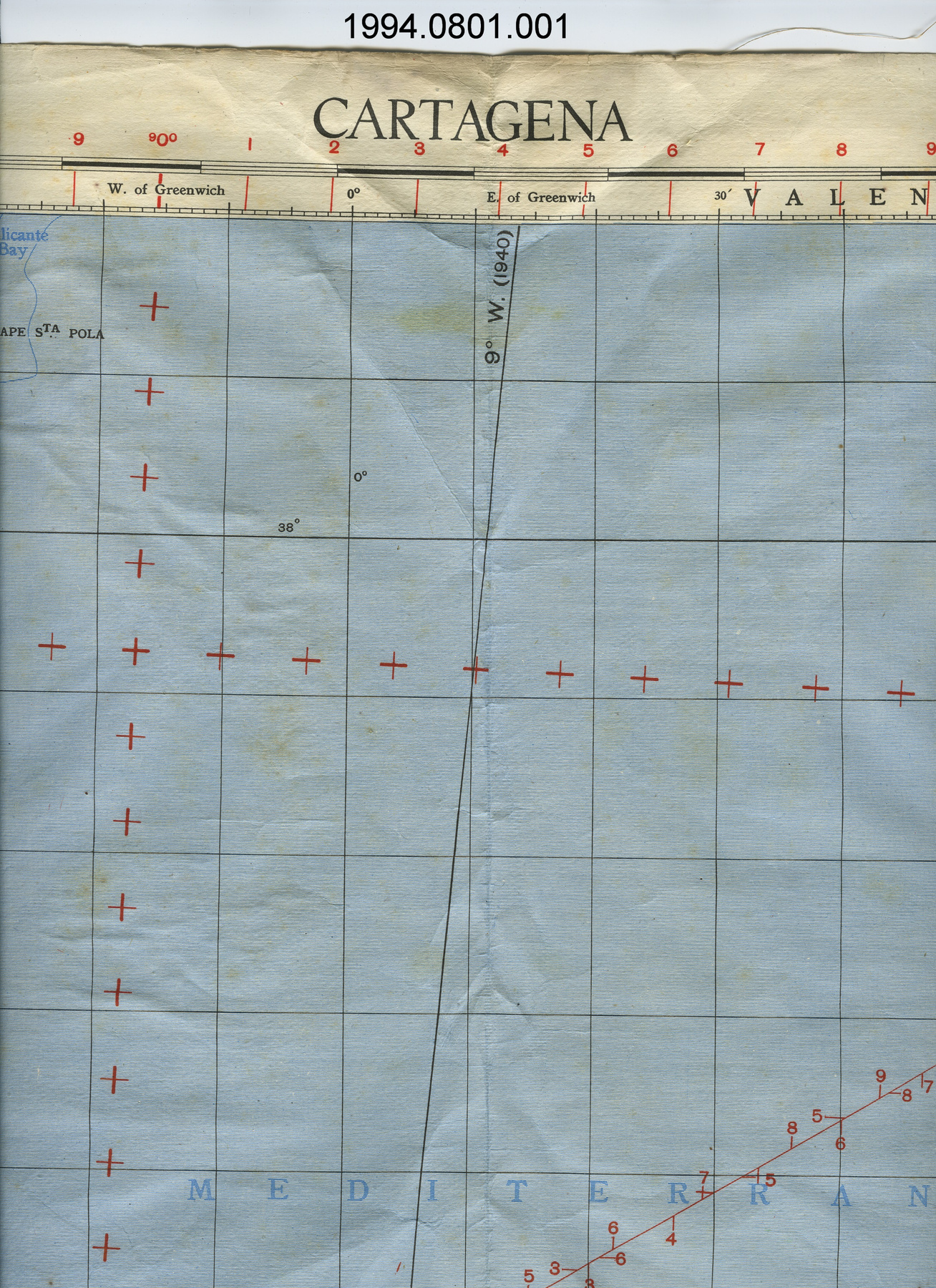
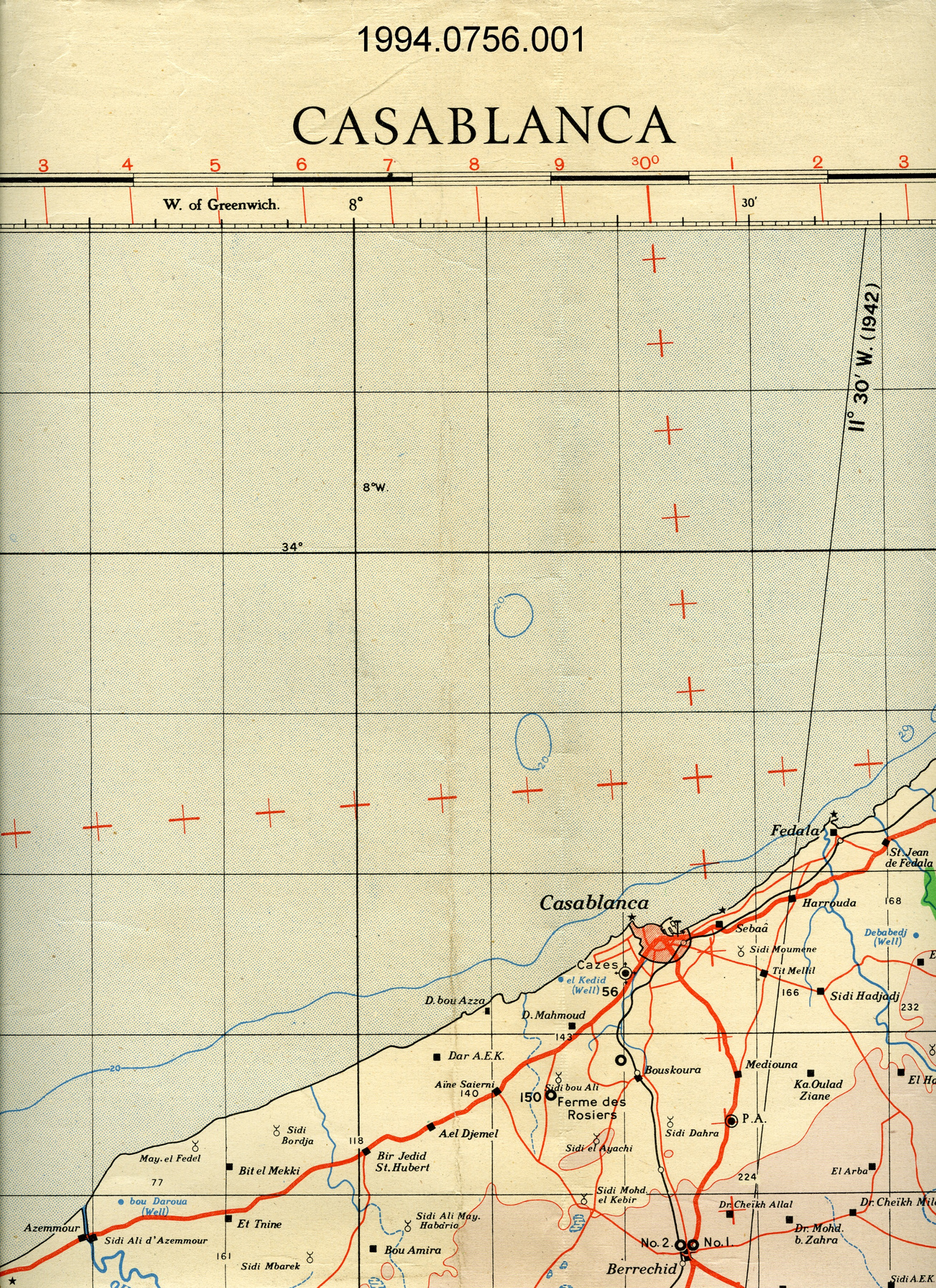
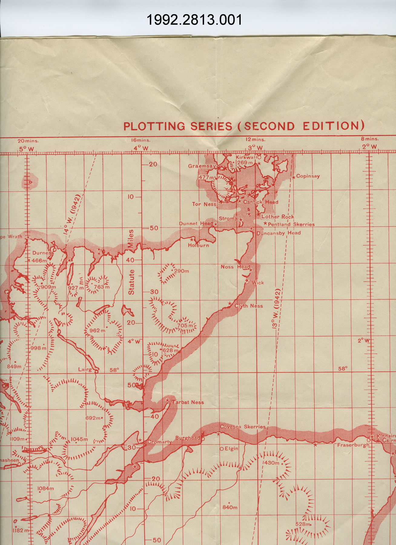
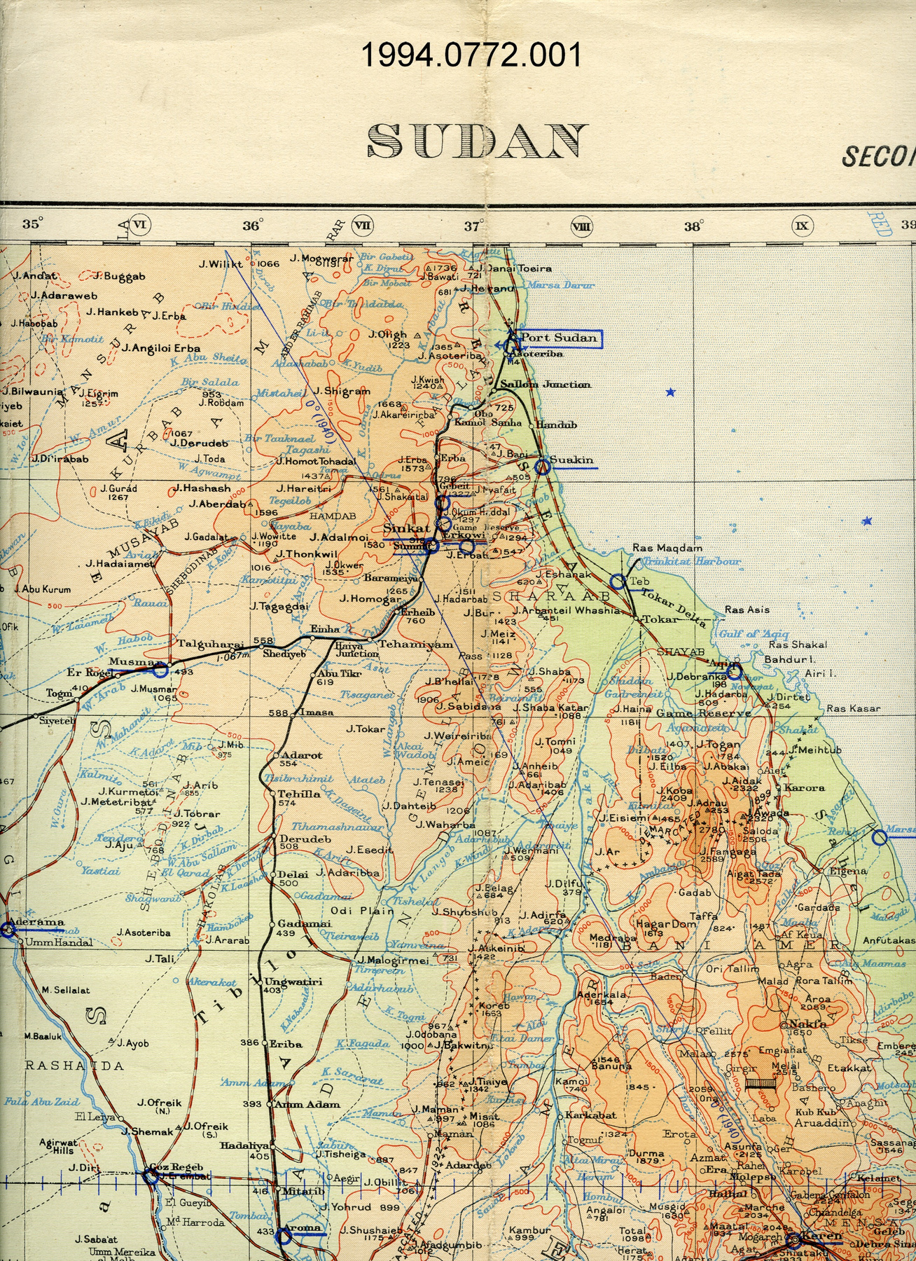
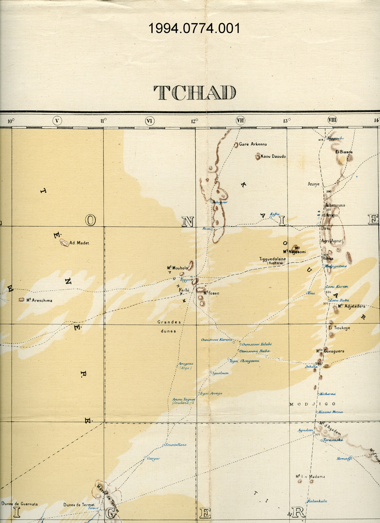
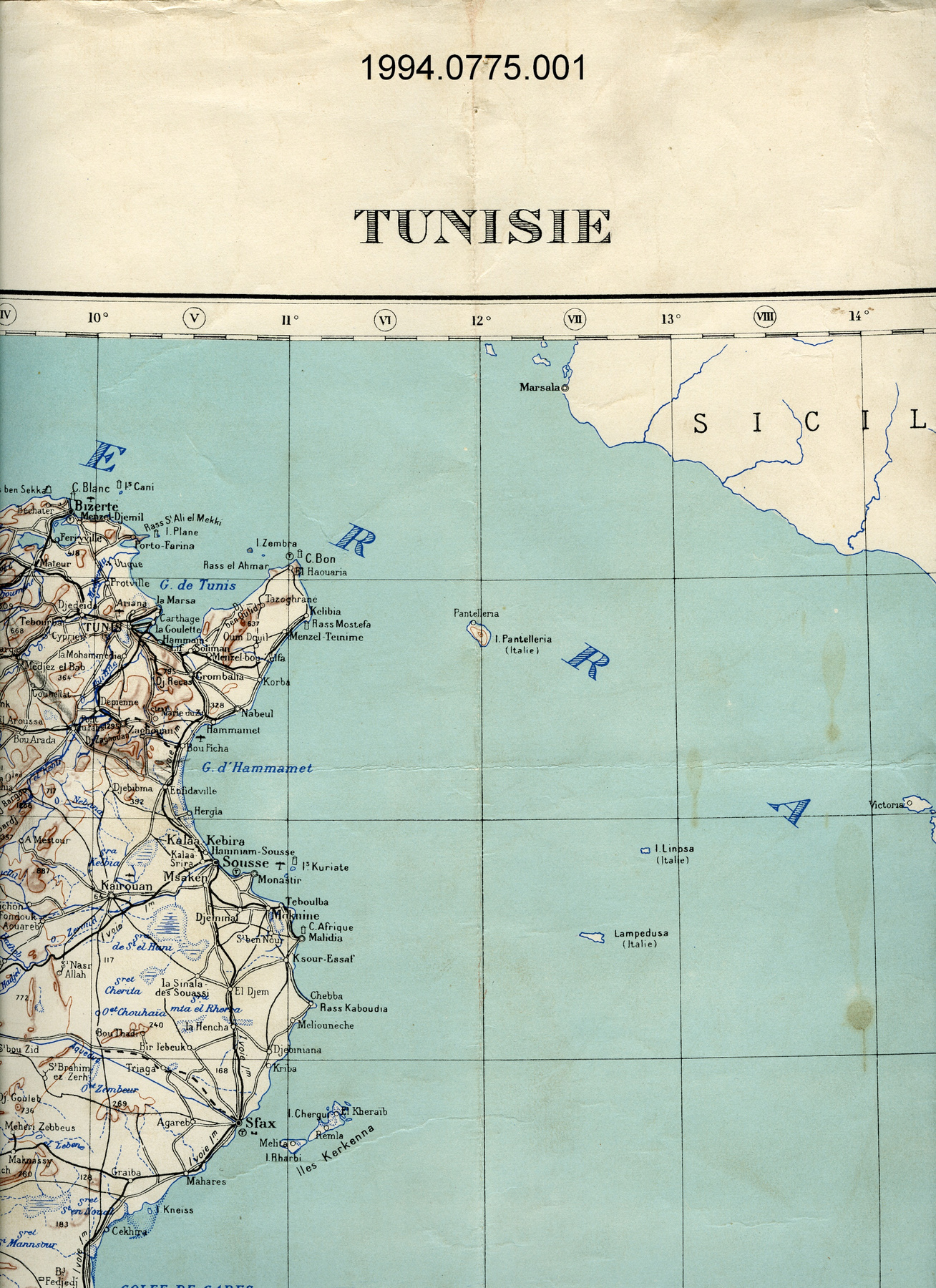
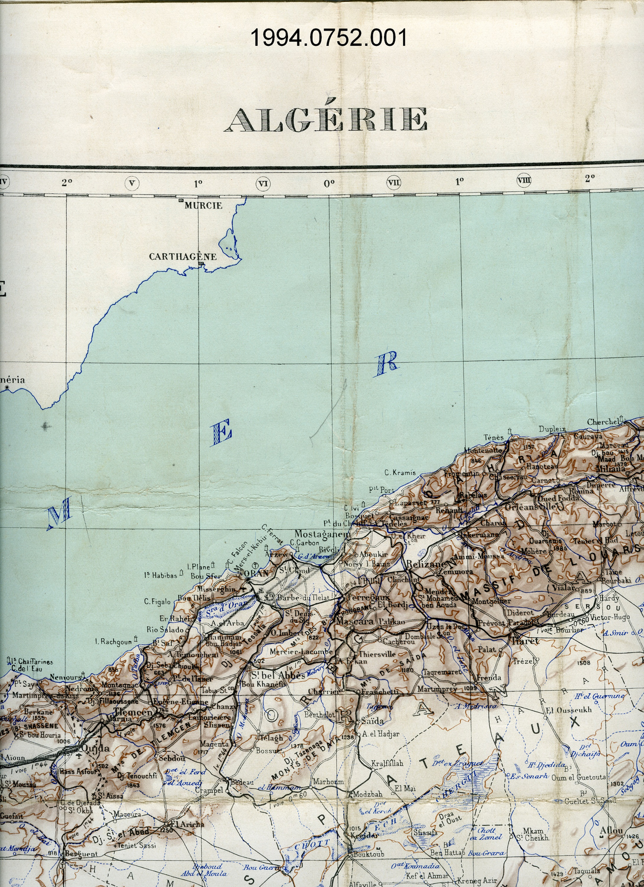
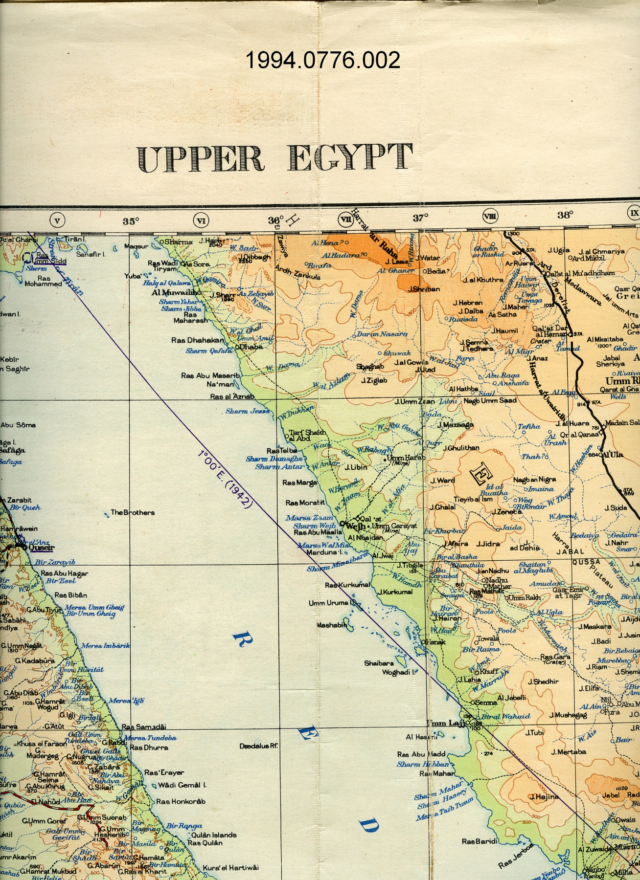
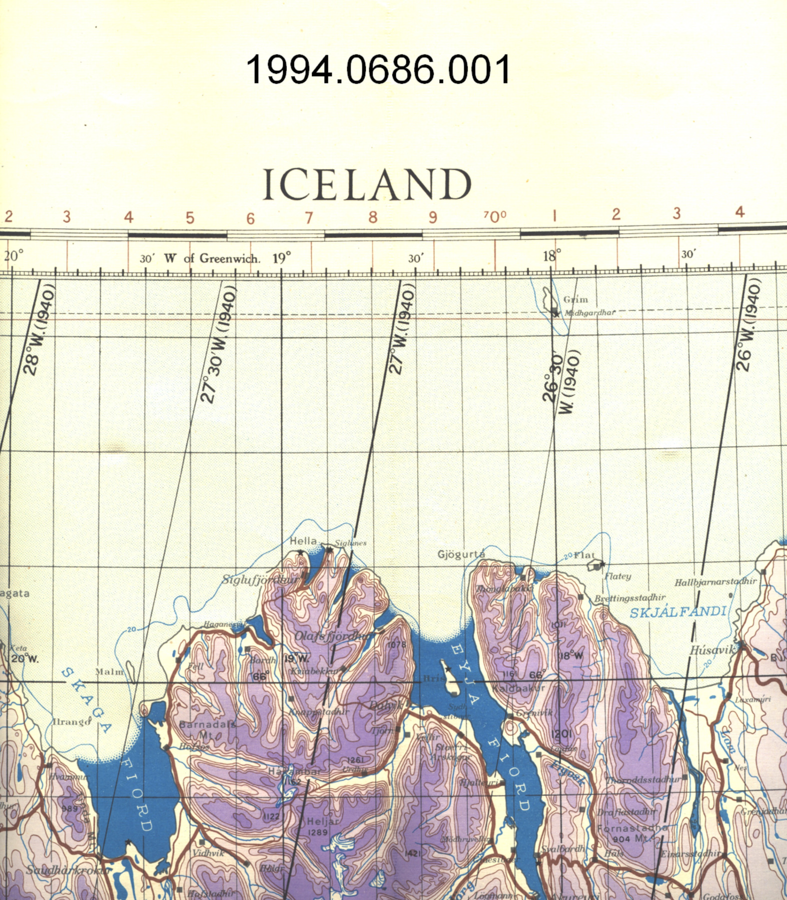
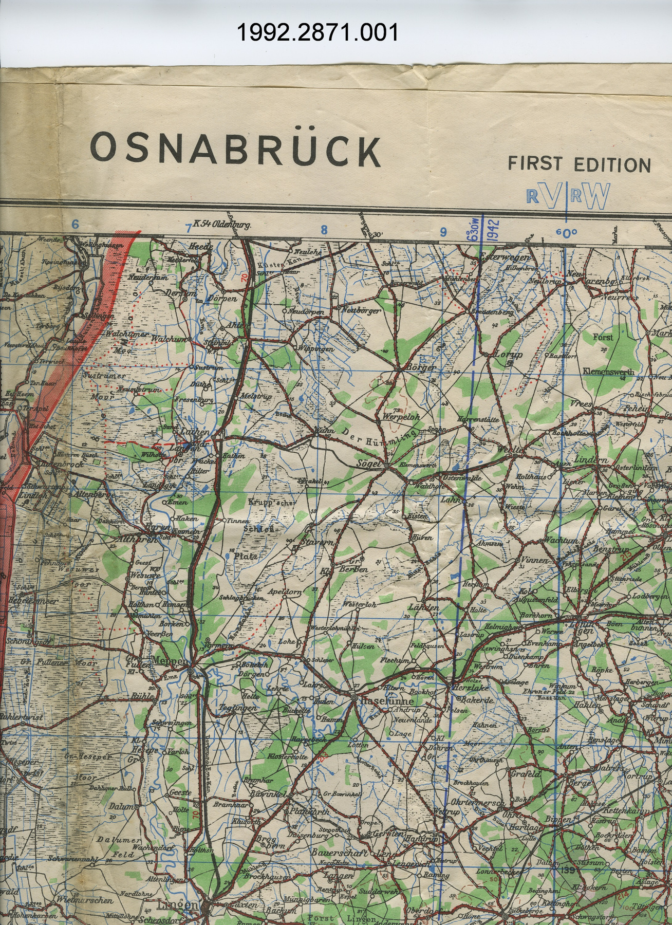
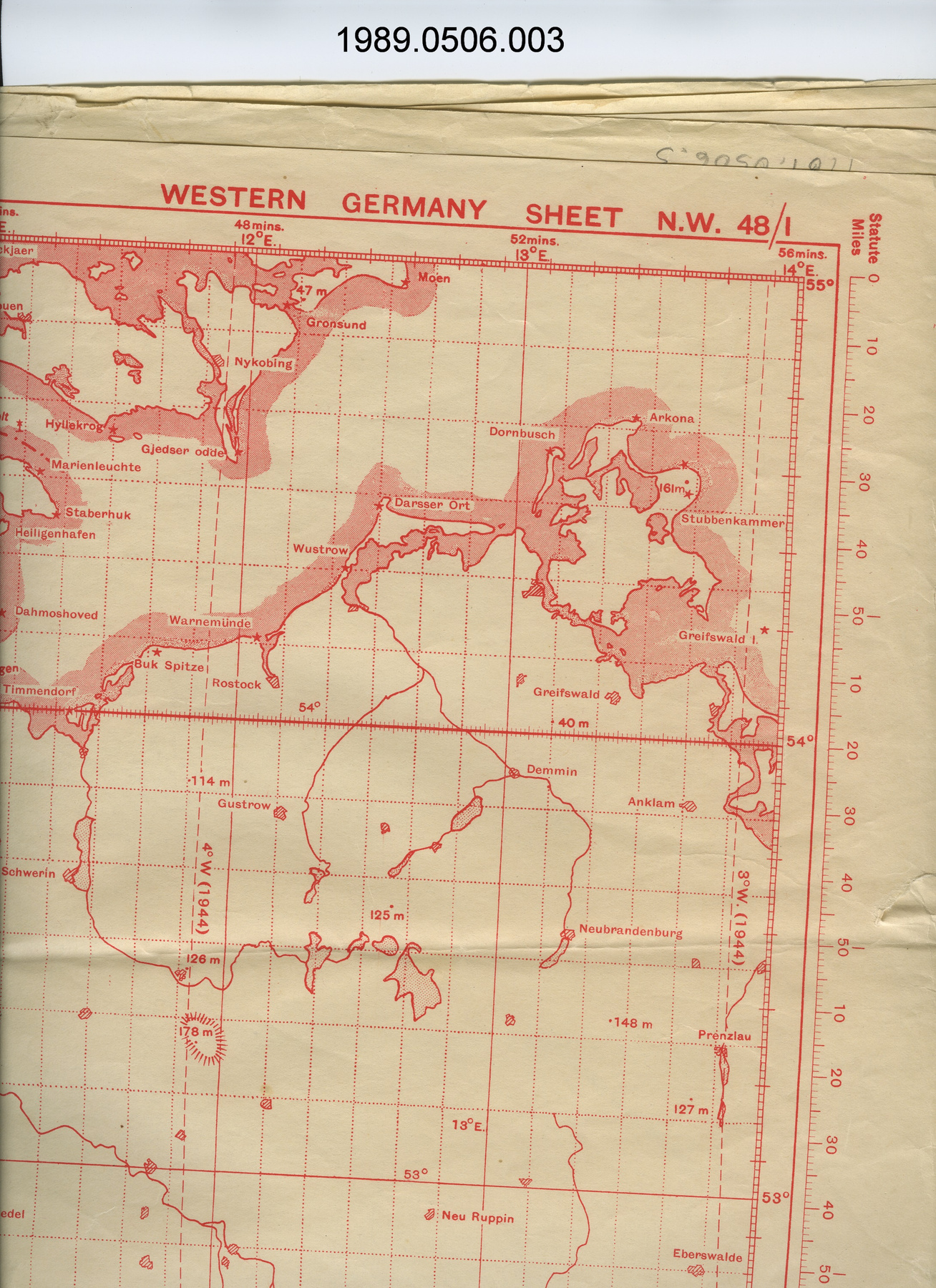
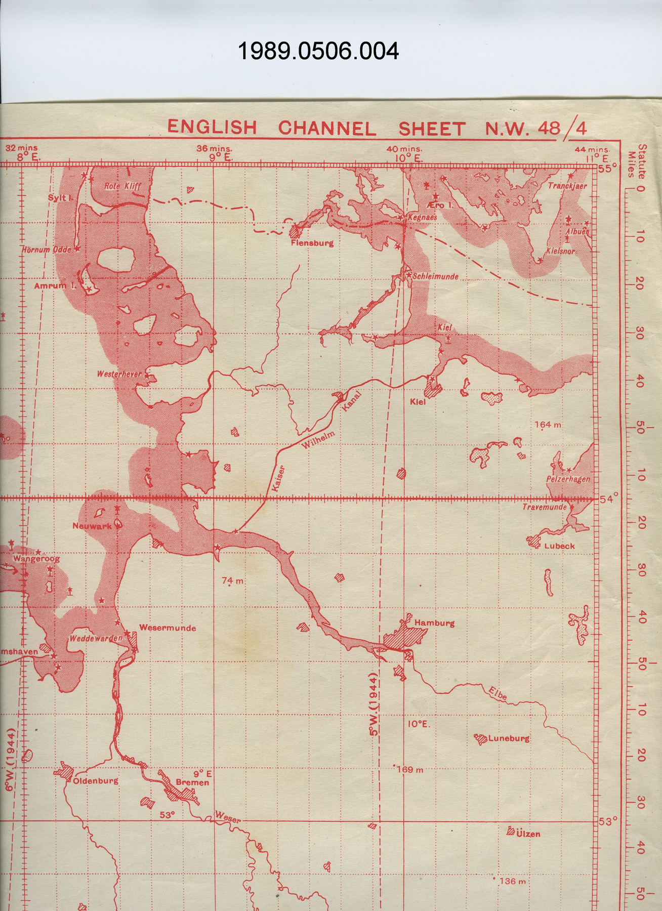
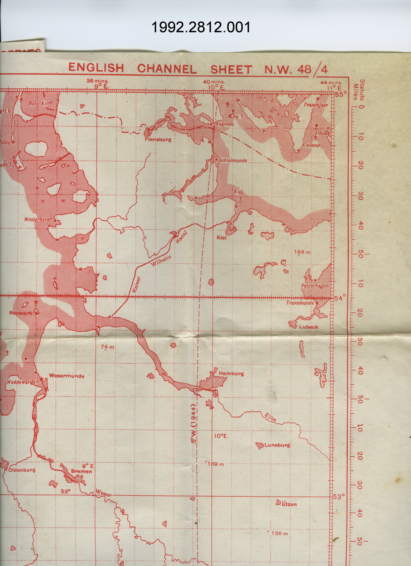
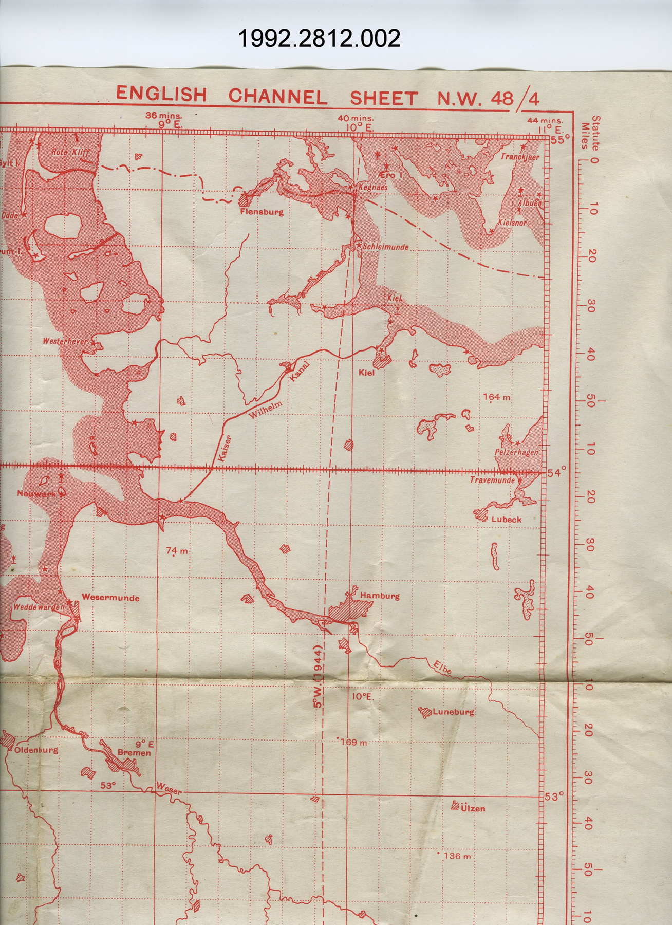
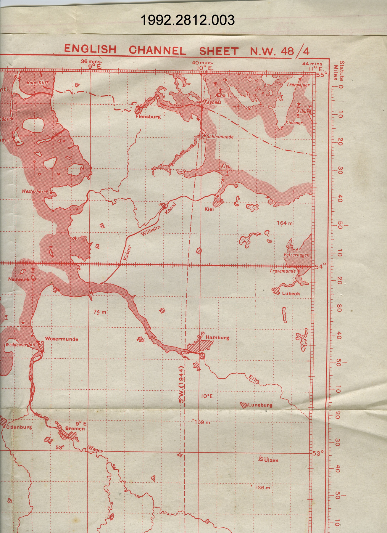
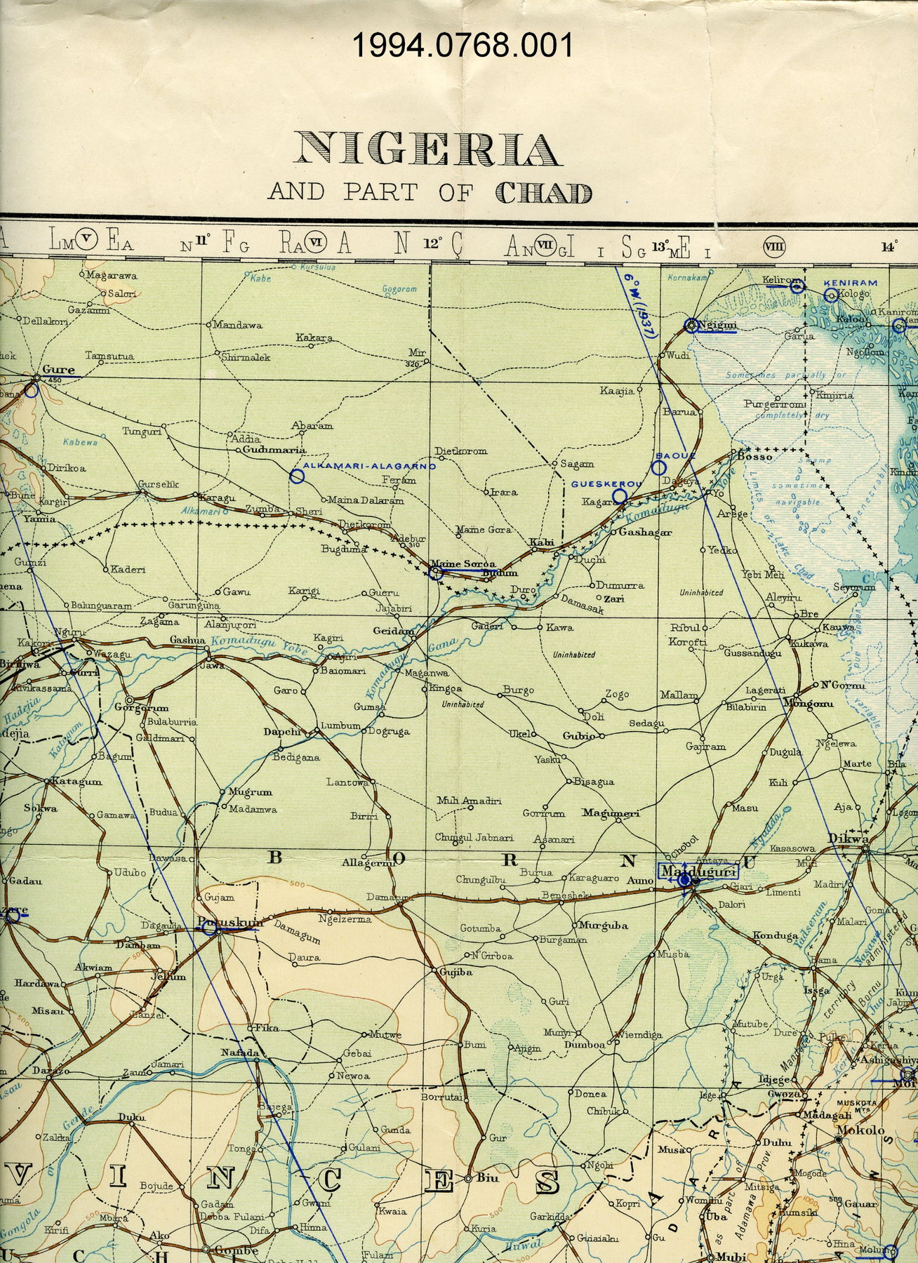
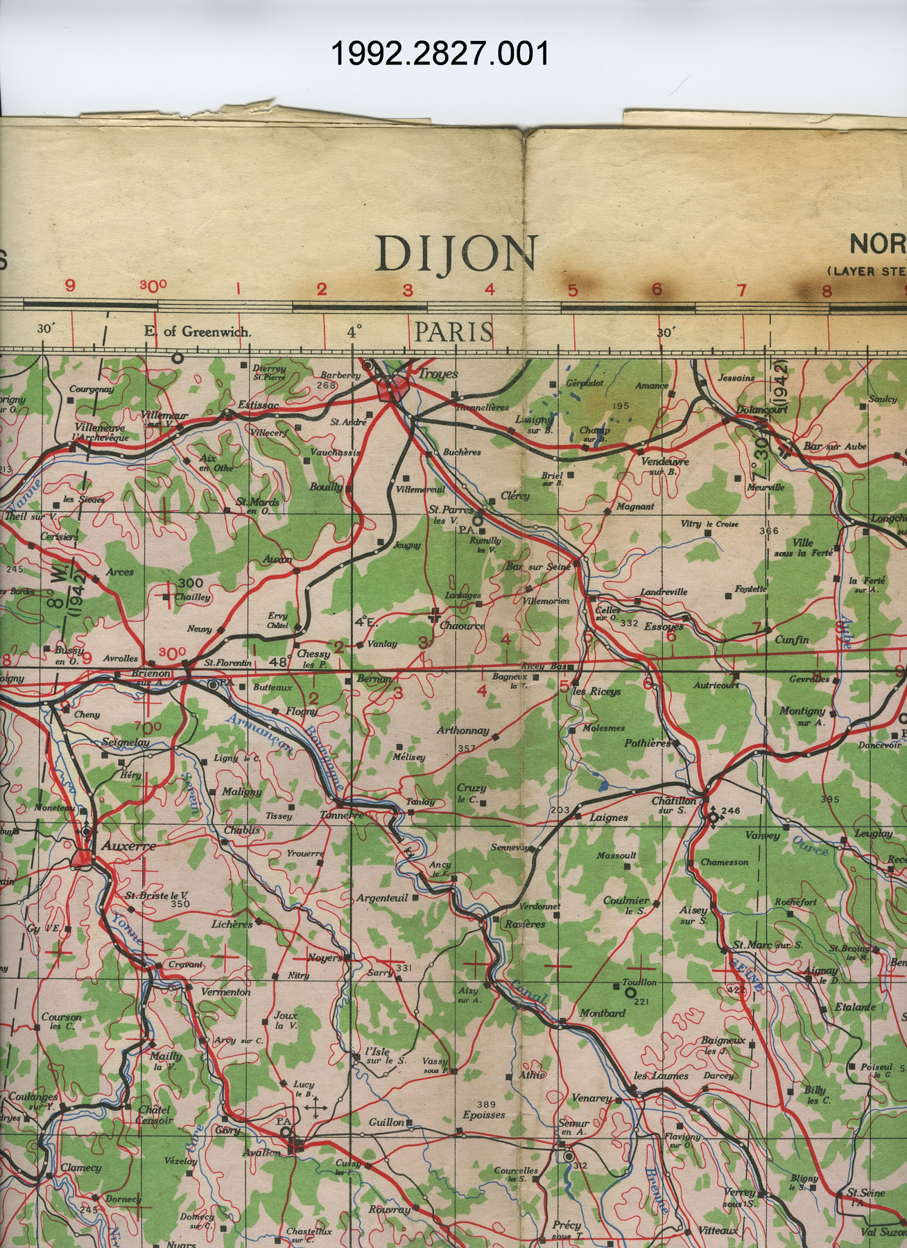
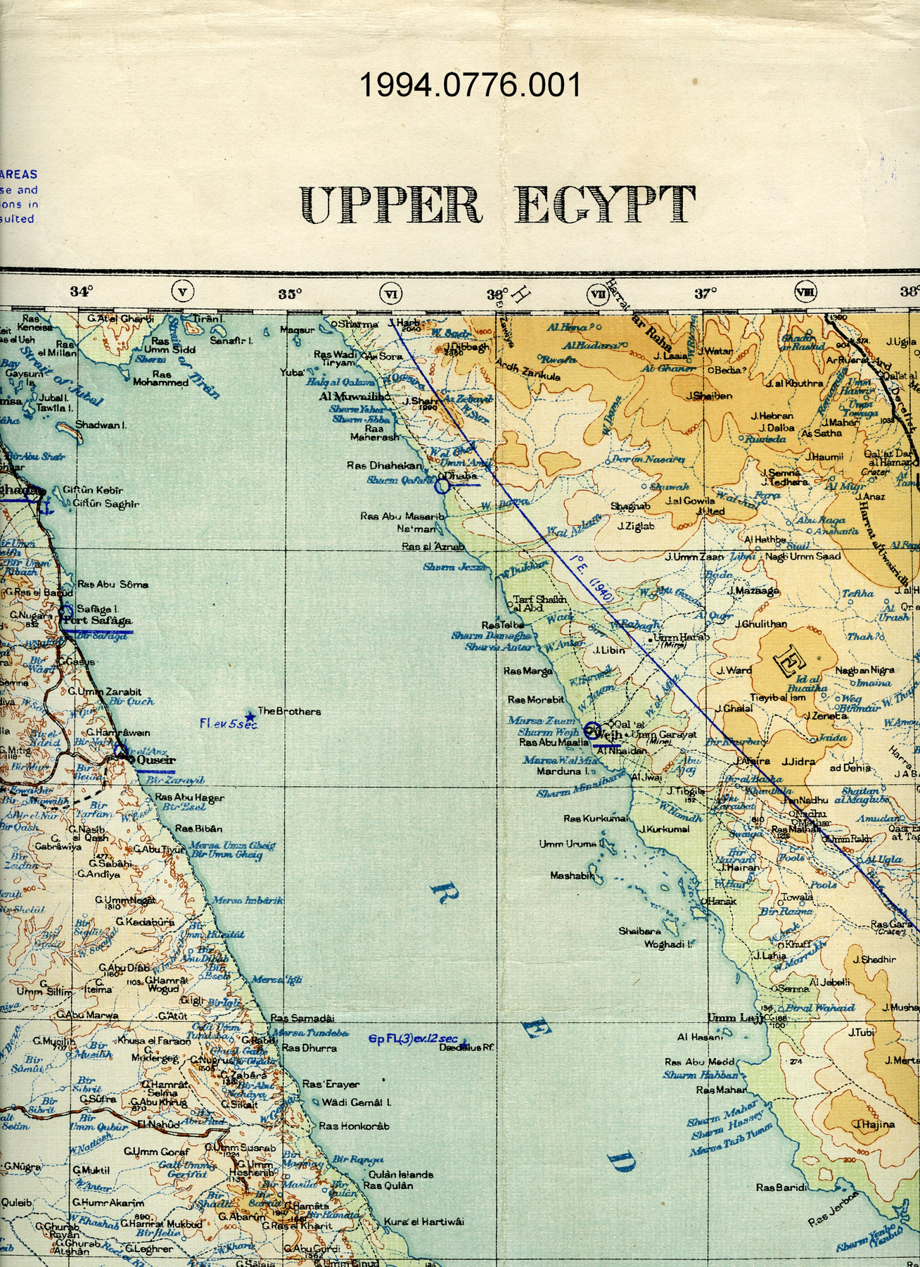
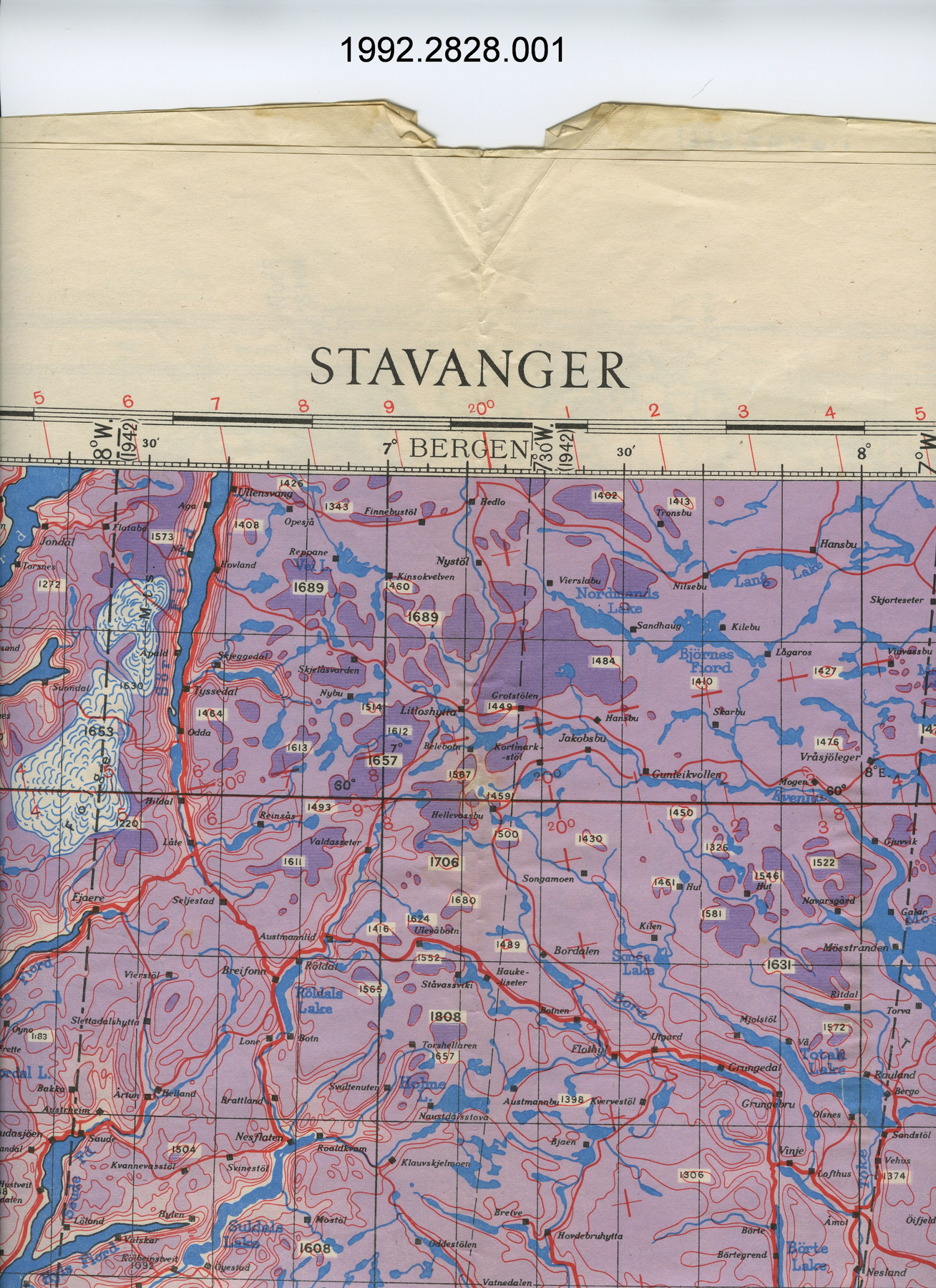
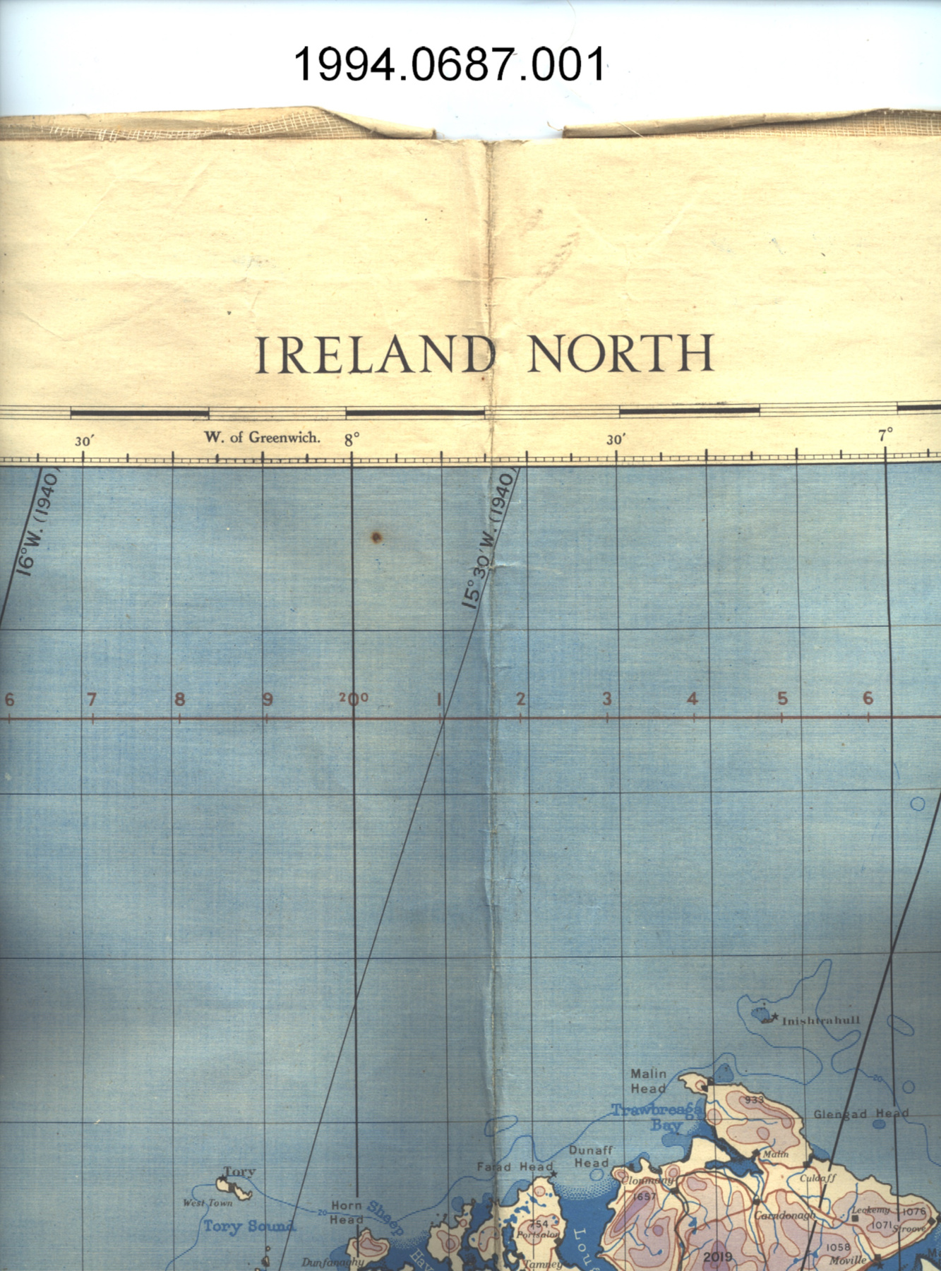
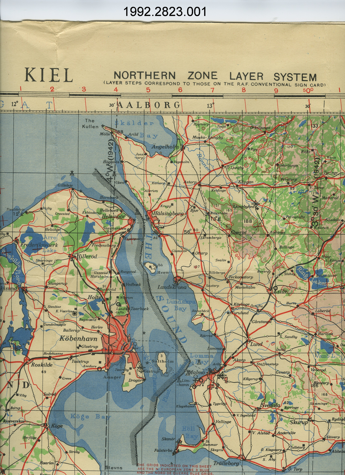
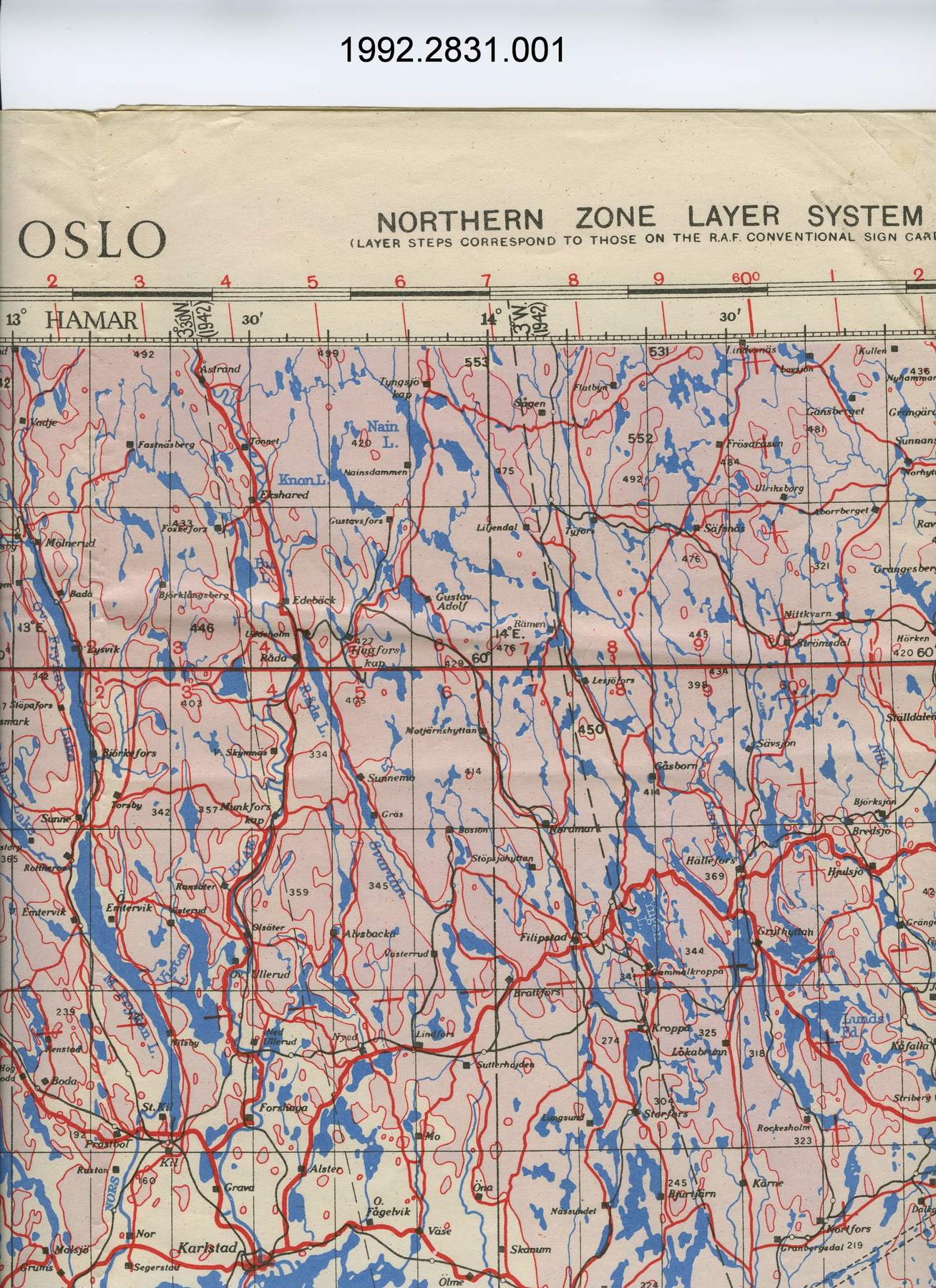
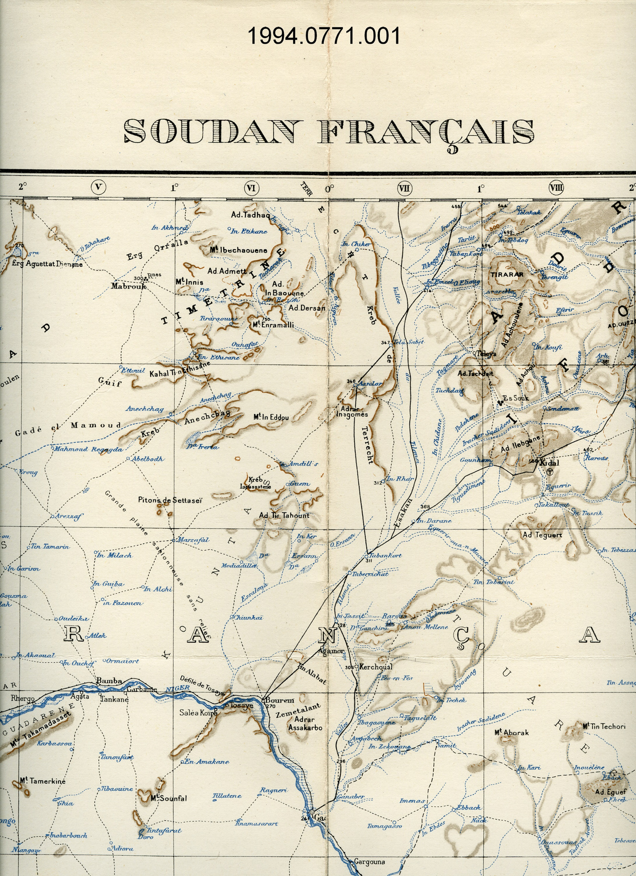
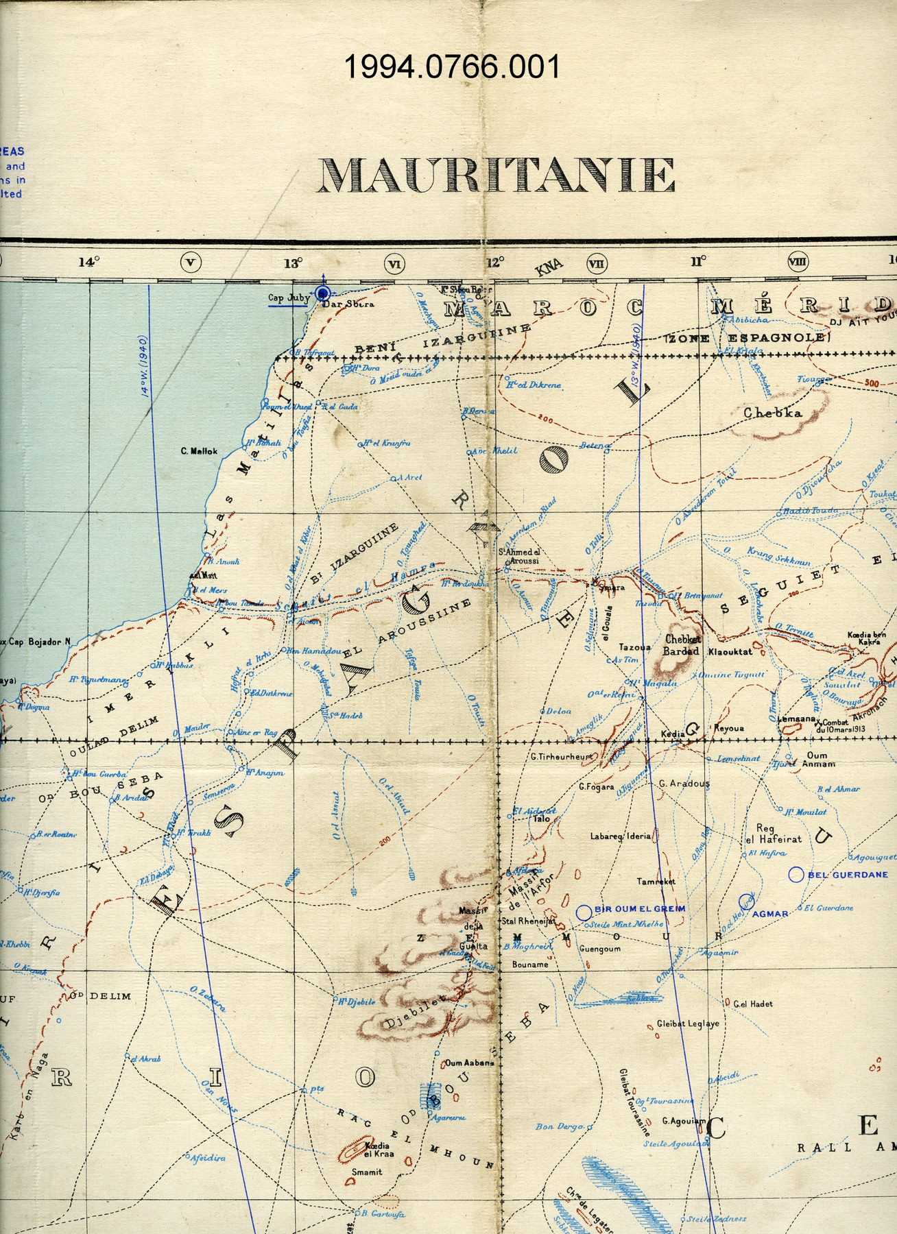
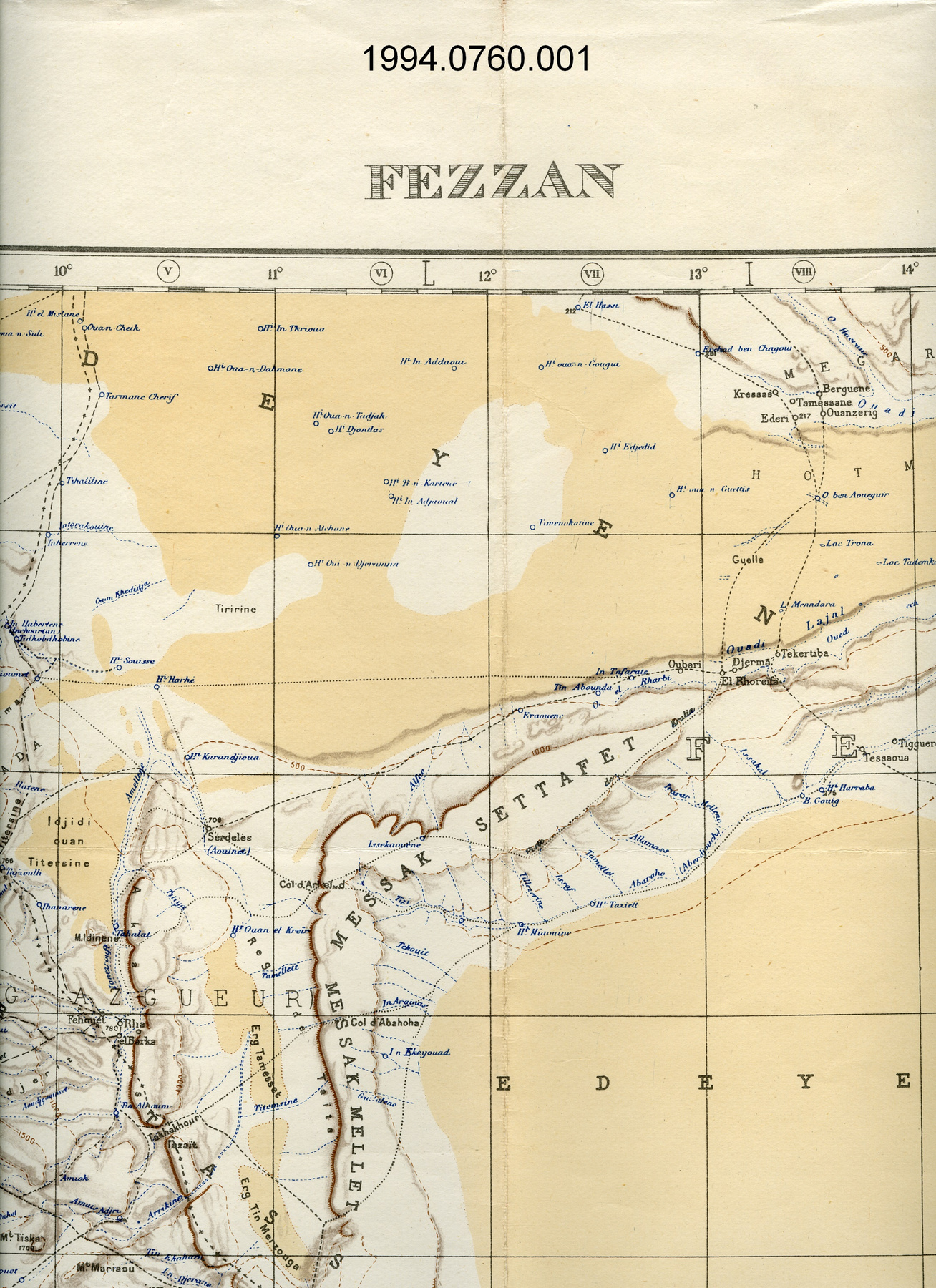
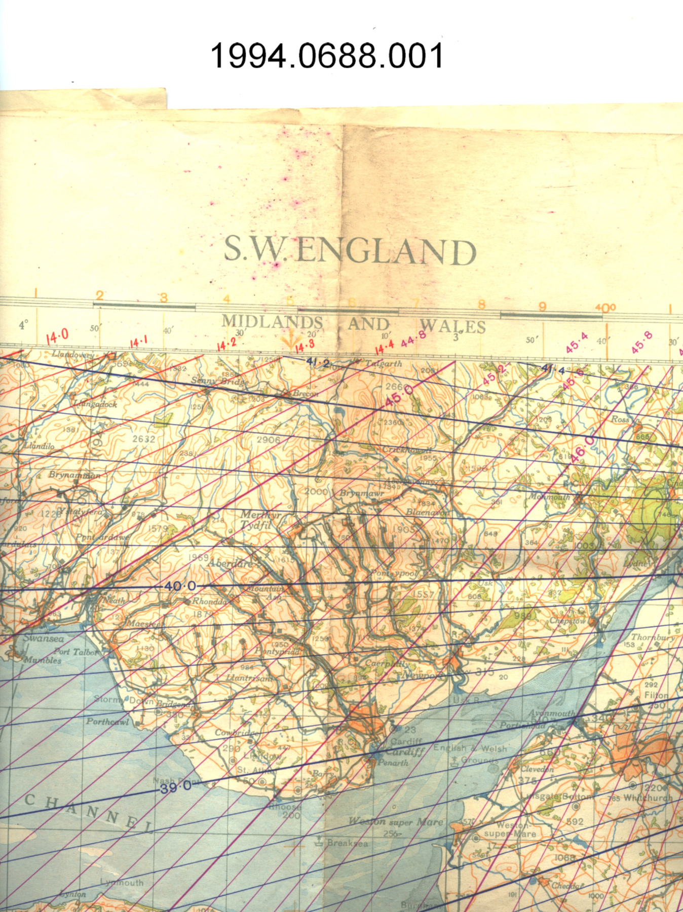
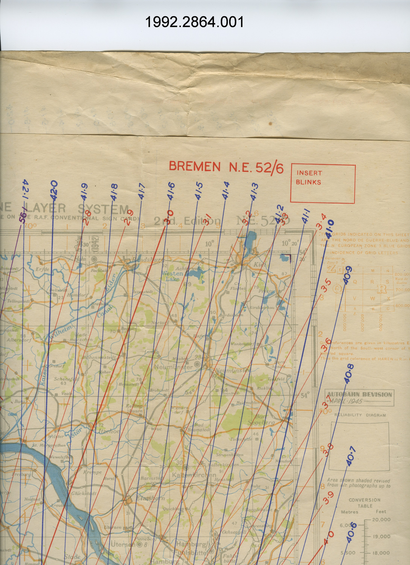
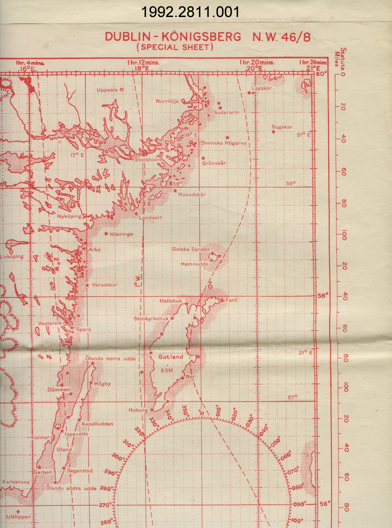
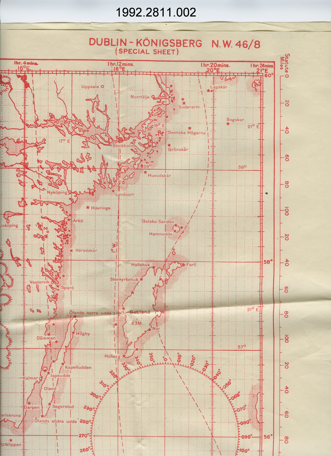
- OBJECT TYPE
- topographical/aeronautical
- DATE
- 1942
- ARTIFACT NUMBER
- 1994.0710.001
- MANUFACTURER
- Geographical Section, General Staff, War Office
- MODEL
- Cairo
- LOCATION
- England
More Information
General Information
- Serial #
- N/A
- Part Number
- 1
- Total Parts
- 1
- AKA
- N/A
- Patents
- N/A
- General Description
- paper
Dimensions
Note: These reflect the general size for storage and are not necessarily representative of the object's true dimensions.
- Length
- 76.1 cm
- Width
- 65.3 cm
- Height
- N/A
- Thickness
- N/A
- Weight
- N/A
- Diameter
- N/A
- Volume
- N/A
Lexicon
- Group
- Aviation
- Category
- Navigation instruments & equipment
- Sub-Category
- N/A
Manufacturer
- AKA
- Defence UK
- Country
- England
- State/Province
- Unknown
- City
- Unknown
Context
- Country
- Africa
- State/Province
- Unknown
- Period
- WWII (1939-1945)/ this map is a 1942 4th edition of a map originally published in 1934.
- Canada
-
Unknown - Function
-
two dimensional graphic representation of a section of the earth's surface/used for aerial navigation - Technical
-
Unknown - Area Notes
-
Unknown
Details
- Markings
- lettering printed on border above map reads: "ASIA 1:1,000,000/CAIRO/FOURTH EDITION. ARMY/AIR STYLE/NORTH H-36"; lettering printed on border below map reads: "Geographical Section, General Staff, No. 2555./Published by War Office, 1934./4th Edition 1942/10,000/8/43 Ch./Annual change about 3' Easterly./Projection of the International Map/L.M.T. 2 hrs. 12 mins. ahead of G.M.T./HEIGHTS IN METRES/Certain main spot heights are indicated/by a white tab to improve legibility.Scale 1:1,000,000/1 inch = 15.78 Miles or 1.014 Inches = 16 Miles/1 Millimetre = 1 Kilometre/Compiled at W.O., drawn and heliographed by O.S., 1940./Roads partially revised 1942"
- Missing
- N/A
- Finish
- colour map on white background
- Decoration
- none
CITE THIS OBJECT
If you choose to share our information about this collection object, please cite:
Geographical Section, General Staff, War Office, Map, 1942, Artifact no. 1994.0710, Ingenium – Canada’s Museums of Science and Innovation, http://collections.ingeniumcanada.org/en/id/1994.0710.001/
FEEDBACK
Submit a question or comment about this artifact.
More Like This
1994.0710.001