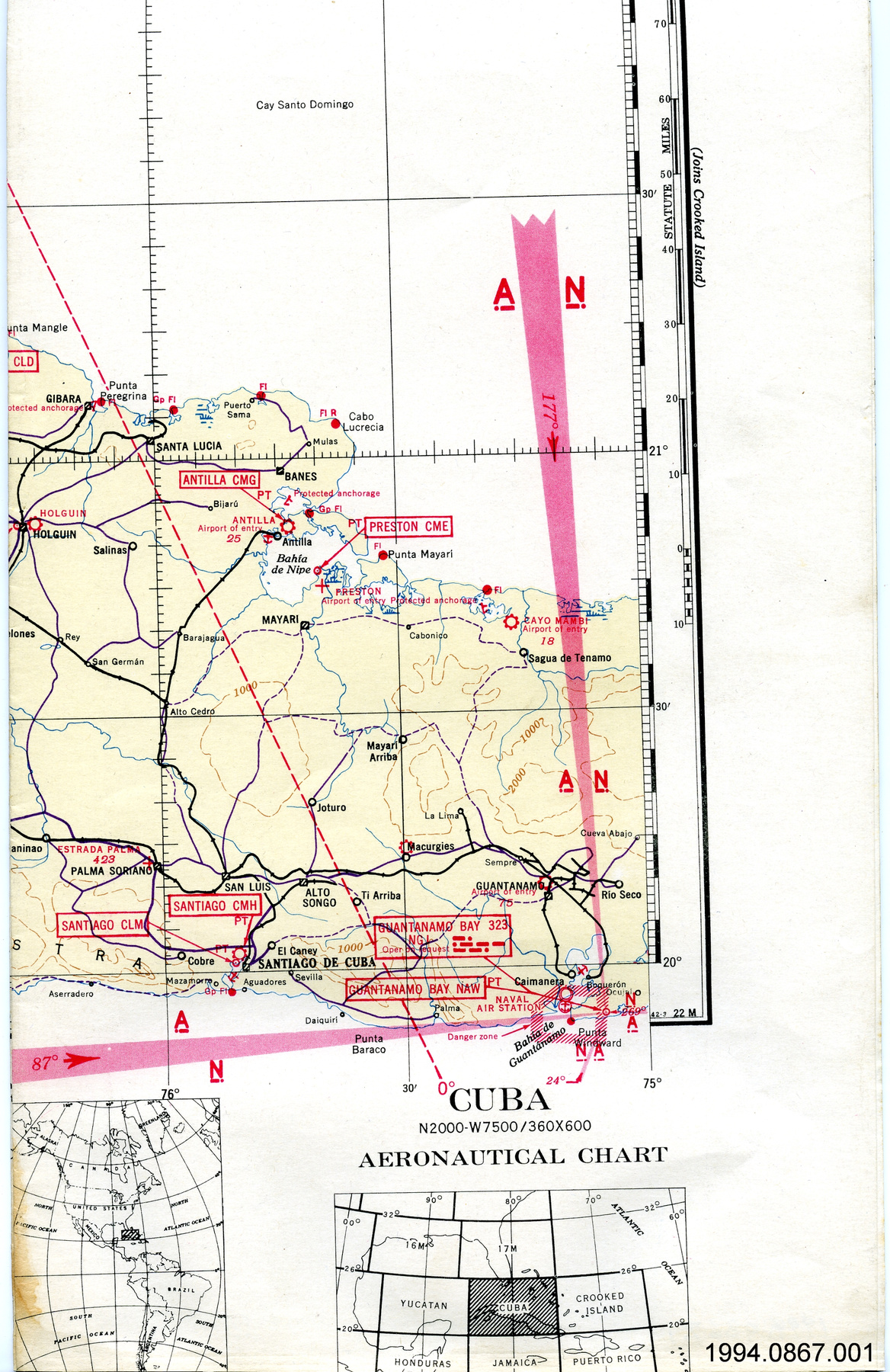
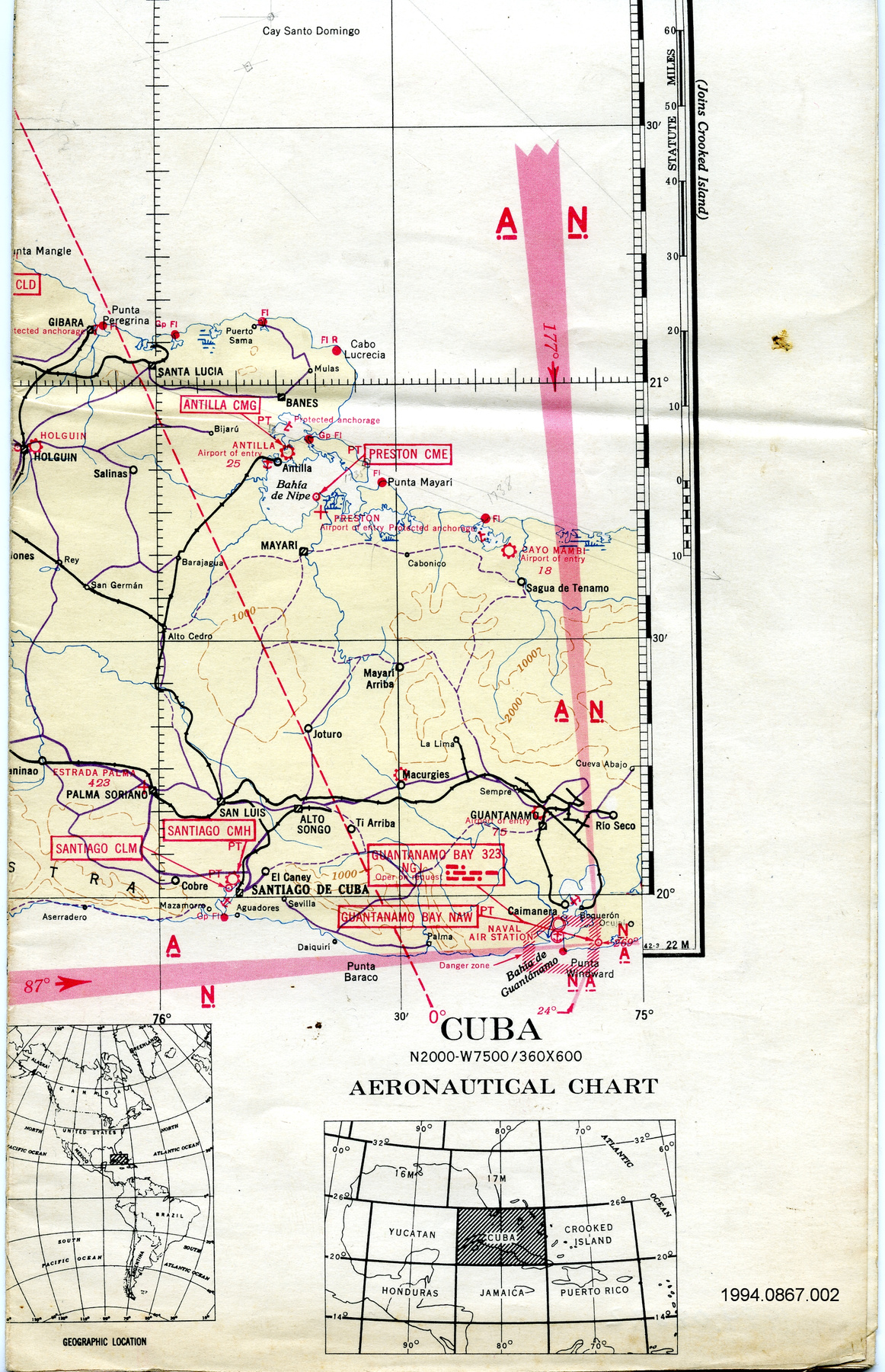
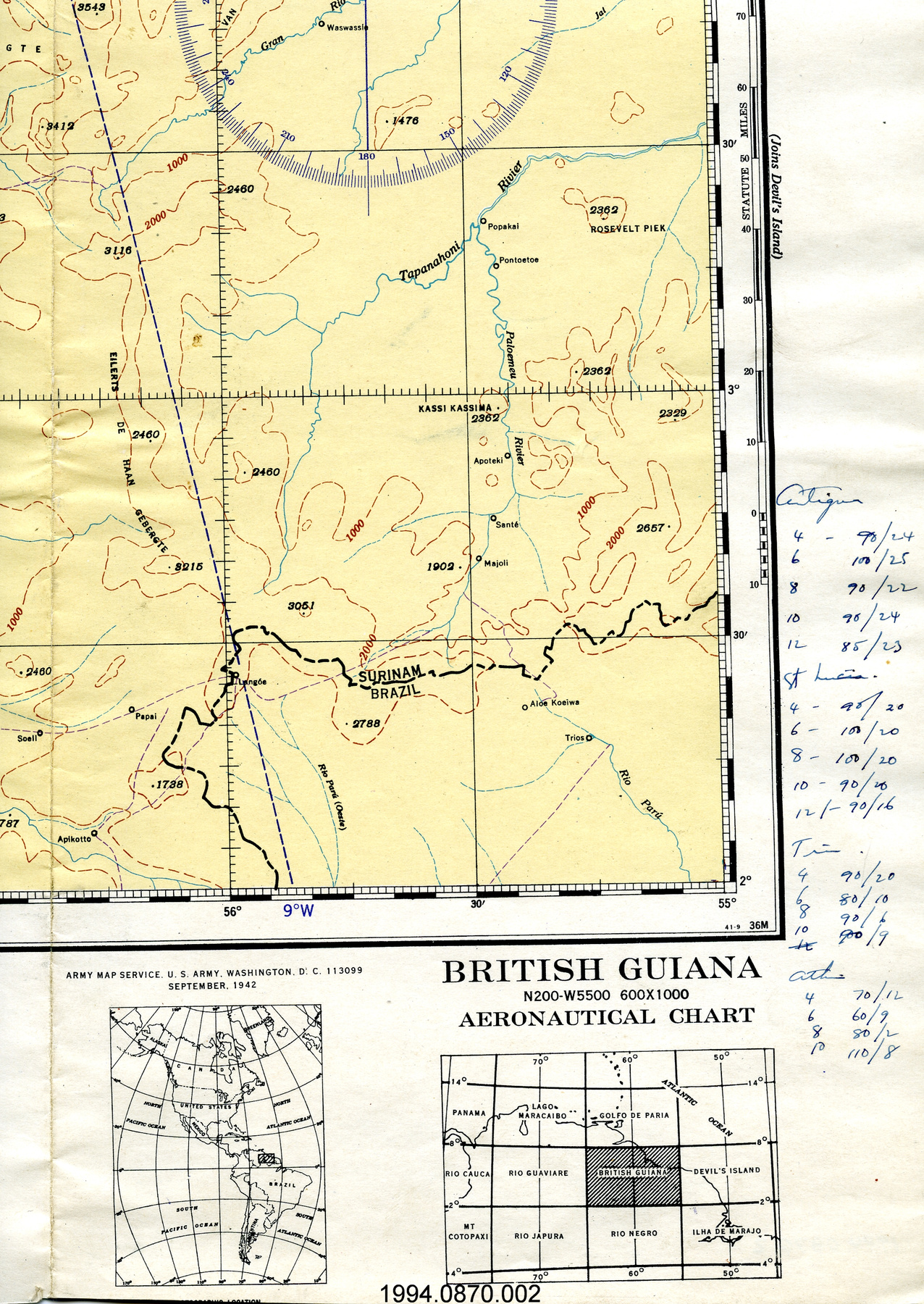
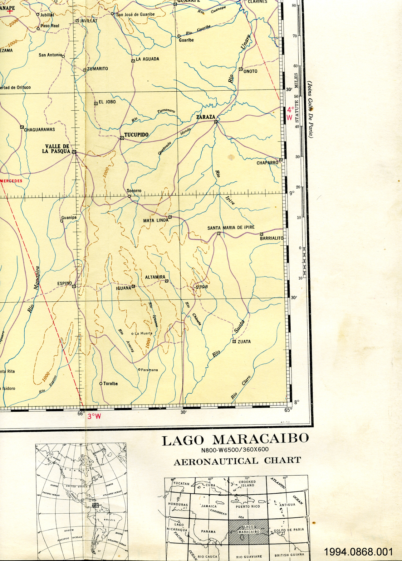
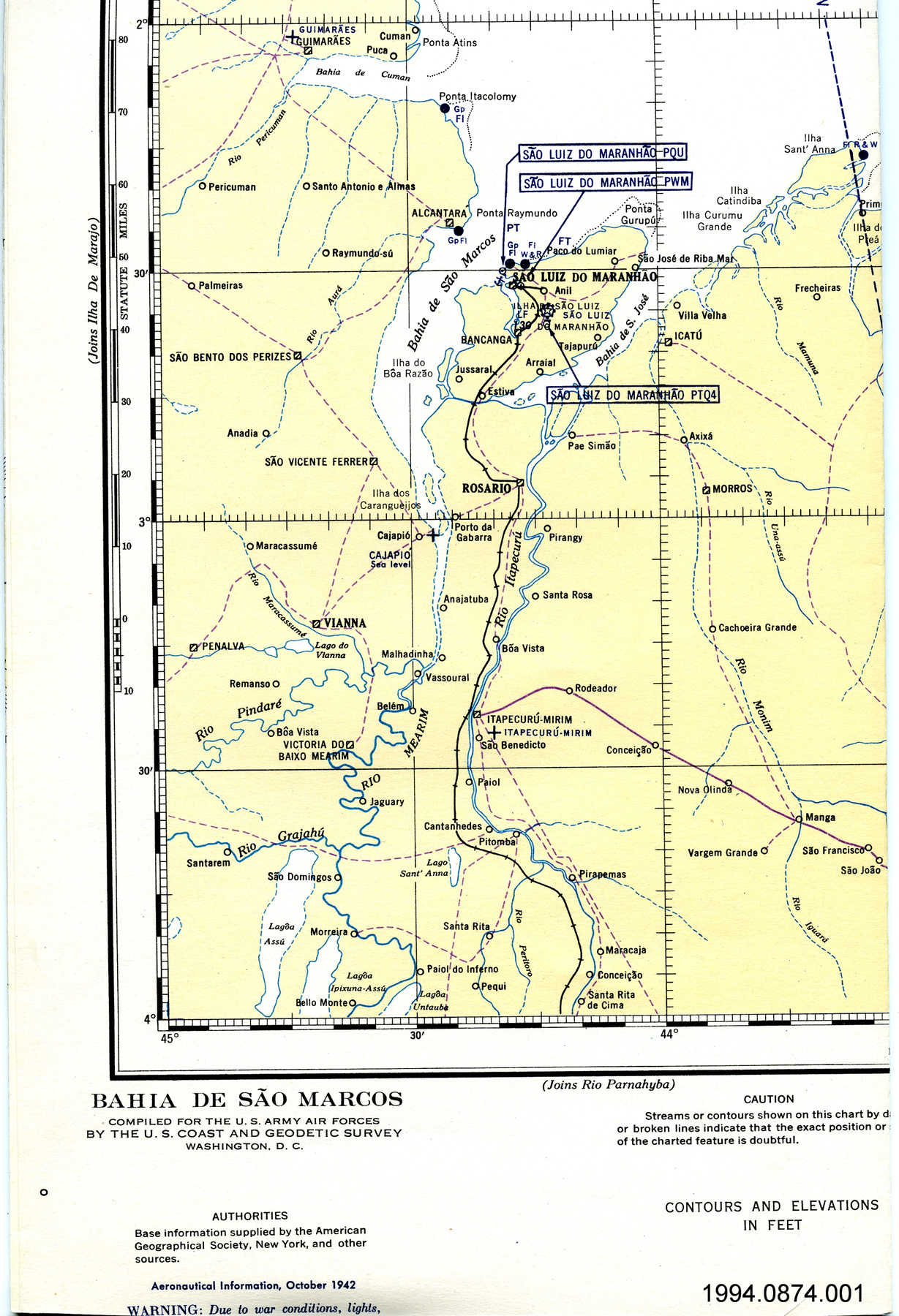
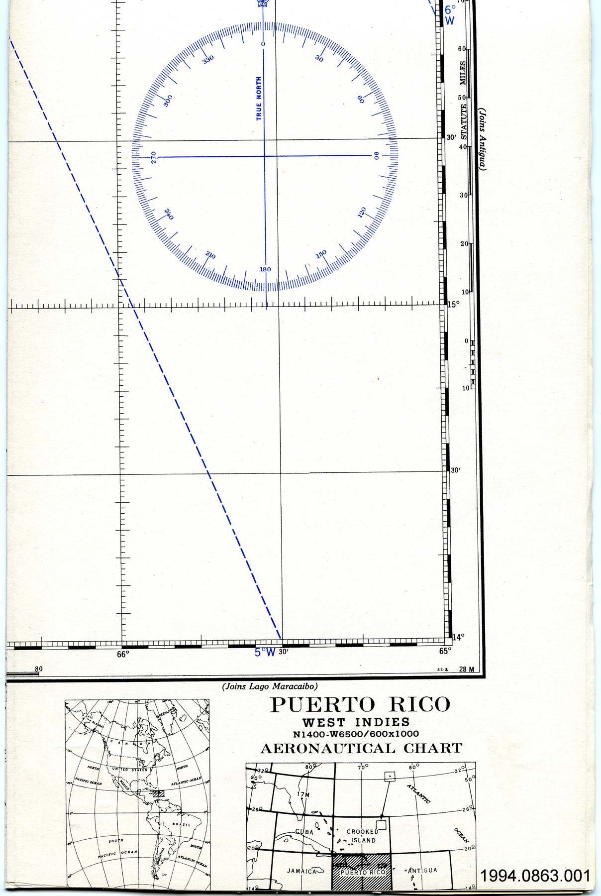
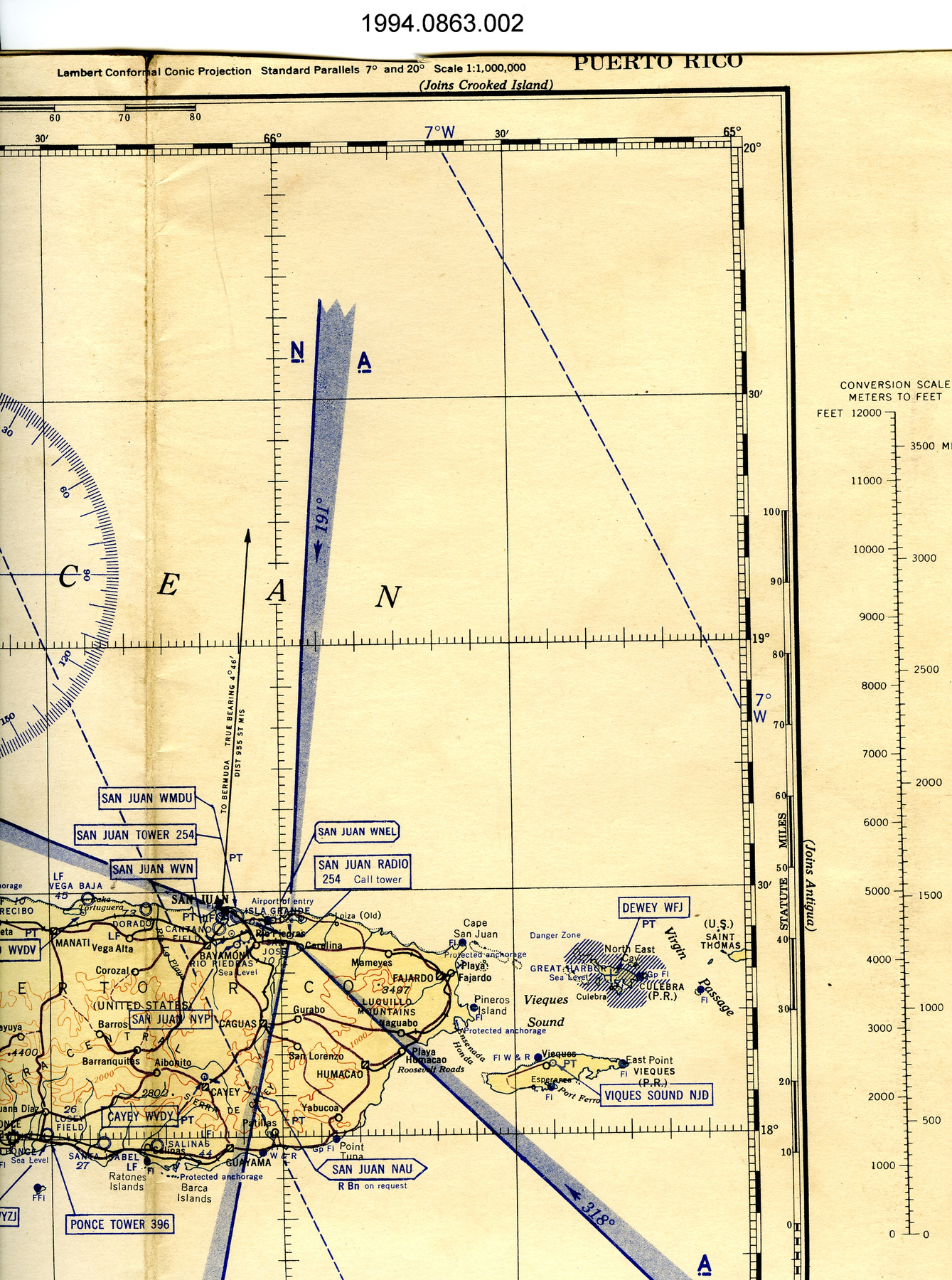
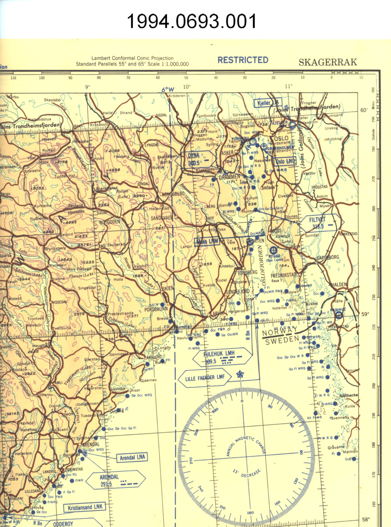
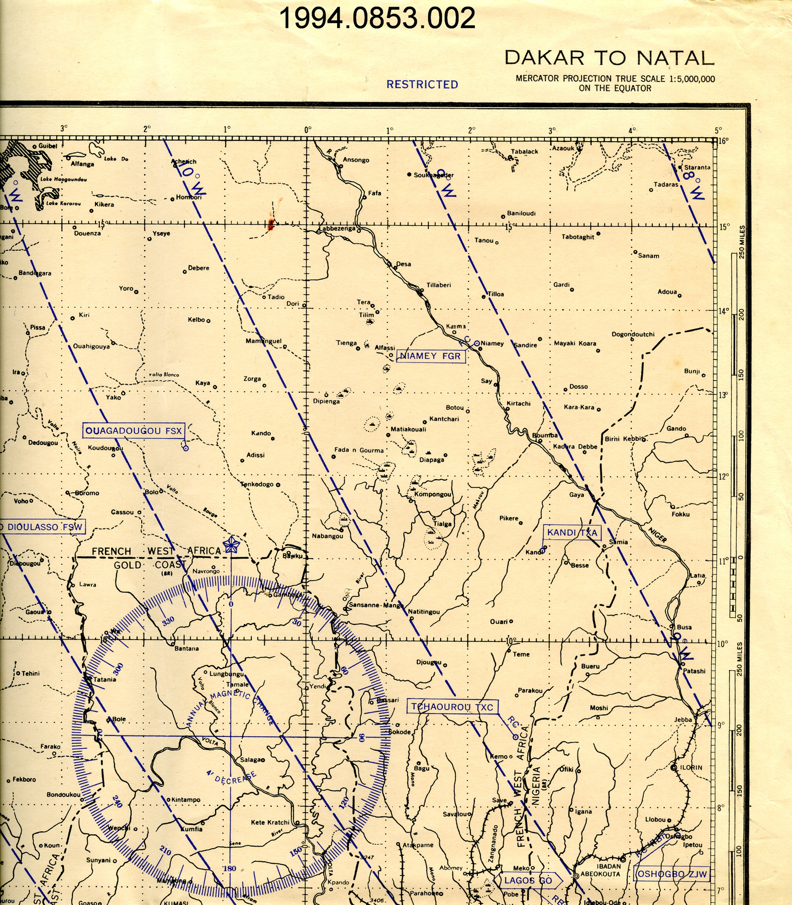
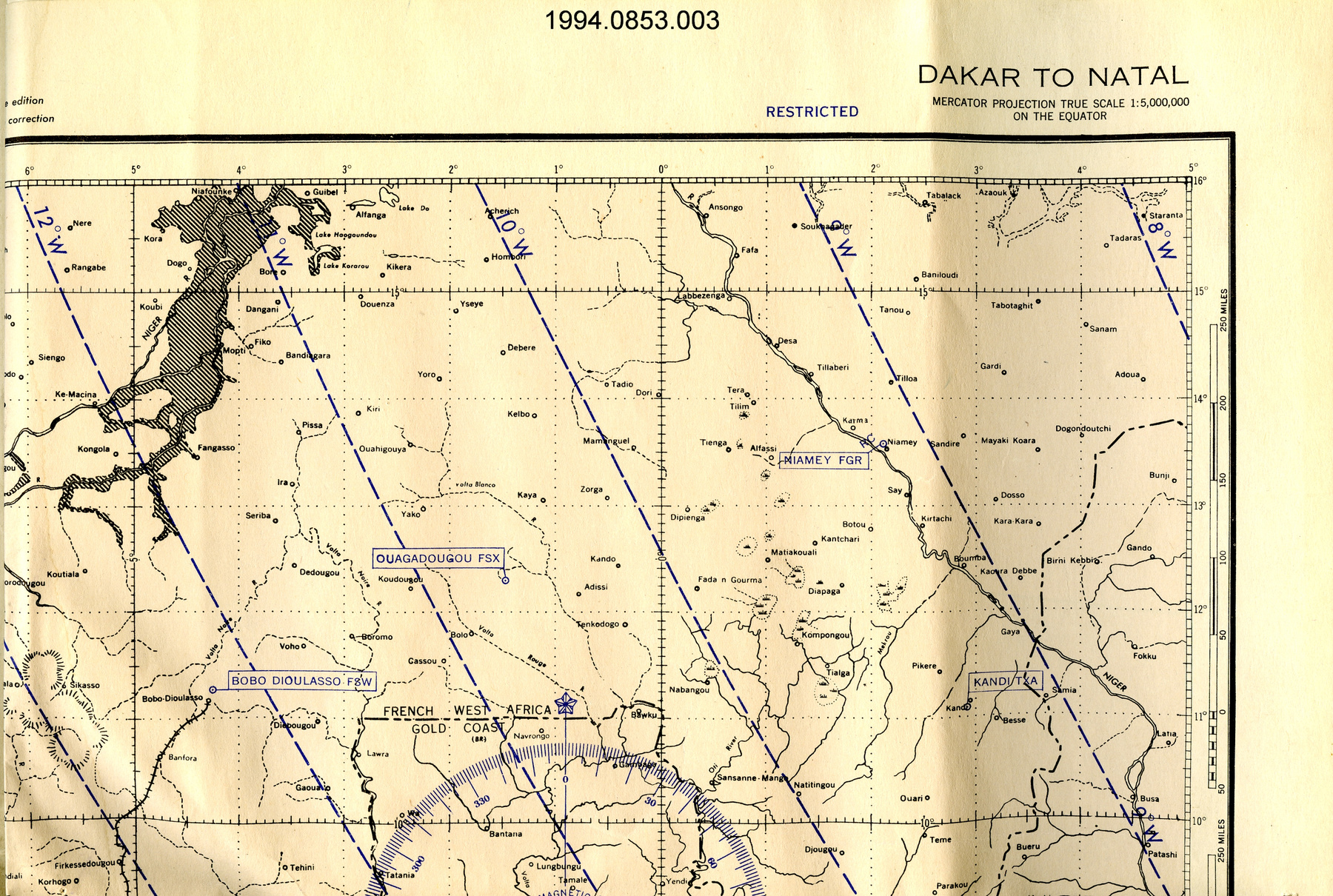
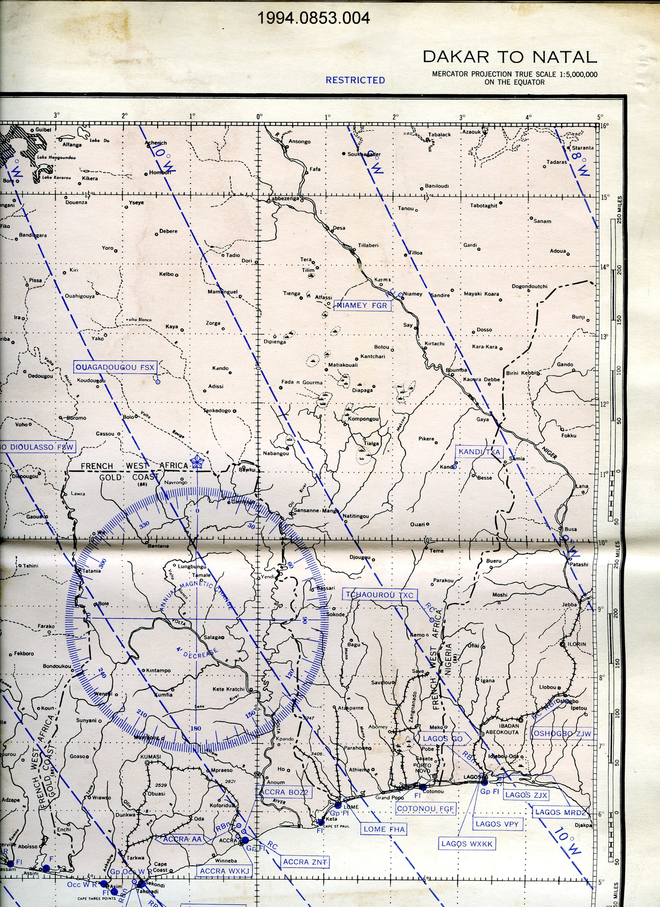
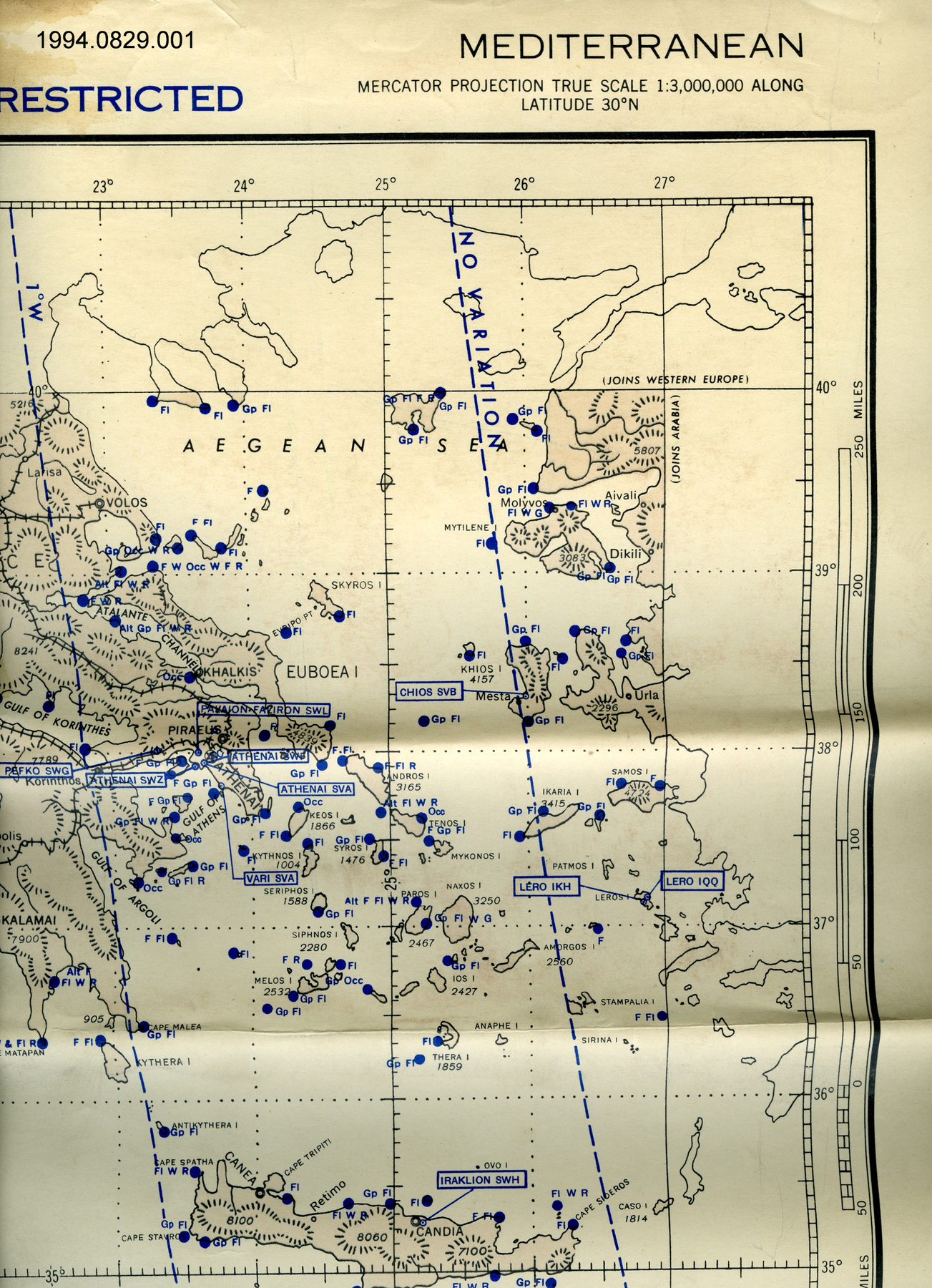
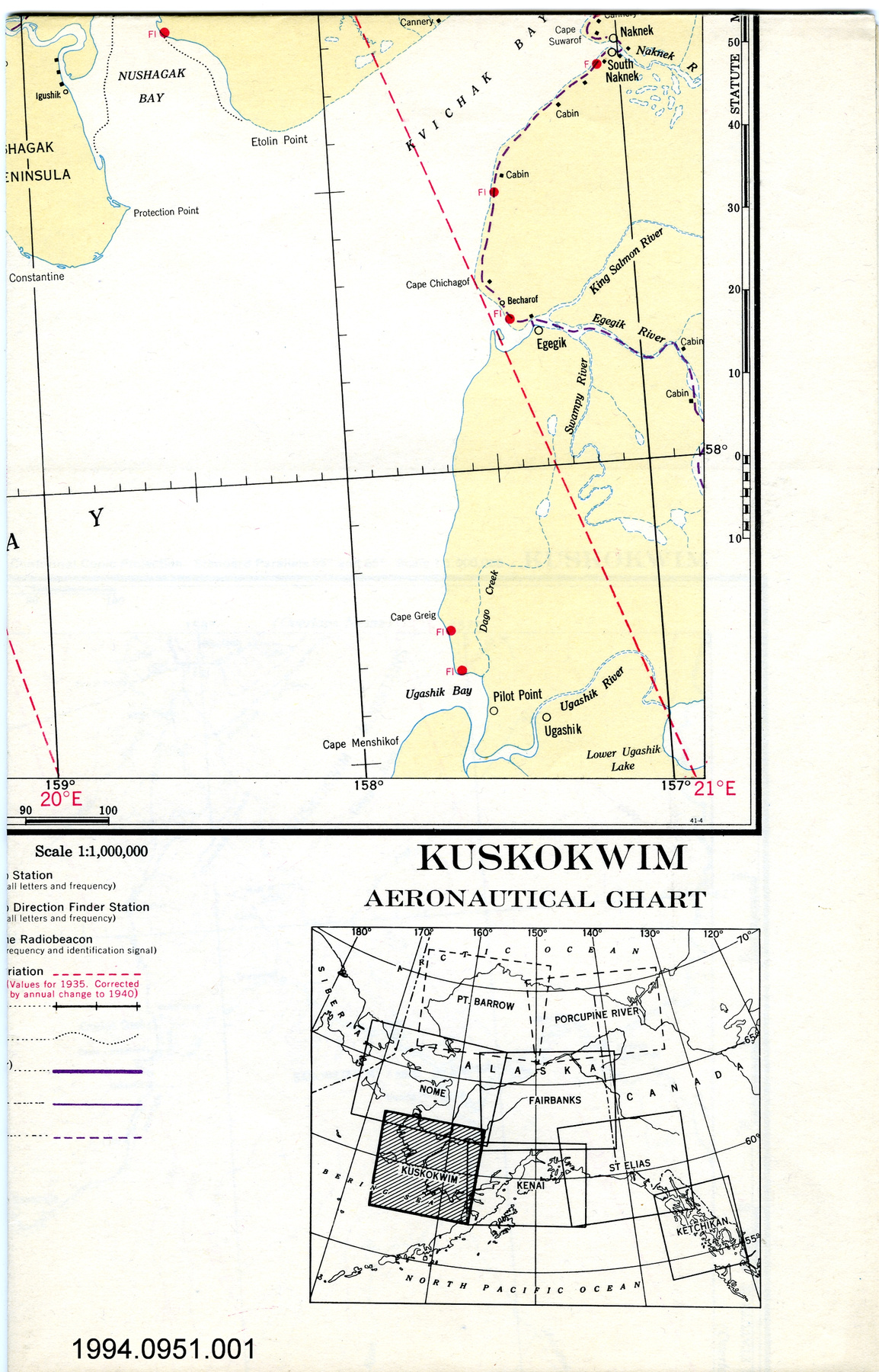
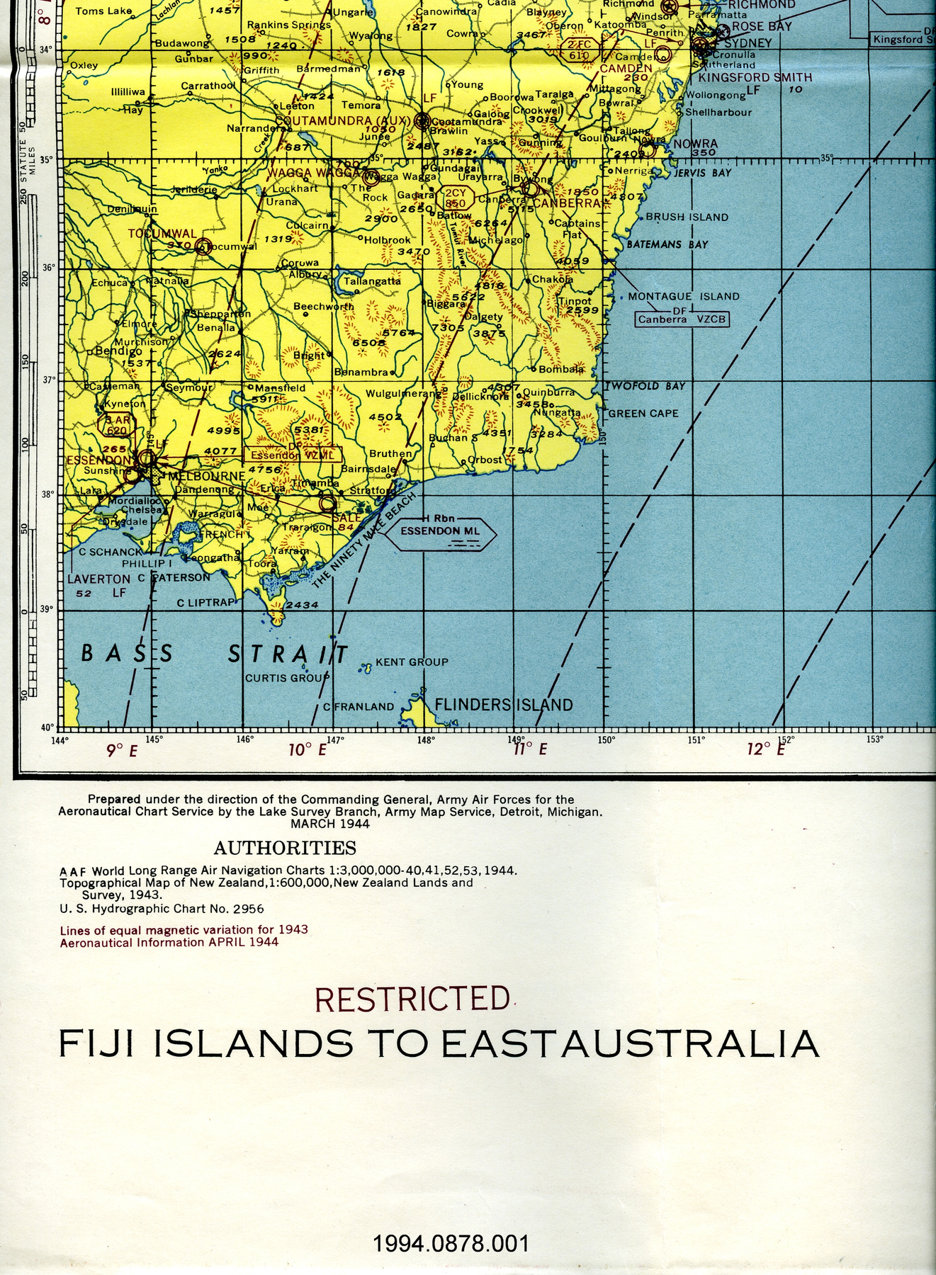
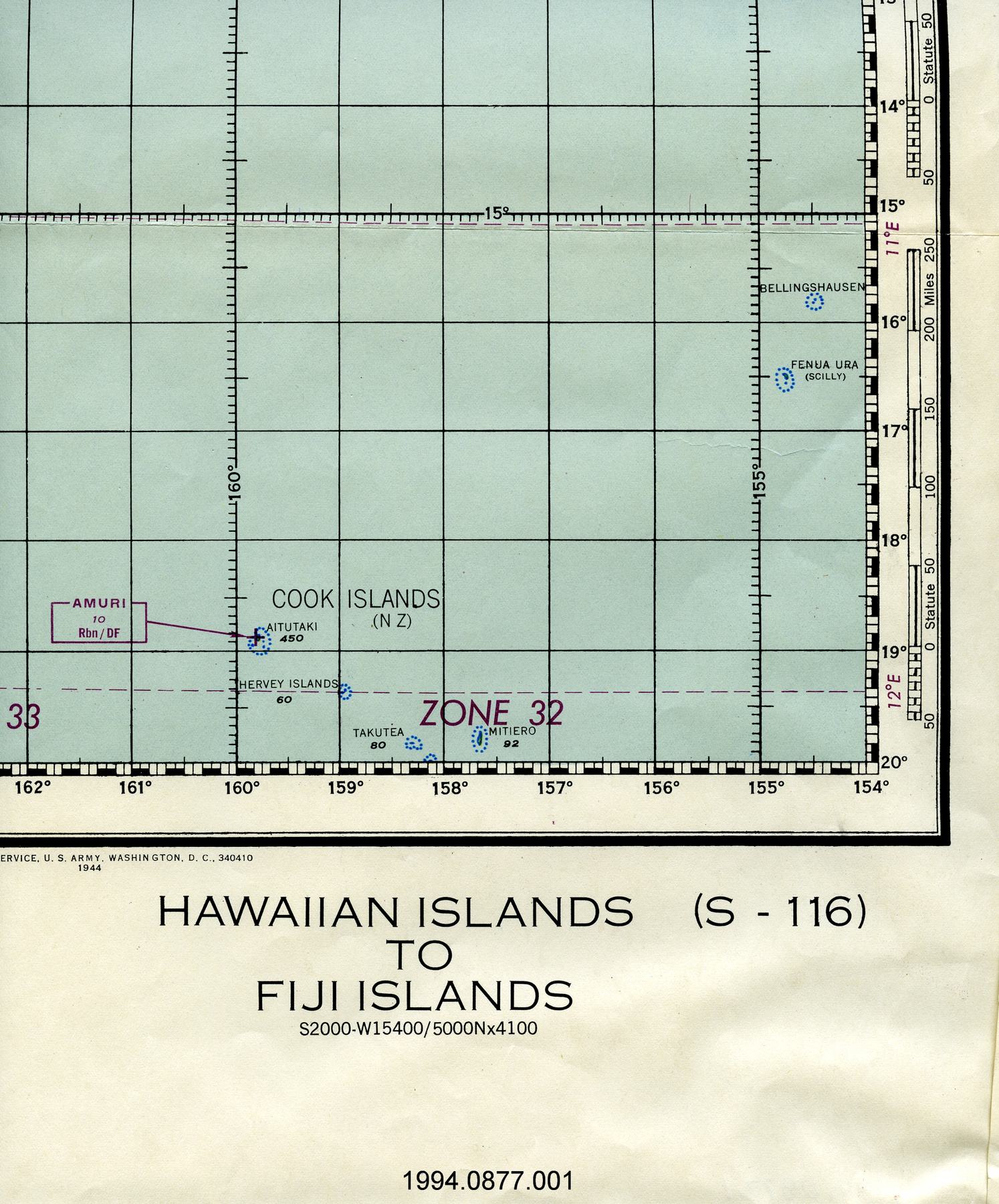
Map
Use this image
Can I reuse this image without permission? Yes
Object images on the Ingenium Collection’s portal have the following Creative Commons license:
Copyright Ingenium / CC BY-NC-ND (Attribution-NonCommercial 4.0 International (CC BY-NC 4.0)
ATTRIBUTE THIS IMAGE
Ingenium,
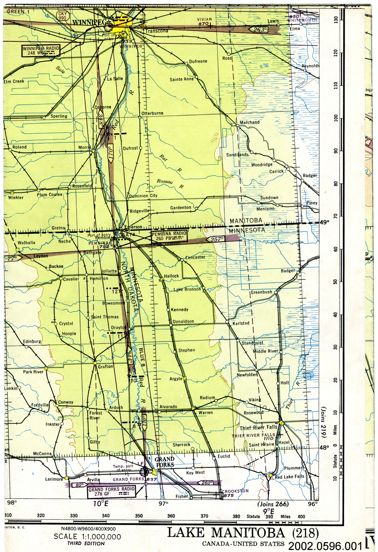
2002.0596.001
Permalink:
Ingenium is releasing this image under the Creative Commons licensing framework, and encourages downloading and reuse for non-commercial purposes. Please acknowledge Ingenium and cite the artifact number.
DOWNLOAD IMAGEPURCHASE THIS IMAGE
This image is free for non-commercial use.
For commercial use, please consult our Reproduction Fees and contact us to purchase the image.
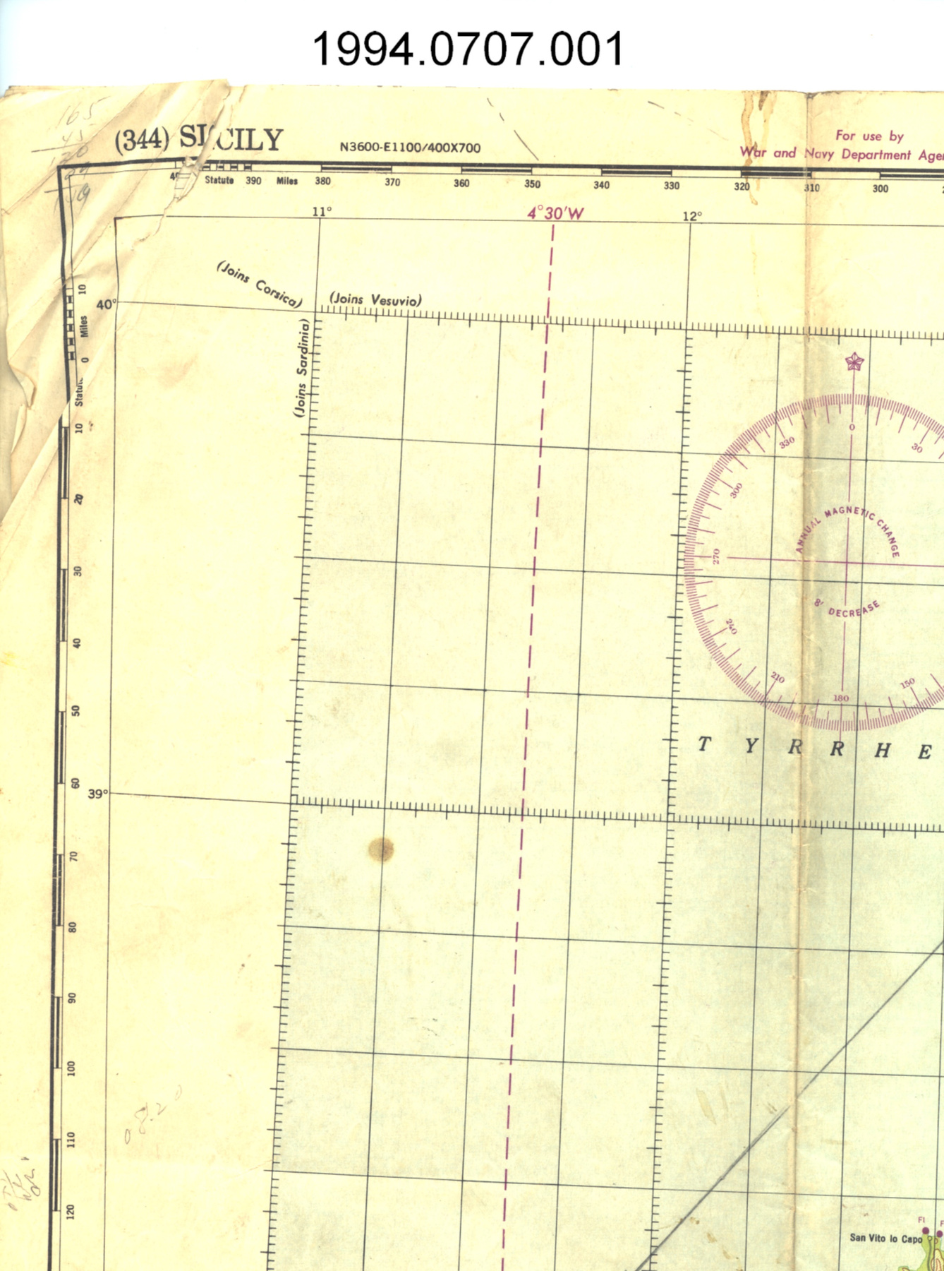
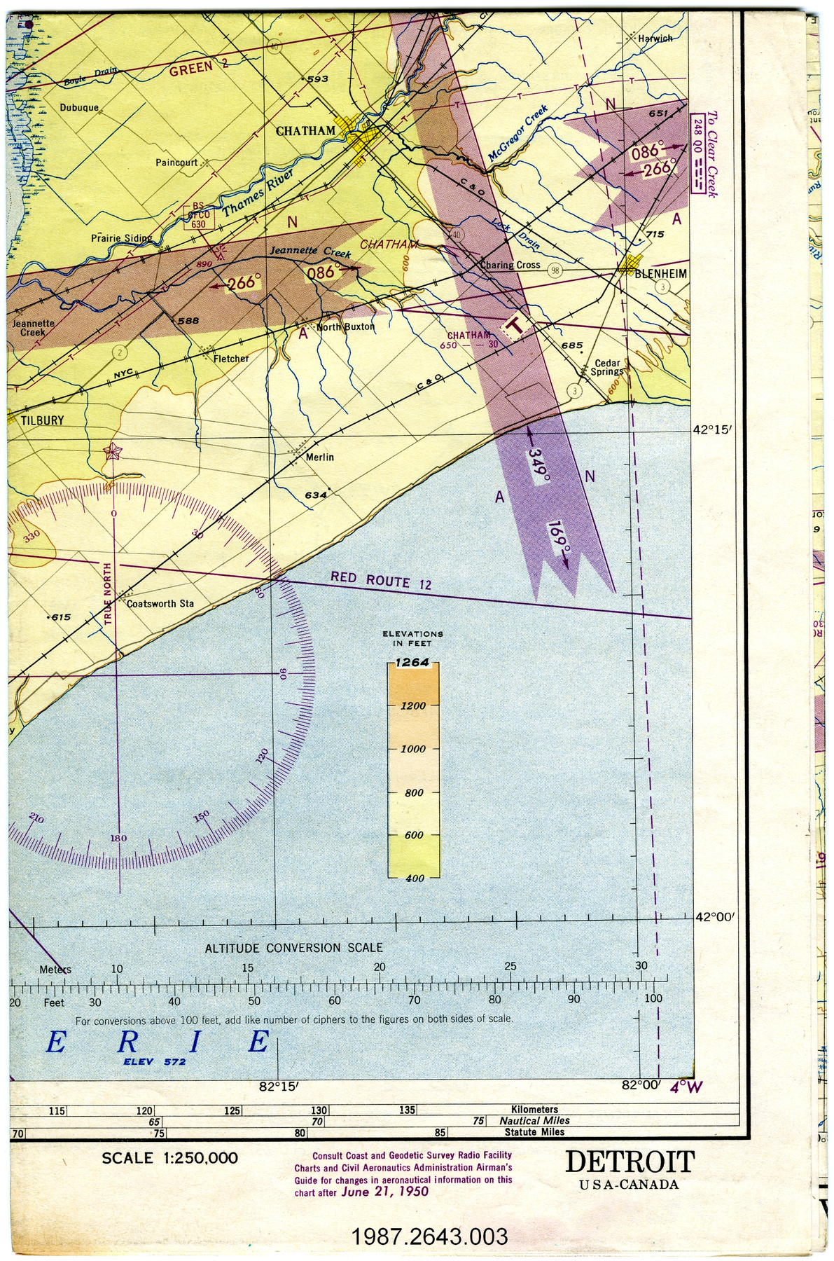
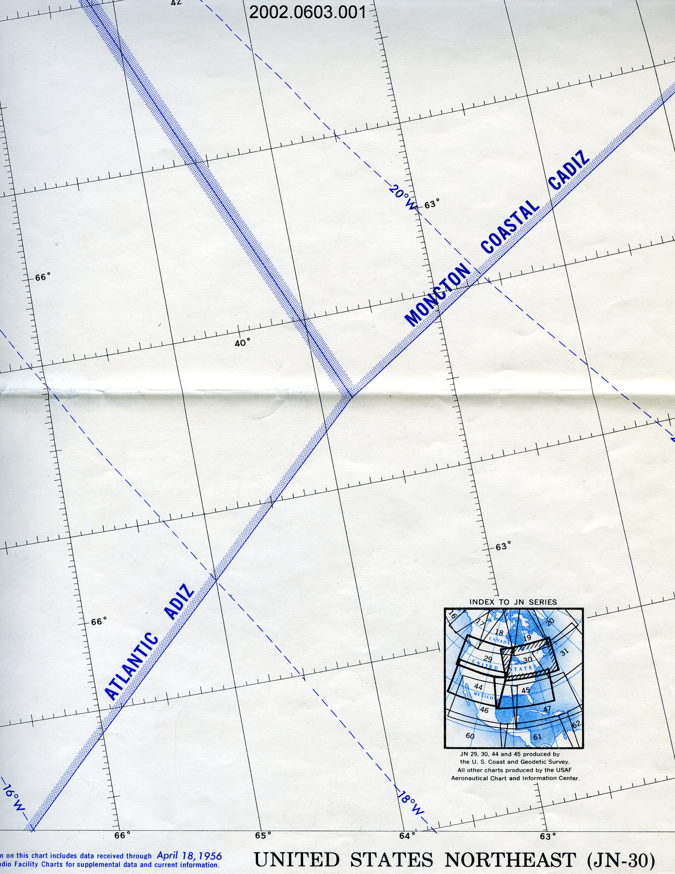
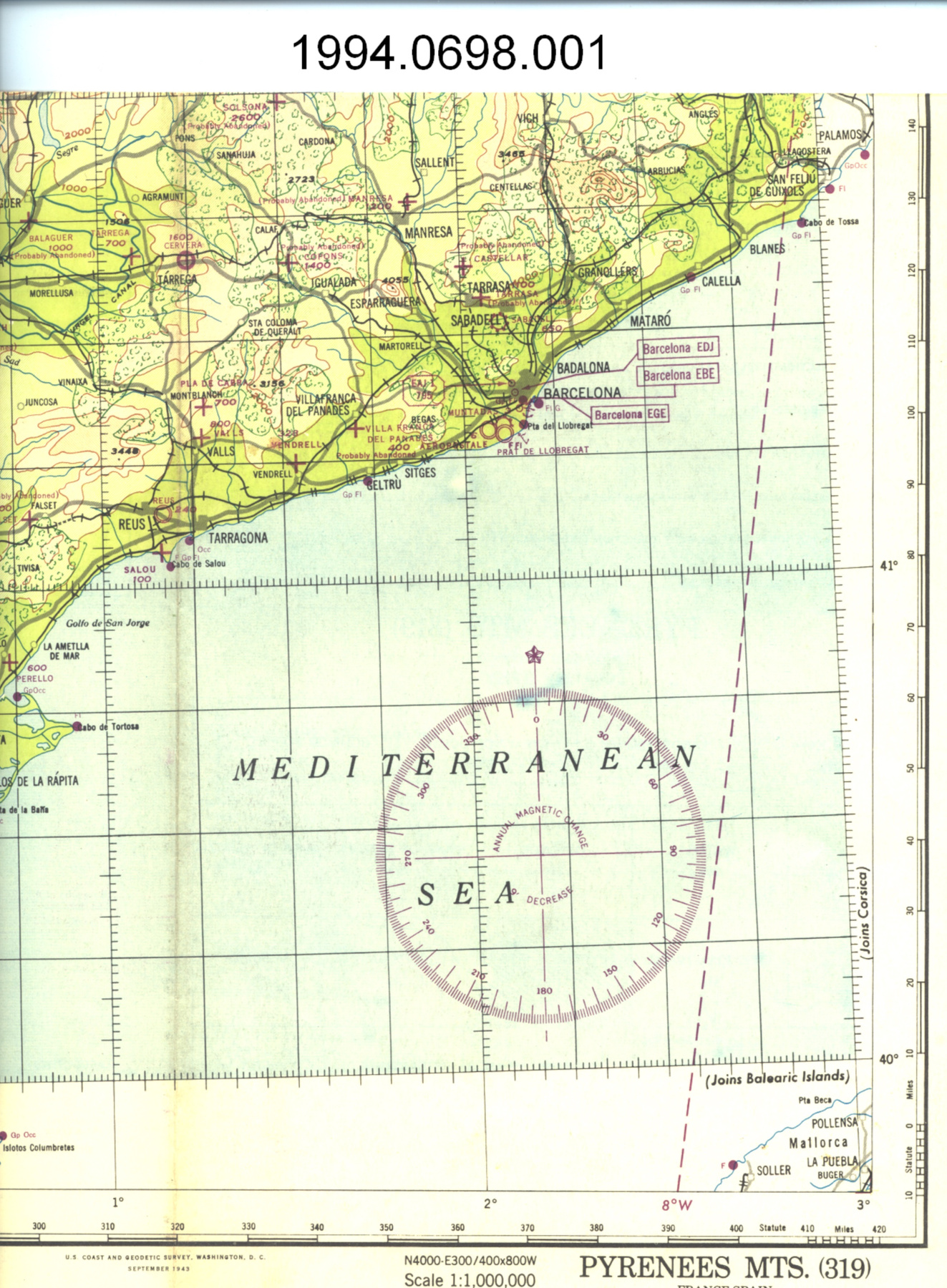
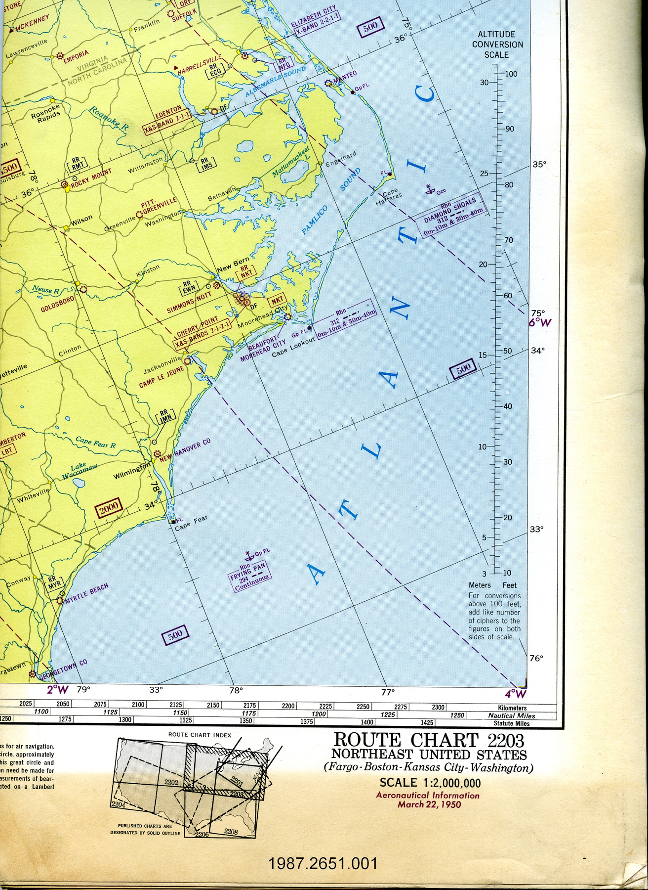
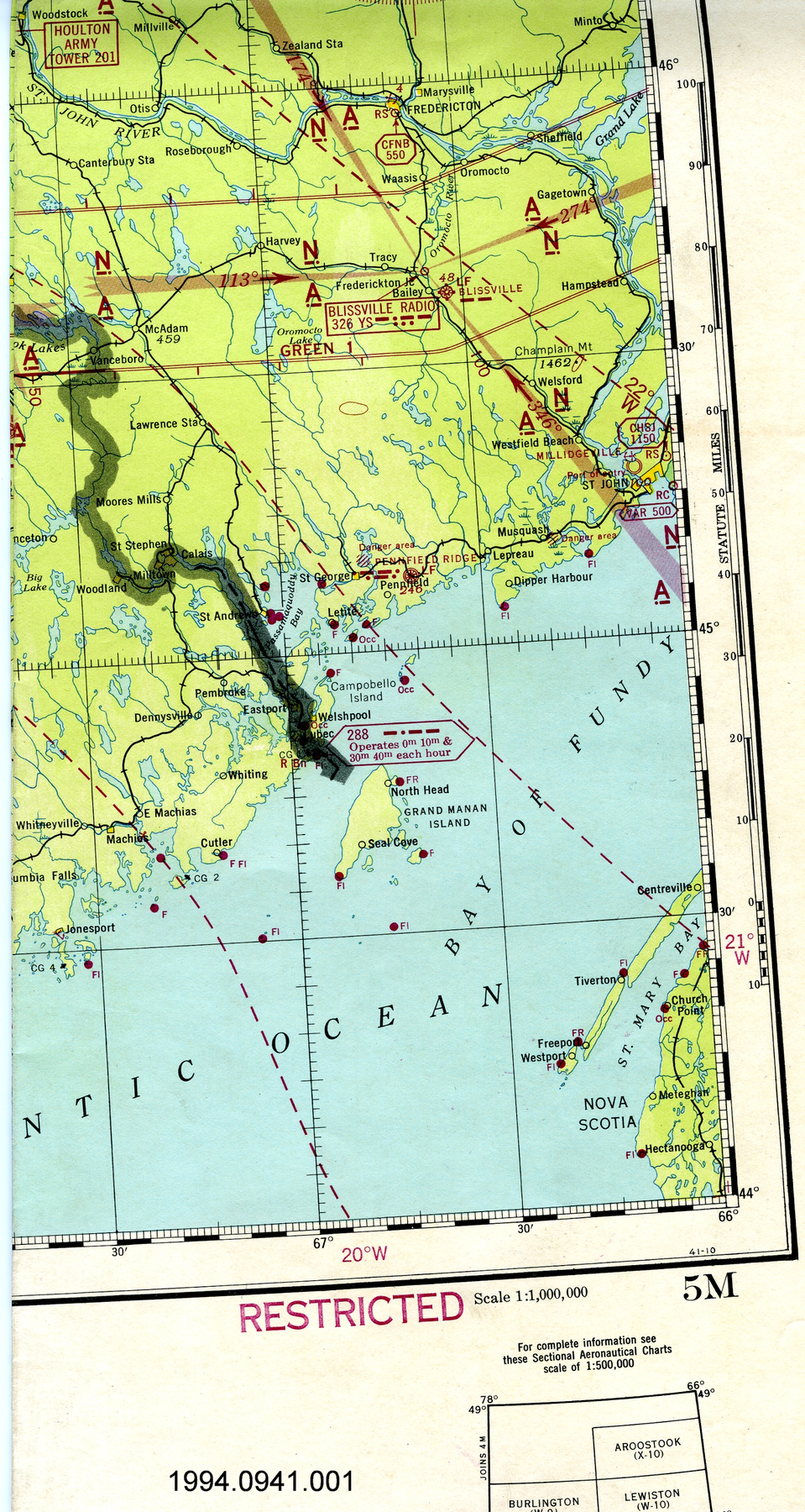
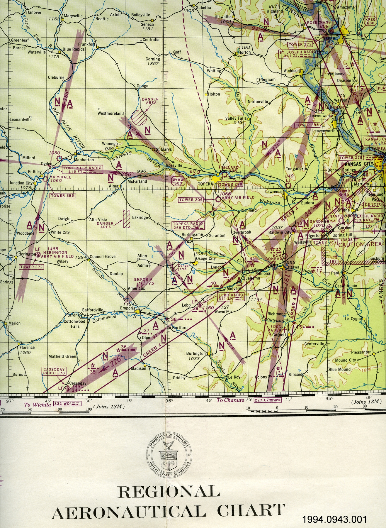
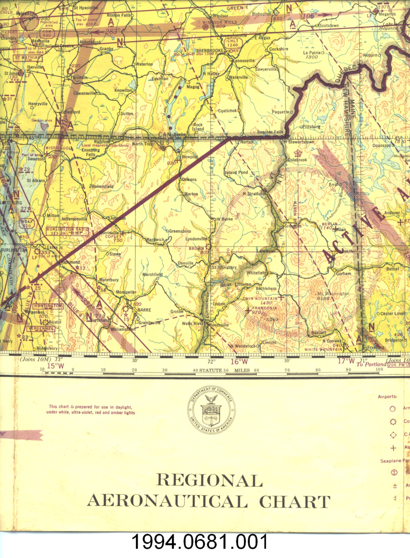
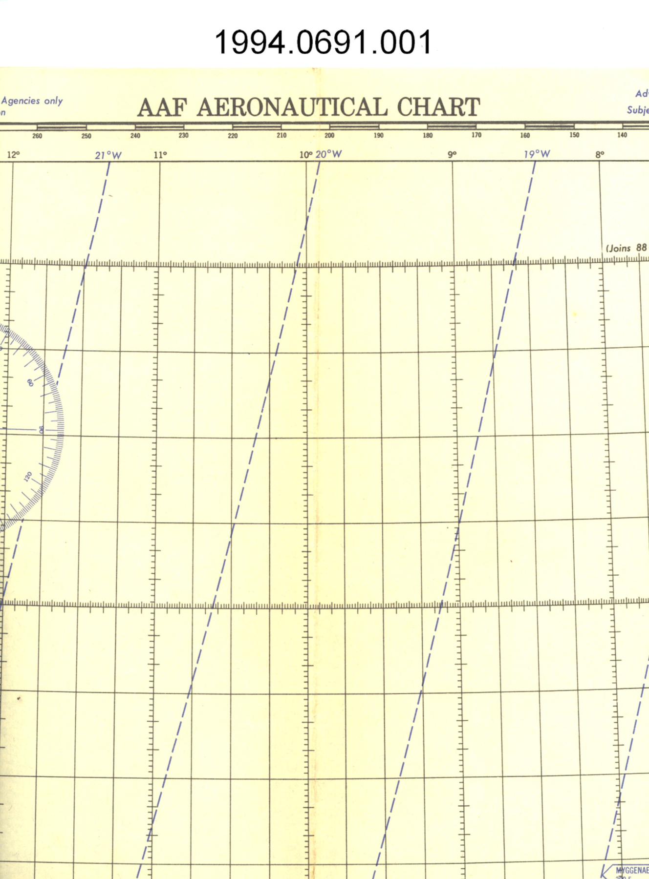
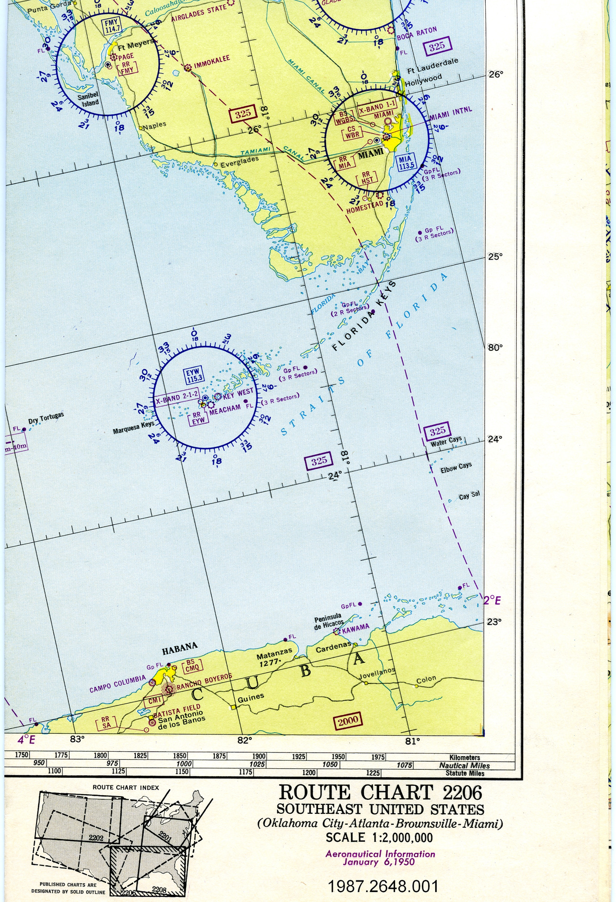
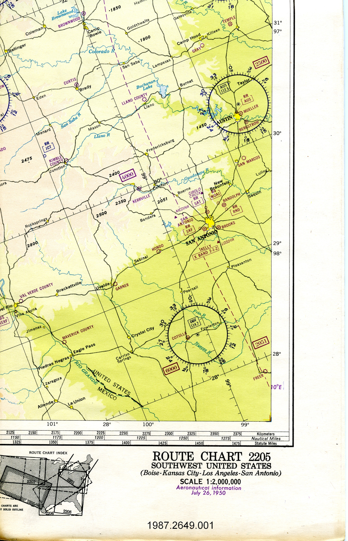
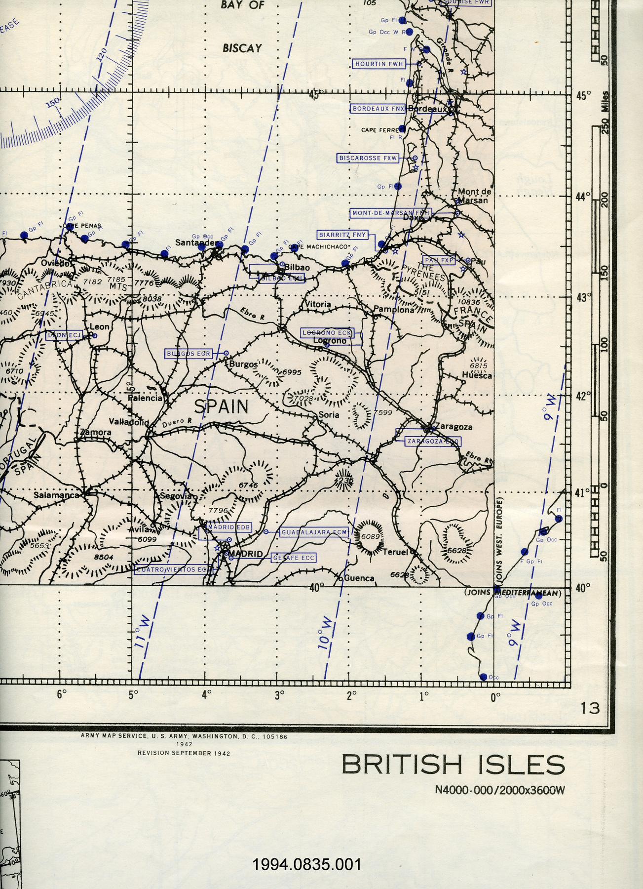
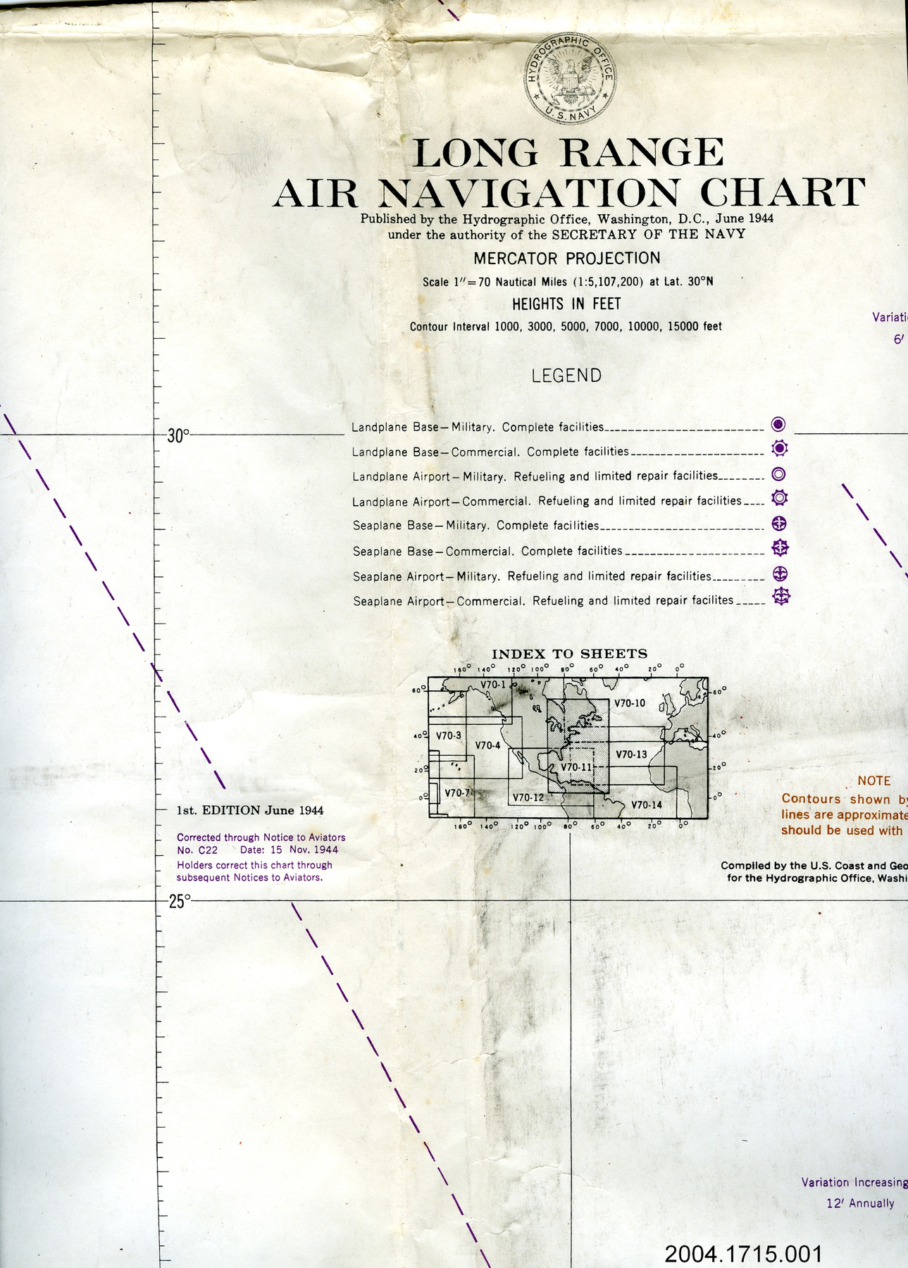
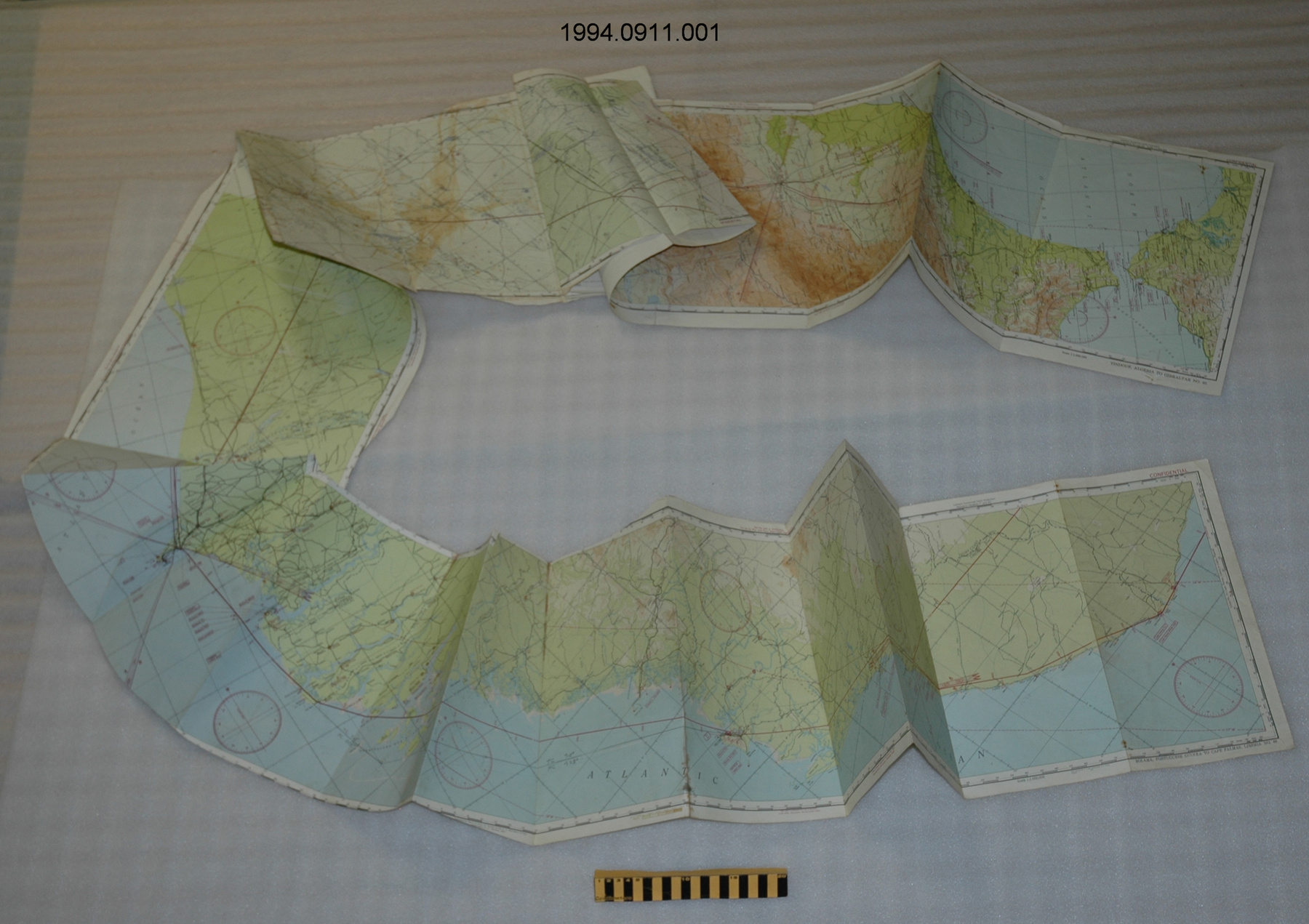
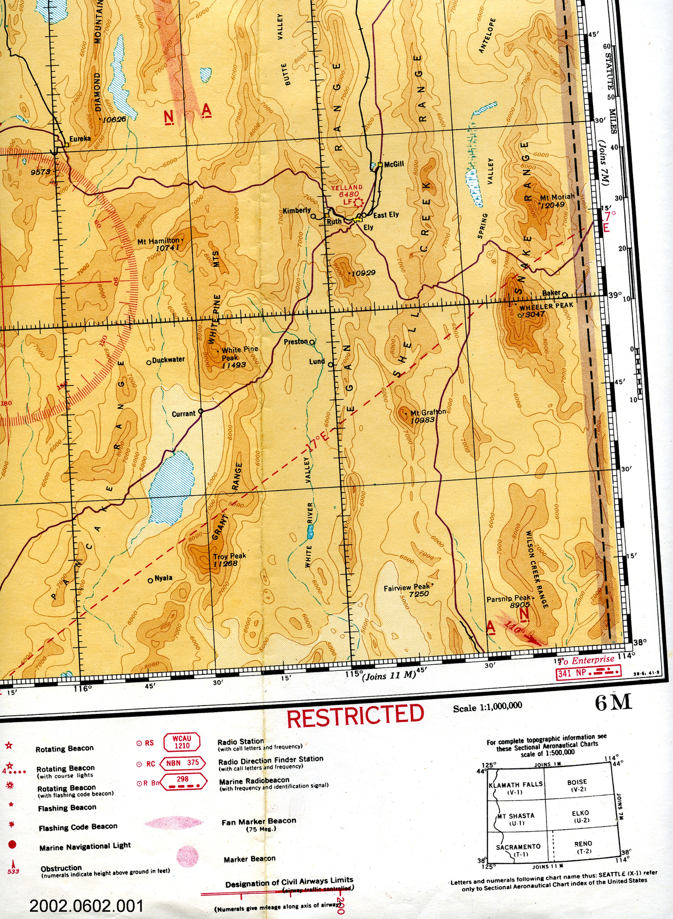
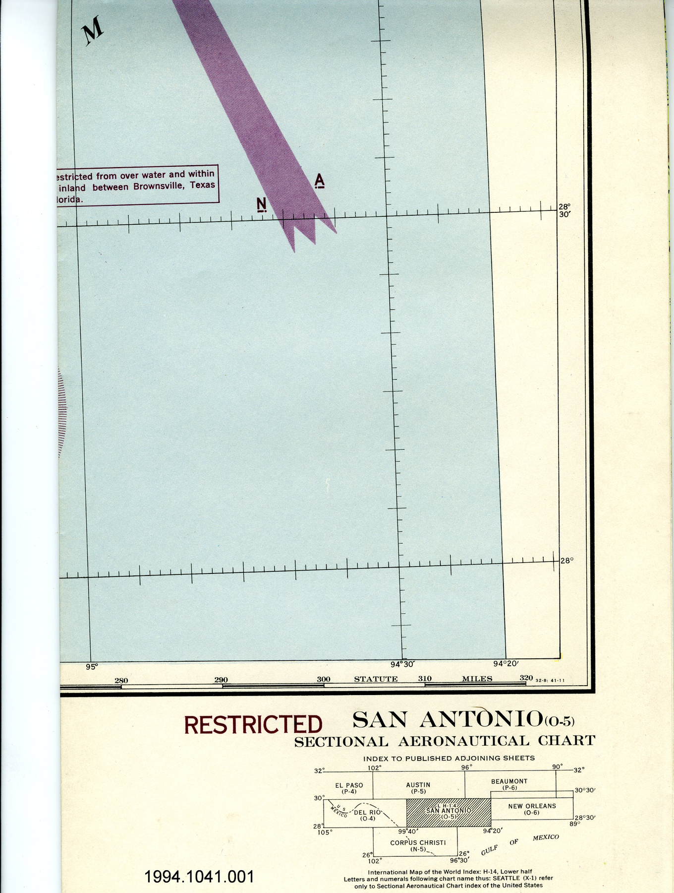
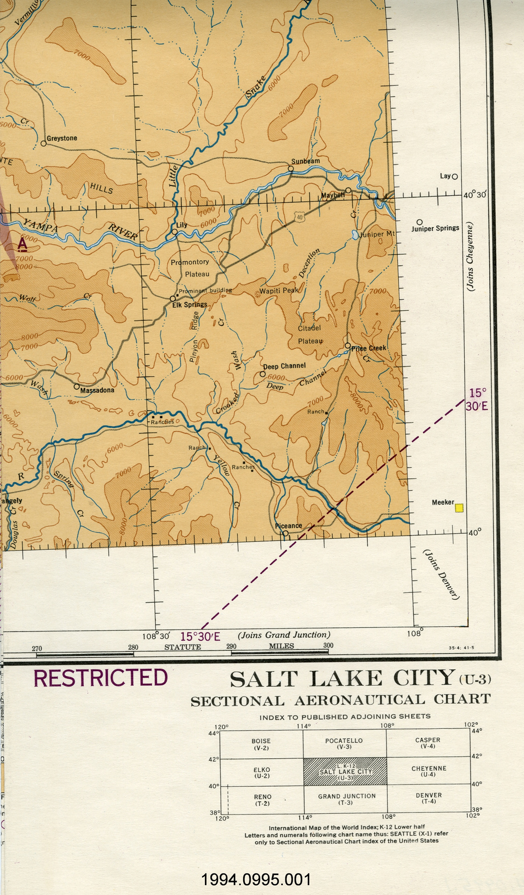
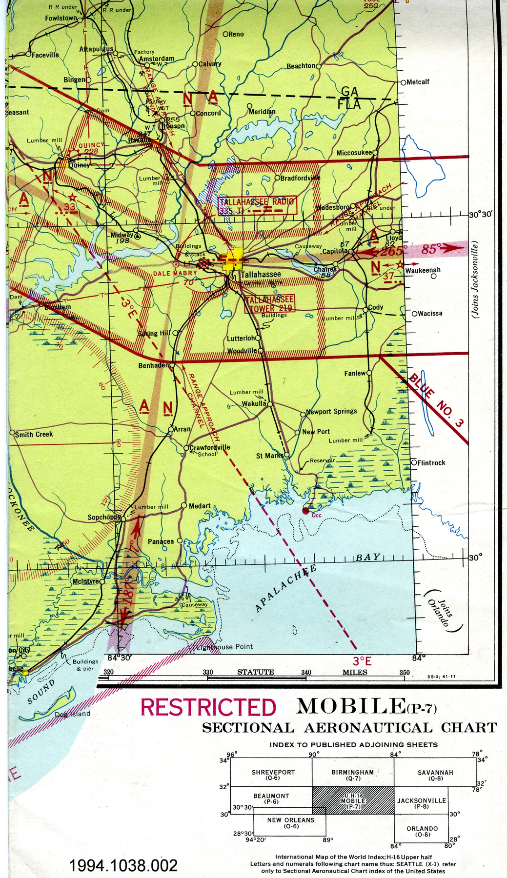
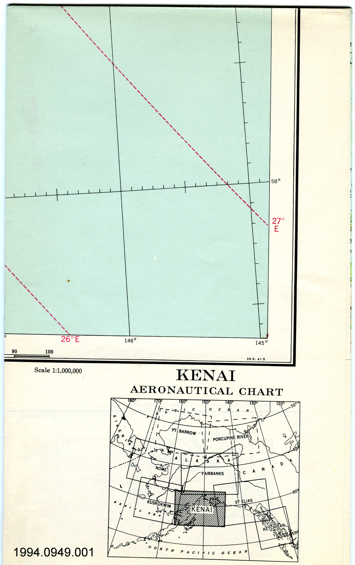
- OBJECT TYPE
- topographical/aeronautical/folding
- DATE
- 1946
- ARTIFACT NUMBER
- 2002.0596.001
- MANUFACTURER
- U.S. Coast & Geodetic Survey
- MODEL
- Lake Manitoba
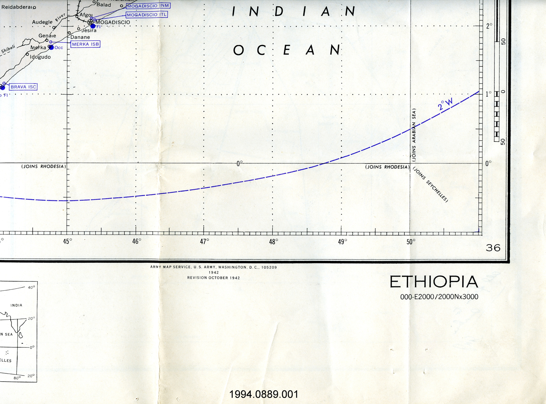
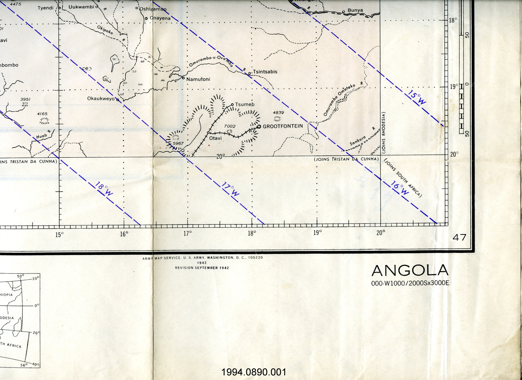
- LOCATION
- Washington, District of Columbia, United States of America
More Information
General Information
- Serial #
- N/A
- Part Number
- 1
- Total Parts
- 1
- AKA
- N/A
- Patents
- N/A
- General Description
- paper
Dimensions
Note: These reflect the general size for storage and are not necessarily representative of the object's true dimensions.
- Length
- 73.5 cm
- Width
- 56.0 cm
- Height
- N/A
- Thickness
- N/A
- Weight
- N/A
- Diameter
- N/A
- Volume
- N/A
Lexicon
- Group
- Aviation
- Category
- Navigation instruments & equipment
- Sub-Category
- N/A
Manufacturer
- AKA
- Survey US
- Country
- United States of America
- State/Province
- District of Columbia
- City
- Washington
Context
- Country
- Canada
- State/Province
- Unknown
- Period
- printed with overprint June 17, 1946 from a revised map produced April 1946; original published March 1945
- Canada
-
Unknown - Function
-
two-dimensional representation of a portion of the Earth's surface; used for aeial navigation - Technical
-
Unknown - Area Notes
-
Unknown
Details
- Markings
- lettering on bottom border reads: "46-6 (218) PRICE 25 CENTS/Date of magnetic information, 1947/Consult Notices to Airmen for changes/occurring in aeronautical data on this chart/after June 17, 1946.Compiled at Washington, D.C. by the U.S. Coast & Geodetic Survey under/authority of the Secretary of Commerce for civil aviation and by direction of the/Commanding General, Army Air Forces, for the Aeronautical Chart Service,/MARCH, 1945 Revised APRIL, 1946 BASE NO. 1R1/NOTE: Military users of this chart will mark hereon corrections and additions/which come to ttheir attention and mail to HEADQUARTERS,/AERONAUTICAL CHART SERVICE, ARMY AIR FORCES, WASHINGTON, D.C./U.S. COAST AND GEODETIC SURVEY, WASHINGRTON, D.C./JUNE 1946/N4800-W9600/400X900/SCALE 1:1,000,000/THIRD EDITION/LAKE MANITOBA (218)/CANADA-UNITED STATES"
- Missing
- N/A
- Finish
- colour map on white sheet; purple overprint
- Decoration
- none
CITE THIS OBJECT
If you choose to share our information about this collection object, please cite:
U.S. Coast & Geodetic Survey, Map, 1946, Artifact no. 2002.0596, Ingenium – Canada’s Museums of Science and Innovation, http://collections.ingeniumcanada.org/en/id/2002.0596.001/
FEEDBACK
Submit a question or comment about this artifact.
More Like This

2002.0596.001